 |
|

11 Aug 2010
|
|
Registered Users
New on the HUBB
|
|
Join Date: Aug 2010
Location: St. Louis, Missouri USA
Posts: 3
|
|
Quote:
Originally Posted by RustyG

. . . The only plans I have is to arrive San Francisco about 19 December, travel through Death Valley to Las Vegas then wander down to New Orleans to fly out around January 8th.
|
You've had some great advice so far. +1 on having heated gear if possible.
I'd carry a laptop with a broadband modem and data plan, or even better an Ipad, to have good quick access to weather.com and google maps throughout my journey. Especially if you decide to nip up into the higher elevations, where weather can change quickly.
But, sometimes mother nature cooperates and some great riding remains accessible.
If you feel like exploring SF while you're there, this may be of interest: 49-mile drive.
BTW, given the amount of time you've budgeted, unless you've ridden the Northern CA coast before I'd start with a good ride up north and back. It won't be warm but there will be no disk of snow or ice. Often December has less of the fog that can take away the views. It's real "Bucket List" material.
Here's a route that takes you up from SF, through the often-missed "Lost Coast" area (Petrolia), then back south starting with the "Avenue of the Giants". I had to stick lots of waypoints to keep the route on the Avenue and off the nearby parallel 101.
Then I have it returning south via 101 just to avoid the repetition, but honestly after the Giants I'd head back to Hwy 1 and retrace my steps south from there: San Francisco, CA to Morro Bay, CA - Google Maps
The bit between Half Moon Bay and Santa Cruz (with an obligatory stop at Alice's Restaurant of course) is really nice, especially once you get to 236.  After that you'll want to stop at Phil's Fish Market in Moss Landing for some Cioppino.
+1 on the advice about Hearst Castle and Nacimiento-Fergusson Rd. But beware, google maps has lots of other enticing squiggly lines in that part of CA, that are often unpaved, primitive surface.
That should be a great time of year to visit Death Valley. From there to New Orleans is something I'd probably plan on the fly based on the weather. There are some wonderful roads in AZ and NM, but most of the best can't be counted on in the winter. You may be able to catch the south rim of the Grand Canyon, but only if the weatherman gives you permission.
Here's a route that should be safe:
Morro Bay, CA to Unknown road - Google Maps. Sticking to the southwest, south of the Rockies, all you should need to be concerned with is the occasional freak ice storm. Big Bend National Park should be quite fun.
From there to New Orleans is dues-paying time. Very slabby, through San Antonio and Houston. Depending on the weather and how much time you have left, I'd probably instead explore the Piney Woods of east Texas, or maybe even nip up to northwestern and north central Arkansas for some really great riding.
I hope this helps!
Regards,
 King of the ferries!
"Ride To Eat" data Czar
King of the ferries!
"Ride To Eat" data Czar
|
11 Aug 2010
|
 |
Registered Users
Veteran HUBBer
|
|
Join Date: Nov 2005
Location: Columbia, MO usa
Posts: 108
|
|
|
U.S weather
I've ridden the southern route from Missouri to California in mid October and almost froze! Of course it depends on the year and how hearty you are. I just looked up the average December 25th temperature for Las Vegas (which you would assume is fairly warm) and for the last four years the HIGH varied from 45 to 52 degrees f. I would suggest the following web site for weather data.
Welcome to Weather Underground : Weather Underground
Roberto Forsellini
|
12 Aug 2010
|
 |
Moderated Users
Veteran HUBBer
|
|
Join Date: Jan 2010
Location: California
Posts: 501
|
|
|
Sorry, I don't know how to give you embedded Google mag links on Google maps. But just Google the main roads or towns and its all there.
From Pismo (or in the area)
Head NORTH on 101. Exit at Santa Margarita road. (highway 58 / 229)
Go EAST on 58 towards Creston. shortly, you Go left at the 229 cut off towards Creston. Bunch of great roads right in this area. But to get you down to DV we'll skip most of them. Lots of ways to go to get you over there. Once you are out in the Central valley, not very interesting.
Continue on past Creston to Highway 58. Take a right ... Go EAST.
Take 58 all the way to Highway 5. This is a long stretch. Watch your fuel.
Highway 5 is the main north south artery for the whole US west coast. Go South on highway 5. Exit about 20 miles South at 223/Arvin. Go EAST on 223 all the way to highway 58 (remember that one?)
Go South (right turn) onto 58, go South over the Tahachapi pass. If really really bad weather you can have SNOW or ICE on this bit. Very unlikely but it does happen. If the Semi trucks are going, you can go. If bad, CHP will close it. Get a room, it never lasts more than a day or two. I done it about 50 times, only turned back once.
As you come down the South side of the pass you'll approach Mojave and a junction with Highway 14. This is before the town. Watch for sign for Highway 14 and go NORTH. (left turn ... or loop around at junction)
Go North on 14 until 178 / Ridgecrest. Turn Right (East) Follow signs to Ridgecrest. As you approach Ridgecrest town proper there is a very serious military base entrance. DO NOT DRIVE in that entrance! Turn Right! (follow main road) This is posted but some folks get confused. DO NOT ENTER .... they WILL SHOOT YOU! (Drone program and God knows what else run there)
Go through Ridgecrest on main road (Gas up) and follow 178 signs. You will turn left off of North China Lake Blvd. onto 178. Watch for sign about 3 miles.
If you'd like to adopt a wild Horse or Burro, the BLM's Burro center is right out of town. Hundreds there. Quite amazing and sweet guys.
Continue on 178 all the way to 190. You are now in Death Valley. Follow signs. Take Wild Rose Canyon, best road to get to Stovepipe Wells.
From here use your maps and guide books. Be sure to visit the Museums in
Furnace Creek and do a Scotty's Castle tour. (worth it). Lots to do and see in DV. Tons of Europeans. But usually they come in Summer (mistake) when it 120F. :confused1:
All the roads listed are PAVED roads ... with the exception of a few gravel patches on Wild Rose Canyon in Death Valley. No problem at all.
From here you're on your own. Stay South if bad weather.
Have a great trip.
Last edited by Mickey D; 12 Aug 2010 at 06:10.
|
12 Aug 2010
|
|
Moderated Users
Veteran HUBBer
|
|
Join Date: Jan 2010
Location: California
Posts: 501
|
|
Quote:
Originally Posted by RideToEat
Here's a route that takes you up from SF, through the often-missed "Lost Coast" area (Petrolia), then back south starting with the "Avenue of the Giants". I had to stick lots of waypoints to keep the route on the Avenue and off the nearby parallel 101.
|
I think he's only got about two weeks total, otherwise I would have suggested going North, weather permitting. The Lost Coast area has the best roads in California. We ride them every year.
Some of the Google routes linked above are dirt roads. I don't think the rental bike is going to do that well on that stuff ... and dirt roads take LOTS OF TIME .... I know cause I've done most of them riding dirt, dual sport and Adventure bikes!  There are dozens of routes in these areas. All you need is time and some good maps.
Nacimiento-Ferguson rd, just above Highway One, Big Sur.
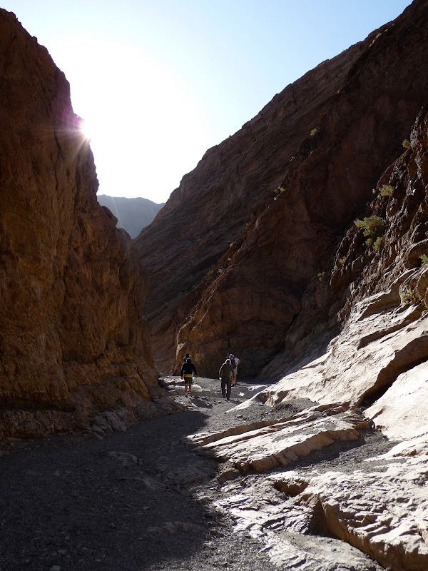
Great hiking in Death Valley
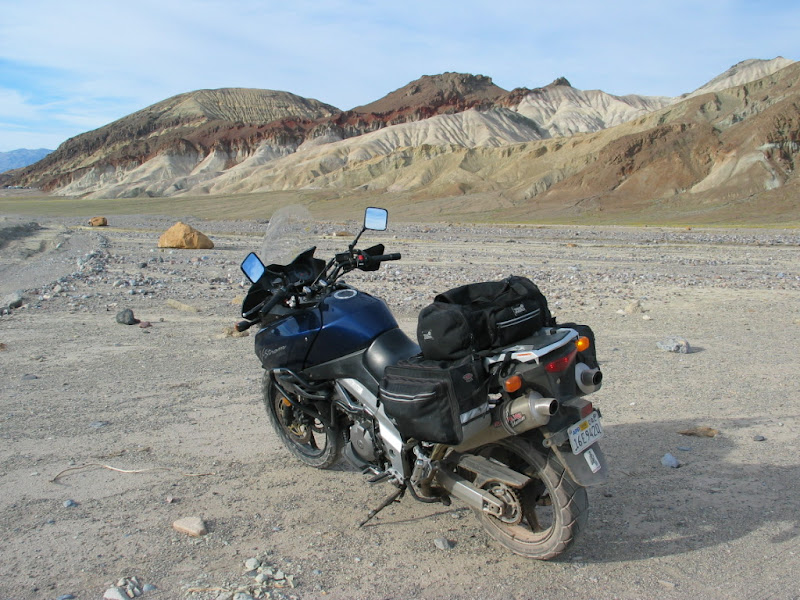
Stunning landscapes everywhere you look in Death Valley
Short Cut across the Mojave? Hmmm?
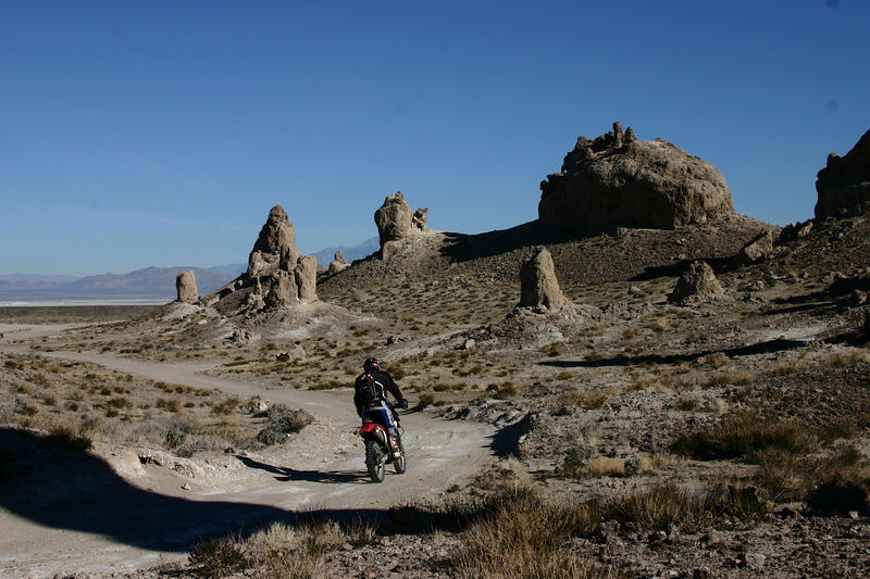
Be sure to stop at The Pinnacles near Trona, between Ridgecrest and Trona. Doable on a street bike.
|
12 Aug 2010
|
|
Registered Users
New on the HUBB
|
|
Join Date: Aug 2010
Location: St. Louis, Missouri USA
Posts: 3
|
|
Quote:
Originally Posted by Mickey D
I think he's only got about two weeks total, otherwise I would have suggested going North, weather permitting. The Lost Coast area has the best roads in California. We ride them every year.
Some of the Google routes linked above are dirt roads. I don't think the rental bike is going to do that well on that stuff ...
|
Great Pics.
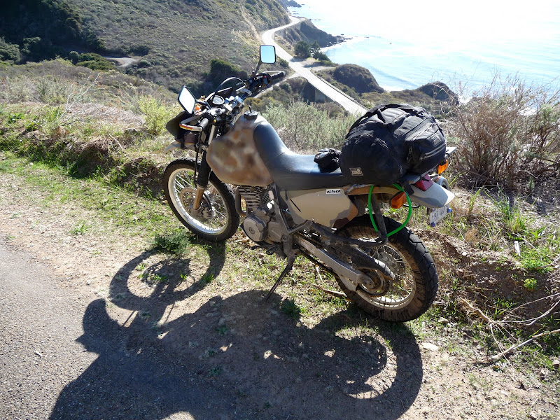
The dates he mentioned gives him 20 days, I think that's plenty to include the trip up north. Like you said, Lost coast is something special. Here's some pics from a trip out there.
If the weather cooperated, I'd even add a loop out 36 and back 299.
Are you saying my link included some dirt roads? Not unless I made a mistake with google maps. I've ridden all of that and didn't hit any dirt. Can you tell me what part you're talking about?
Regards,
King of the ferries!
"Ride To Eat" data Czar
|
12 Aug 2010
|
|
Registered Users
New on the HUBB
|
|
Join Date: Aug 2010
Location: St. Louis, Missouri USA
Posts: 3
|
|
Quote:
Originally Posted by Mickey D
Take Wild Rose Canyon, best road to get to Stovepipe Wells. . . . All the roads listed are PAVED roads ... with the exception of a few gravel patches on Wild Rose Canyon in Death Valley. No problem at all.
|
Nice tip! I took the park map at its word and assumed that was bad road. I'll try that next time I'm out there.
Regards,
King of the ferries!
"Ride To Eat" data Czar
|
12 Aug 2010
|
|
Moderated Users
Veteran HUBBer
|
|
Join Date: Jan 2010
Location: California
Posts: 501
|
|
Quote:
Originally Posted by RideToEat
Are you saying my link included some dirt roads? Not unless I made a mistake with google maps. I've ridden all of that and didn't hit any dirt. Can you tell me what part you're talking about?
Regards,
|
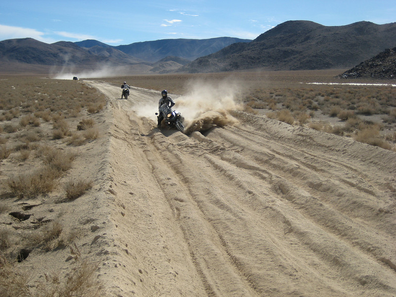
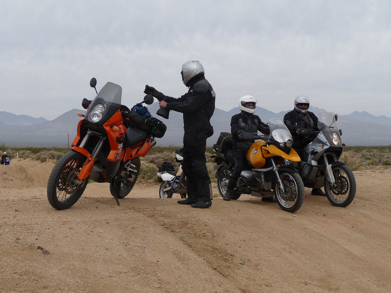
Not sure ... as I didn't follow every road you mapped out. But I know in the California City and Ridgecrest areas there are several dirt roads that go cross country, most over to 395. I guess there are now more and more paved ones. Lots of paving in the last ten years. Most are doable on a street bike but some look like the pic I posted.
We do a dirt short cut into Ridgecrest, not too bad, these guys made it OK:
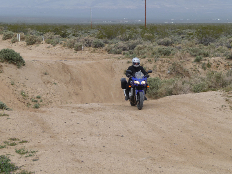
This in March ... and its COLD. (about 50F)
|
|
Currently Active Users Viewing This Thread: 1 (0 Registered Users and/or Members and 1 guests)
|
|
|
 Posting Rules
|
You may not post new threads
You may not post replies
You may not post attachments
You may not edit your posts
HTML code is Off
|
|
|
|

Check the RAW segments; Grant, your HU host is on every month!
Episodes below to listen to while you, err, pretend to do something or other...

2020 Edition of Chris Scott's Adventure Motorcycling Handbook.
"Ultimate global guide for red-blooded bikers planning overseas exploration. Covers choice & preparation of best bike, shipping overseas, baggage design, riding techniques, travel health, visas, documentation, safety and useful addresses." Recommended. (Grant)

Ripcord Rescue Travel Insurance™ combines into a single integrated program the best evacuation and rescue with the premier travel insurance coverages designed for adventurers.
Led by special operations veterans, Stanford Medicine affiliated physicians, paramedics and other travel experts, Ripcord is perfect for adventure seekers, climbers, skiers, sports enthusiasts, hunters, international travelers, humanitarian efforts, expeditions and more.
Ripcord travel protection is now available for ALL nationalities, and travel is covered on motorcycles of all sizes!
What others say about HU...
"This site is the BIBLE for international bike travelers." Greg, Australia
"Thank you! The web site, The travels, The insight, The inspiration, Everything, just thanks." Colin, UK
"My friend and I are planning a trip from Singapore to England... We found (the HU) site invaluable as an aid to planning and have based a lot of our purchases (bikes, riding gear, etc.) on what we have learned from this site." Phil, Australia
"I for one always had an adventurous spirit, but you and Susan lit the fire for my trip and I'll be forever grateful for what you two do to inspire others to just do it." Brent, USA
"Your website is a mecca of valuable information and the (video) series is informative, entertaining, and inspiring!" Jennifer, Canada
"Your worldwide organisation and events are the Go To places to for all serious touring and aspiring touring bikers." Trevor, South Africa
"This is the answer to all my questions." Haydn, Australia
"Keep going the excellent work you are doing for Horizons Unlimited - I love it!" Thomas, Germany
Lots more comments here!

Diaries of a compulsive traveller
by Graham Field
Book, eBook, Audiobook
"A compelling, honest, inspiring and entertaining writing style with a built-in feel-good factor" Get them NOW from the authors' website and Amazon.com, Amazon.ca, Amazon.co.uk.
Back Road Map Books and Backroad GPS Maps for all of Canada - a must have!
New to Horizons Unlimited?
New to motorcycle travelling? New to the HU site? Confused? Too many options? It's really very simple - just 4 easy steps!
Horizons Unlimited was founded in 1997 by Grant and Susan Johnson following their journey around the world on a BMW R80G/S.
 Read more about Grant & Susan's story
Membership - help keep us going!
Horizons Unlimited is not a big multi-national company, just two people who love motorcycle travel and have grown what started as a hobby in 1997 into a full time job (usually 8-10 hours per day and 7 days a week) and a labour of love. To keep it going and a roof over our heads, we run events all over the world with the help of volunteers; we sell inspirational and informative DVDs; we have a few selected advertisers; and we make a small amount from memberships.
You don't have to be a Member to come to an HU meeting, access the website, or ask questions on the HUBB. What you get for your membership contribution is our sincere gratitude, good karma and knowing that you're helping to keep the motorcycle travel dream alive. Contributing Members and Gold Members do get additional features on the HUBB. Here's a list of all the Member benefits on the HUBB.
|
|
|


 Linear Mode


