 |
|

1 Feb 2011
|
|
Registered Users
HUBB regular
|
|
Join Date: Aug 2009
Posts: 94
|
|
|
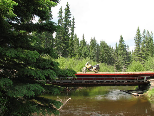
Franks version of day four of the TCAT, Ontario
Day three started early - I had to make sure I was showered and checked out in time to meet the guys at the campground by 8:00. When I got to the campground, we decided to backtrack into town for some Timmies. We finally got underway a little after 9. The fog was mostly burned off and the day was turning out to be mostly sunny.
Except for the slight diversion up the hydro line and its culvert adorned water crossing that we took in both directions, the riding was relatively fast. It starts with some nice gravel road till we meet up with the Seguin trail. The trail appears to be mostly sand fill on bog. This means that most of the trail consists of what is apparently referred to as "woops" with only a few water crossings. Woops are essentially inverted moguls (depressions instead of mounds). And riding woops is a lot like skiing moguls - well if you were wearing 500lbs skis. It is all about picking the line and letting your legs ride up and down while your head remains steady. In other words, its a lot of fun, but hard work. And the faster you ride, the more work it is. Unless, Ted tells me, you're going fast enough that you just hit the tops and don't even hit every woops. I'll take his word for it.
Since we got separated, Jim and I weren't sure if the others were ahead of us or behind us. We finally decided they must be ahead. We eventually got a text to meet in an hour at Seguin Falls. We rode as fast as I could and I was having a blast. The bike was just eating up the trail. I almost lost it trying to ride the side of the woops at one point but the sand was really sloppy and after saving it I just kept in the bumpy but predictable part ofthe trail. After foregoing two or three bail out points where the trail crosses the road, my legs were burning and I finally begged for mercy. Jim took pity on me and agreed we should take the road to the next RDV.
By then it was 11:30 and I had a 5:00 commitment in Ottawa, so I thanked the boys and headed back.
I learned to ski in a small center in northern Quebec and for the first 10 years I thought that skiing was what we did at Mount Fortin. It wasn't till I got my first job after university and was sent out to Calgary on an installation that I even saw what real skiing was about. This weekend riding with this group I had that same type of epiphany. I discovered that there were more than bunny hills out there. I'm not sure if we were riding blue rectangle or black diamond trails this weekend, but now I know there is a different type of riding to be enjoyed and fully expect to spend more time on this type of riding. I still will take the Harley on nice sedate rides, but I will also be looking for trails to give me that rush of adrenalin.
|
8 Feb 2011
|
|
Registered Users
HUBB regular
|
|
Join Date: Aug 2009
Posts: 94
|
|
|
Out West
My diesel Jetta finally died, I've always been a "truck guy" . 5 years ago I decided I'd buy something a bit more pratical. Bad mistake, driving around in a wee little car that shakes and rattles like only a diesel car can, underpowered and well just not suited to the gravel roads I drive on a daily basis. So I knew I wanted something that could have a fighting chance of keeping up with my bike, could be used as a support vechicle for bike trips, would let me go on bike rides and have Mrs Deadly or one of my buddies who doesnt ride come along, have decent gas mileage, could be used as a daily driver, etc
Alot of web research and I decided on a pre runner style small truck. I got a hold of the guys at Baja North in BC and gave them my list of wants and a price range. Nicier guys you'll never meet. The customer service and the quality of work they do is outstanding
So I flew out to BC with a buddy and picked up the truck last week. I spent a bit of time on the web and chatting with some of the folks involved in the TCAT project and put together a list of roads to ride on the way home as a scouting mission for the route. We got lucky with good weather and some damn fun roads
You'll probably be seeing a bit more of this truck in this ride report. Once the salt gets put down on the roads in Canada the bikes typically get put away for the winter. Hopefully this truck will let me keep working on the route during the off season

|
8 Feb 2011
|
|
Registered Users
HUBB regular
|
|
Join Date: Aug 2009
Posts: 94
|
|
Followed part of the route threw the east Kootenay's. Great gravel roads threw some fairly remote area's.
Bull River, White River, Kootenay River, Settlers Rd, etc
Cowboy country...real cowboys


Great roads indeed, the scenery is top drawer and other than the occasional logging truck there isn't a whole lot out there. Perfect roads for the TCAT


The intended route for this section comes over a pass near the Crowsnest Pass before grabbing these roads and heading up to Kootenay National Park. It then swings south to the town of Radium Hot Springs. I lived in Radium for a few years and spent alot of time riding back in the Kootenay valley. Although the terrain isn't challenging the feeling of remoteness and the fun gravel roads should offer a fun day to a day and a half of riding. A couple of great camp sites are available as well as some great outdoor natural hotsprings. I don't think this section of the route will disappoint
|
8 Feb 2011
|
|
Registered Users
HUBB regular
|
|
Join Date: Aug 2009
Posts: 94
|
|
|
|
8 Feb 2011
|
|
Registered Users
HUBB regular
|
|
Join Date: Aug 2009
Posts: 94
|
|
|
|
8 Feb 2011
|
|
Registered Users
HUBB regular
|
|
Join Date: Aug 2009
Posts: 94
|
|
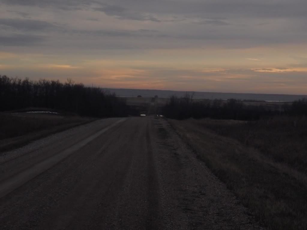
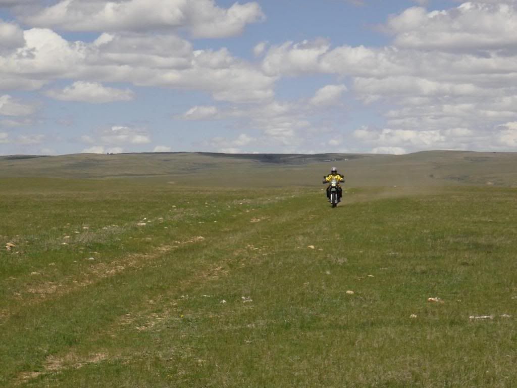
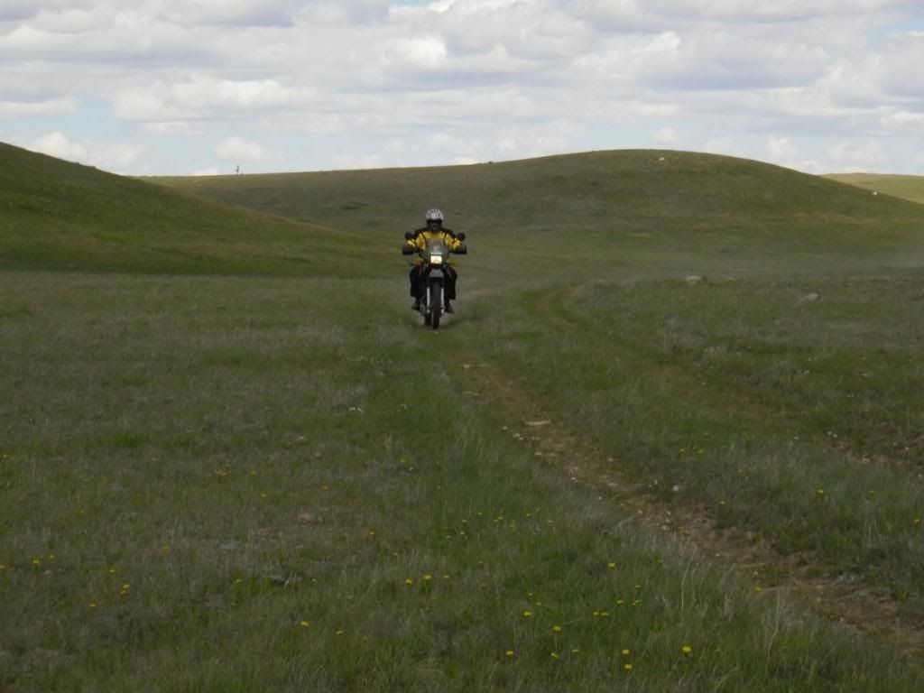
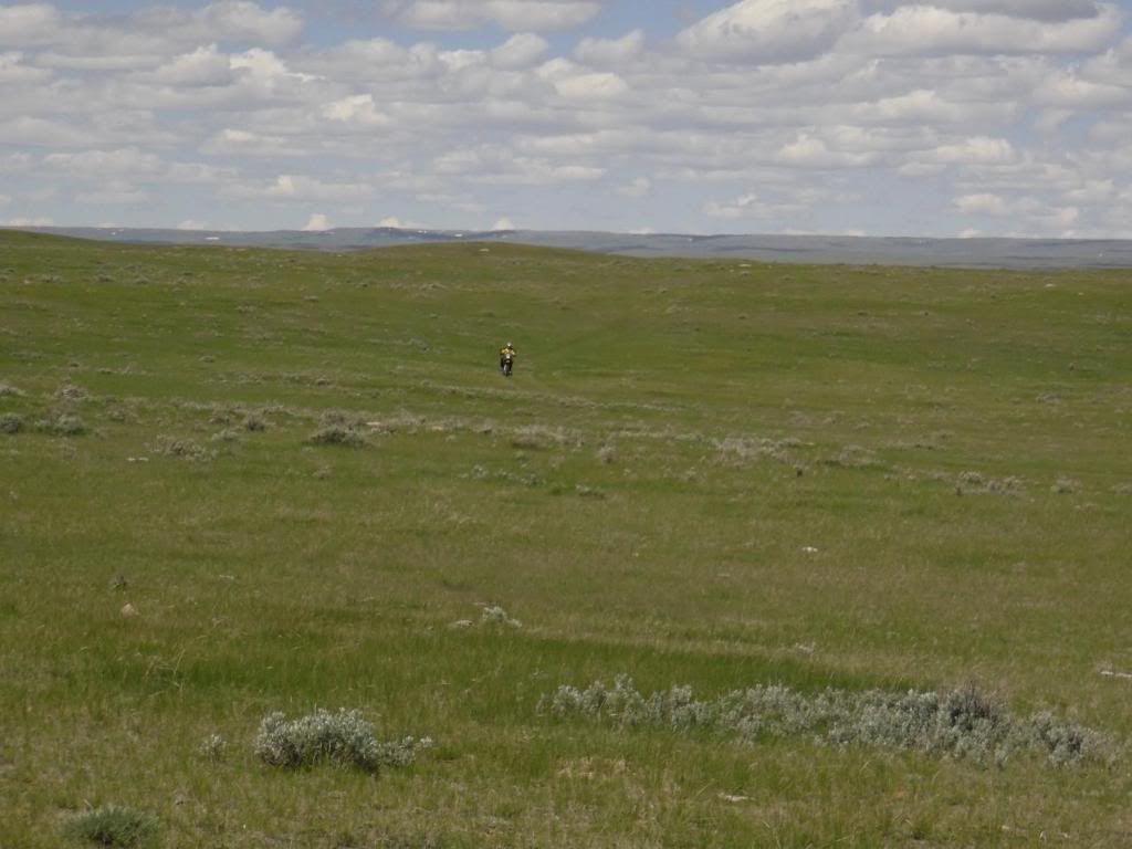
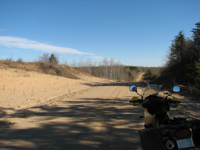
The fun way to enter Saskatchewan

The roads went on for a while, the "unpassable when wet" raised an eyebrow as the sun was coming out and the ground was thawing. I guess it gets a bit slick during the wet season ? There weren't any crazy hills or anything so I don't see "unpassable" happening...maybe a wee bit challenging but not unpassable. A couple of hills where I suppose the ground gets slick when wet, lot's of tree's though to assist if needed.

A VERY fun area indeed and a great addition to the route.
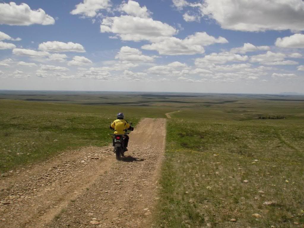
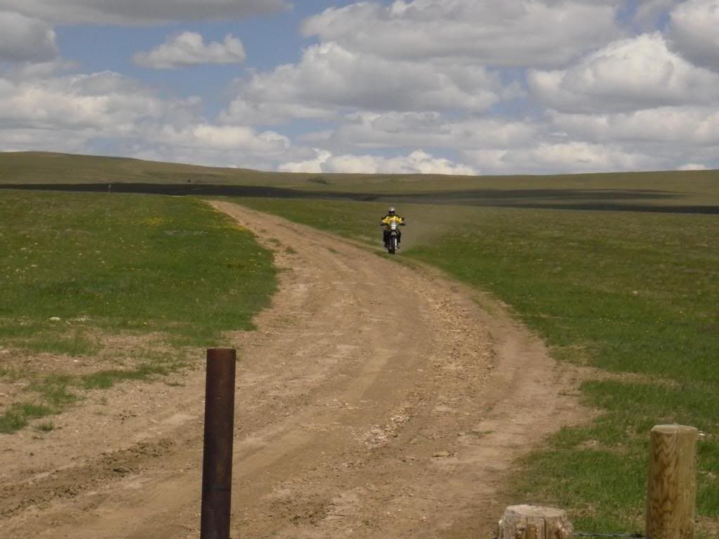
I really enjoyed the prairie scenery. Sorry I didn't grab any pics but we had some fun blasting some nice long gravel roads. A complete grid of gravel of we termed it. Very fun just to unwind and enjoy the scenery.


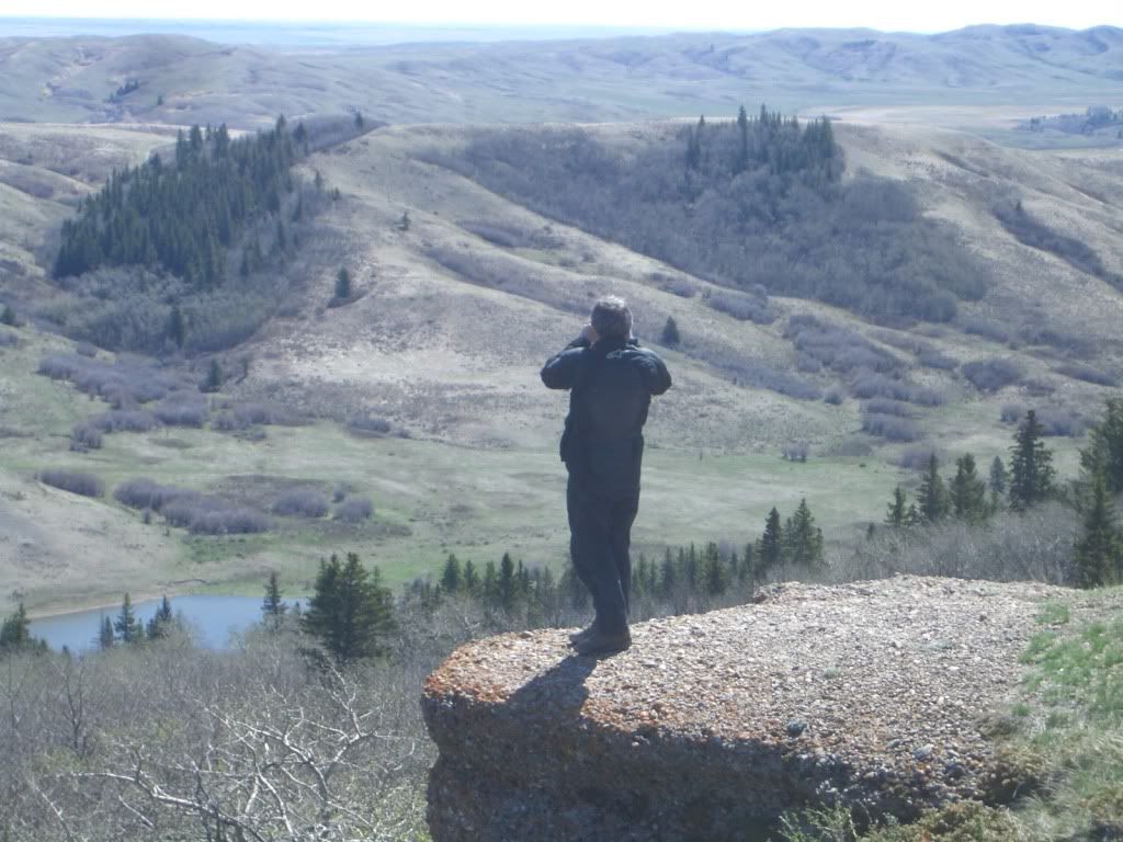
This view seen from a scenic viewpoint in the Cypress park seems to have left a lasting impression on me........

|
8 Feb 2011
|
|
Registered Users
HUBB regular
|
|
Join Date: Aug 2009
Posts: 94
|
|
NOTE: a couple of posts from Chris who is taking on the Sask/Alberta portion of the route. This is being cross posted from another site so please excuse if the timelines, etc don't make sense
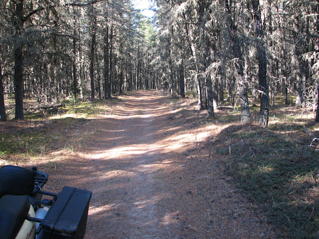
A nice road in the southern end of the Nisbet Forest about 10 km north of the town of Duck Lake SK.
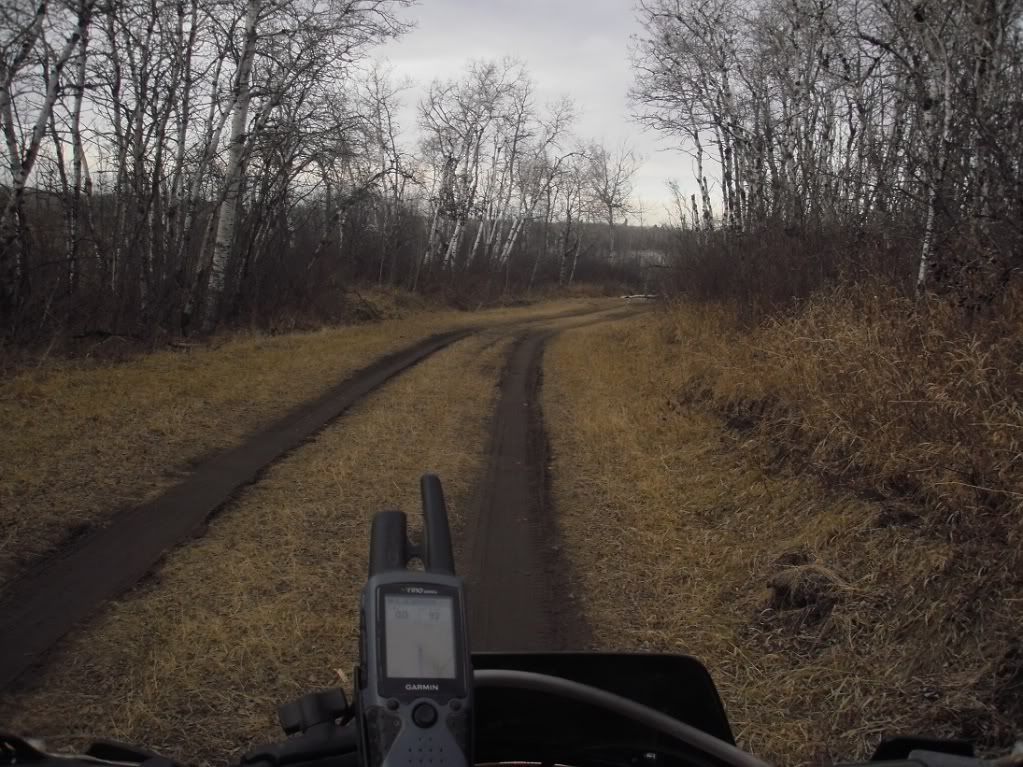
Heading south just across Hwy 11.
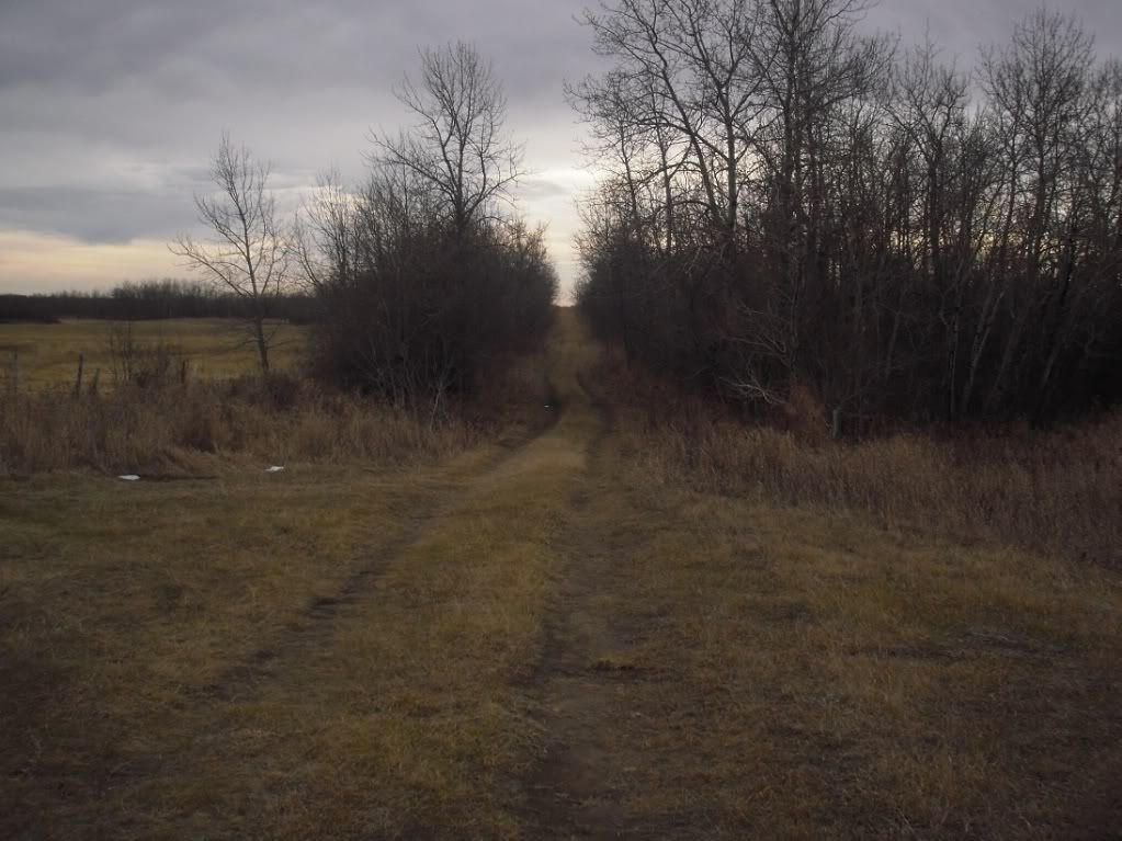
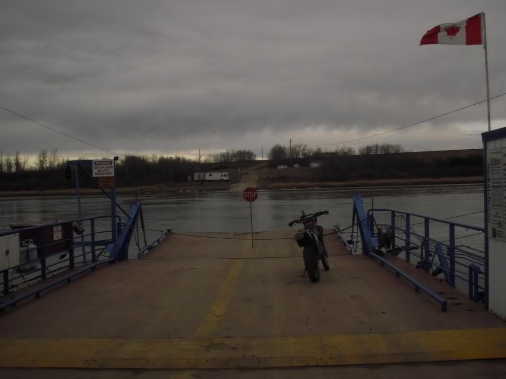
The road to the St. Laurent Ferry. This road was fast, curvy packed sand and a lot of fun to ride. Too bad it's only about 5 km long!
Waiting for the ferry. Saskatchewan has many of these river ferrys. You never have to wait long for them since the river isn't exactly very wide. They also run long hours, though the operator does take a half hour lunch break and a half hour supper break.
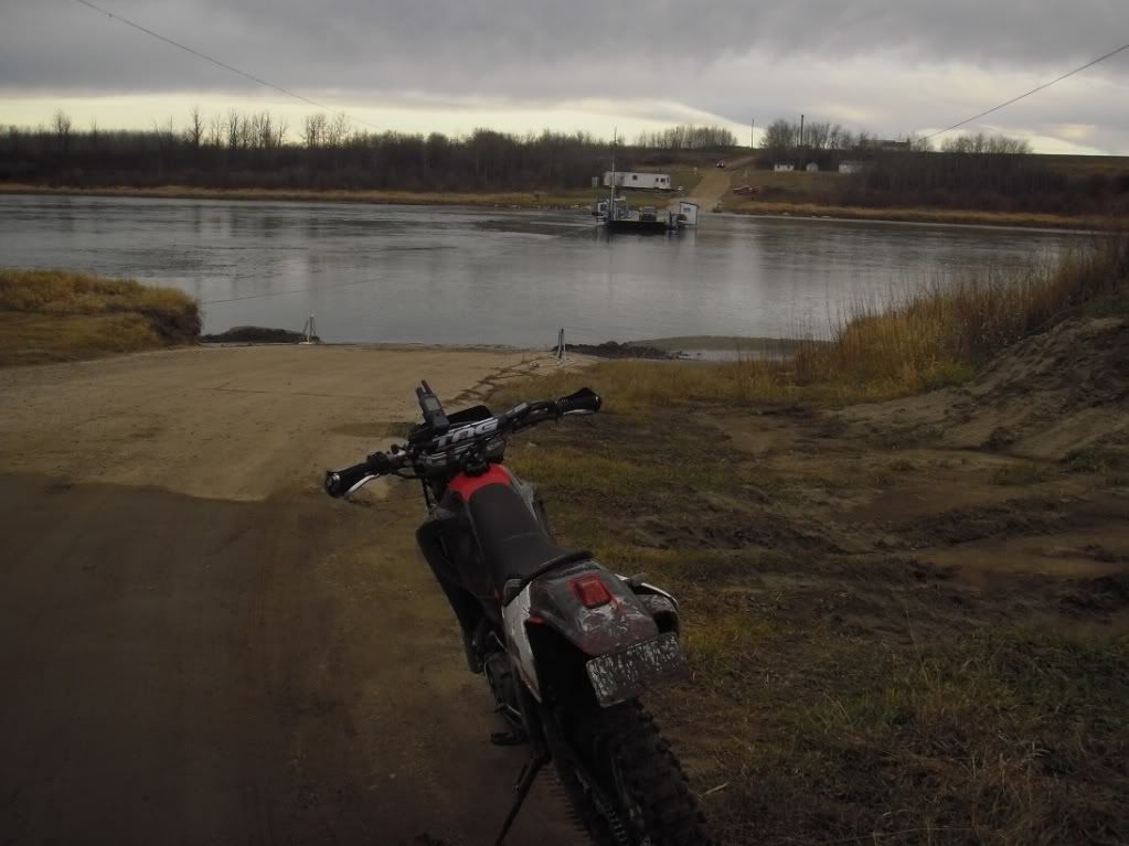
Riding the ferry. The operator thought it was funny when I asked if I was overloading him.
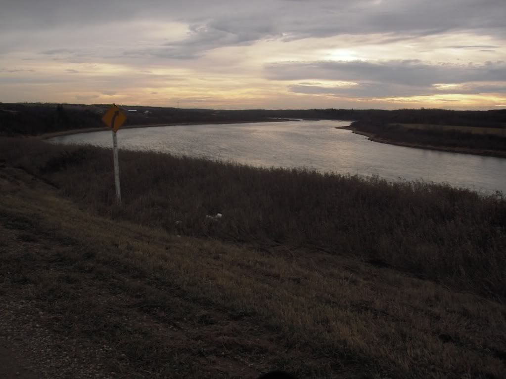
A view of the South Saskatchewan River near the St. Laurent Ferry.
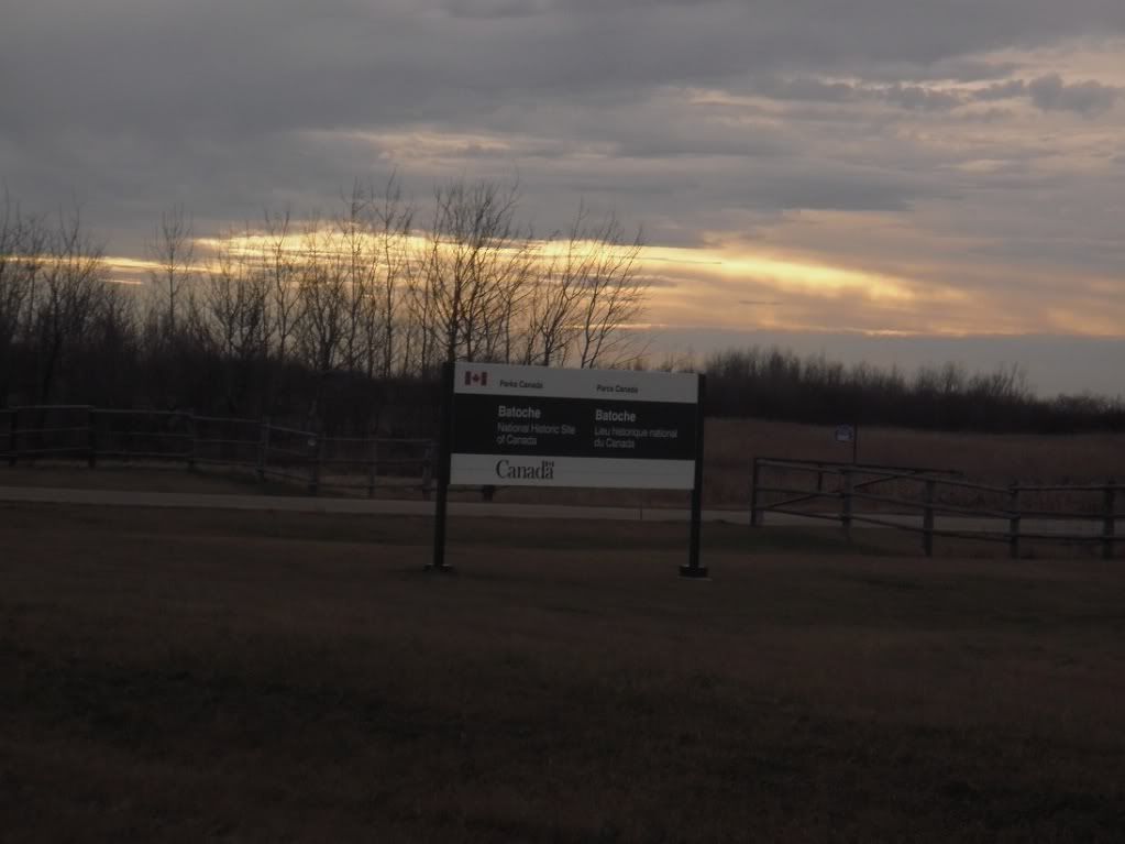
For those interested in Canadian History, the route will run right by Batoche, which is the site of the final battle of the 1885 Riel Rebellion. Even for those non-history-buffs it's worth a quick stop for a look.
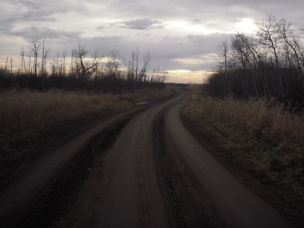
A dirt road on the One Arrow Reserve.
My XR enjoys another view of the South Saskatchewan, this one near the Fish Creek battle site.
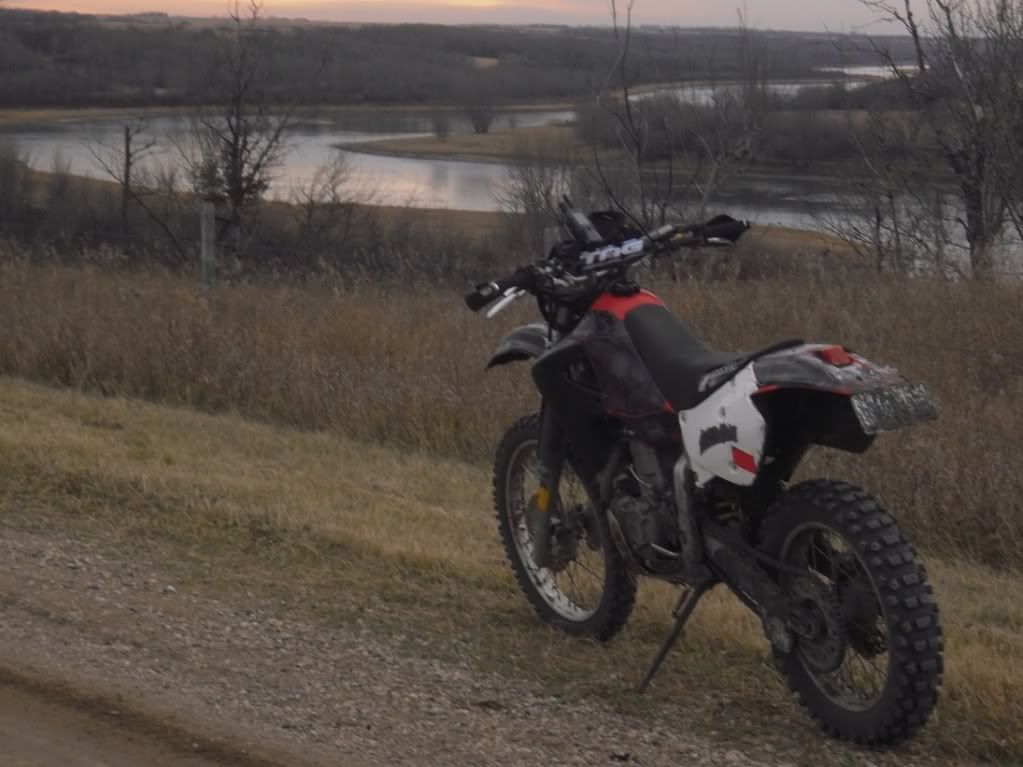
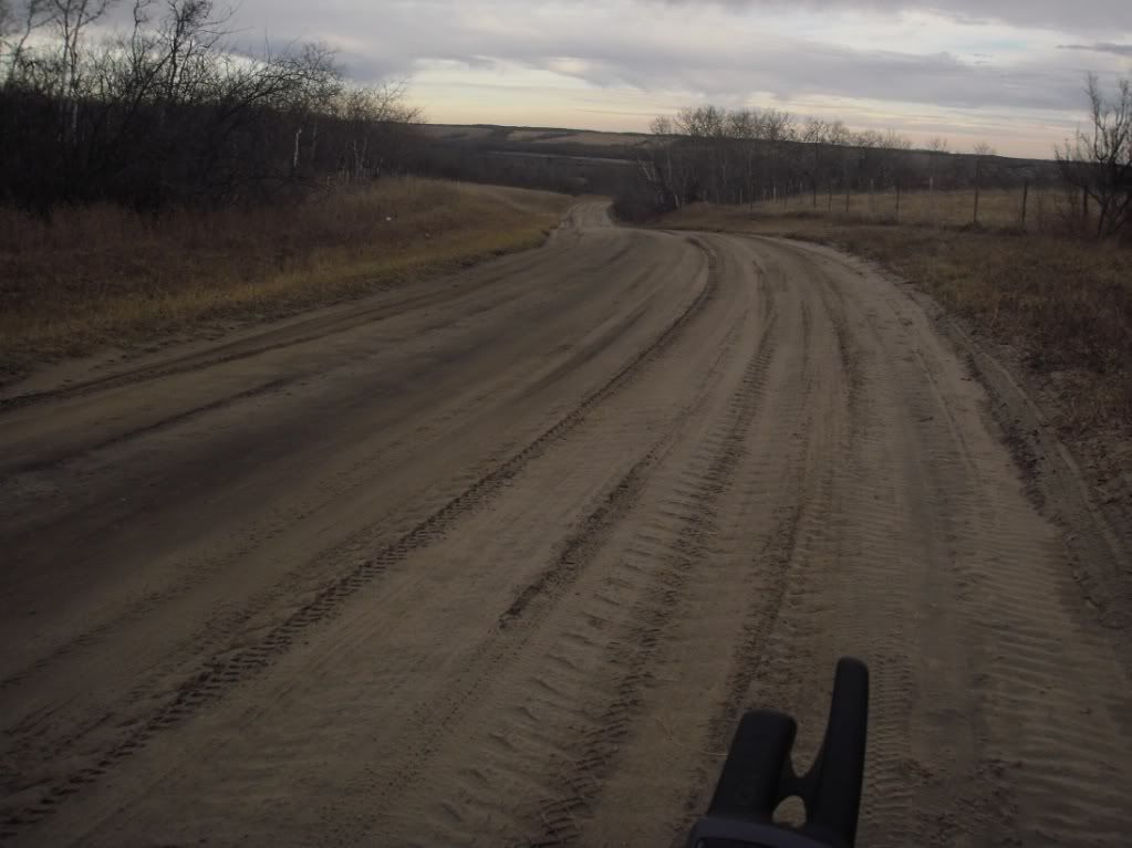
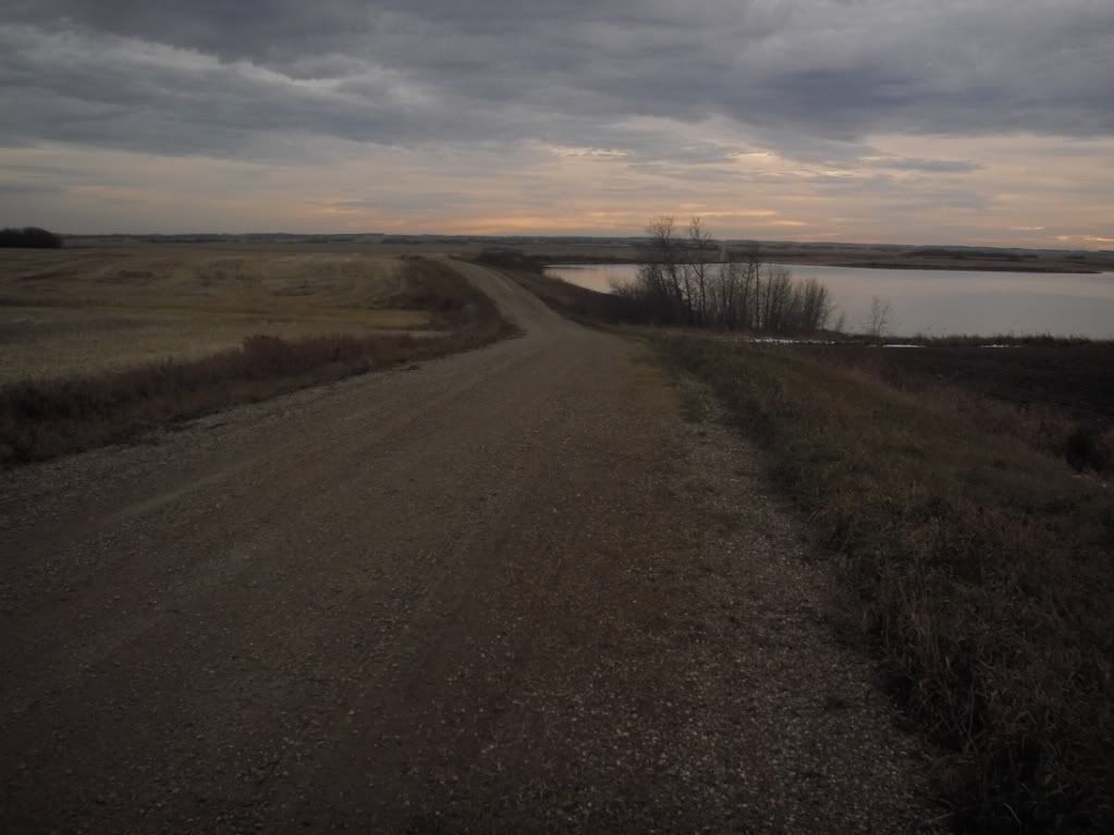
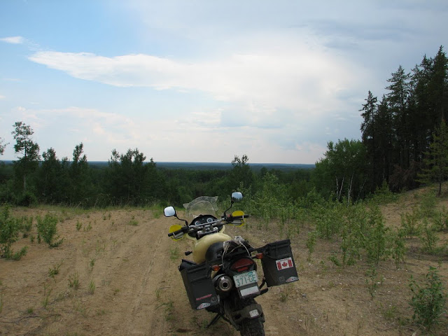
A nice gravel road north of the town of Alvena, SK. It's really easy to get across Saskatchewan on only gravel roads, the tough part is finding the ones that are not DFDS (dead flat dead straight).
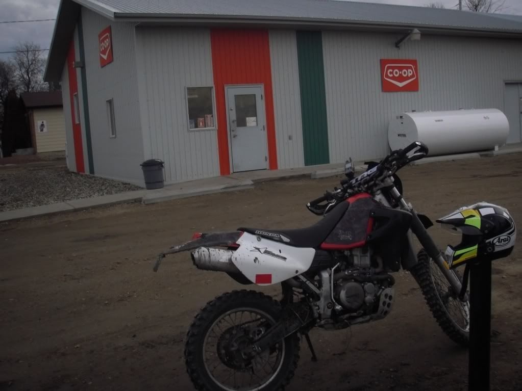
The Alvena Co-op. I was on reserve, and Alvena only has about 50 people at the most, so I figured that knowledge that there is a gas station there was important.
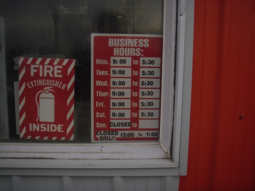
Alvena Co-op hours. These are winter hours. In summer they open an hour earlier and close a half hour later.
The road south of Alvena.
It was getting dark and cooling off at this point, so I made a beeline for home. Got some good scouting done though, and have an idea whether my plans will work (they will, for the most part!).
|
8 Feb 2011
|
|
Registered Users
HUBB regular
|
|
Join Date: Aug 2009
Posts: 94
|
|
|
|
8 Feb 2011
|
|
Registered Users
HUBB regular
|
|
Join Date: Aug 2009
Posts: 94
|
|
A little information about Quebec for those of you who aren't familiar with this province of Canada. It's located in the eastern/central part of Canada and it's ....well.....it's french. Personally I really enjoy exploring the "belle province", it's almost like heading to Europe, well sort of. There are more gravel roads in Quebec than probably in the entire USA (just a hunch ). In the winter time there are more groomed snowmobile trails than there are paved roads. Recreation is BIG in Quebec. Everything seems big , it's the largest province in Canada and has some real history to it.

Another fellow has been working on the route in Quebec. Fabrice has been working his way east from the beginning of the Trans Lab Highway. His portion of the route will meet my portion near a town called La Dore. The route from there has been routed but yet to be ridden. With winter closing in this will more than likely have to wait until spring unfortunately. A nice long 400+ km gravel road will lead from there through a town called Parent, Quebec and will lead into the section we just finished. After that the route will be taken over by Flanny and will bring folks into the city of Ottawa. So....yes things are beginning to really take shape
|
8 Feb 2011
|
|
Registered Users
HUBB regular
|
|
Join Date: Aug 2009
Posts: 94
|
|
Woke up to blue skies and frost on the ground. Freaking freezing outside, frost on the ground, couldn't have much above 0 degree's. I had about an hours ride to the meet spot downtown Ottawa. Heck, we're Canadian, we're supposed to be part lumberjack/part igloo dwellers and part seal blubber eaters aren't we? So I won't complain, let's just leave it at I froze my butt off that morning.
Packed up the bike and hit the road.

A beautiful ride down some fun twisty roads early on a Sunday morning. Got to the meet spot (yes a Tim Hortons) and was surprised to see a handful of bikes. I'd thought there was only going to be 3 of us for the day.

A few familiar faces to those who have been following this thread and a few new ones as well. A real mix of bikes, grabbed a coffee and did the small talk/introduce ourselves and whatnot. Probably my favourite part of creating this route so far has been meeting all the like minded folks along the way. A real mix of bikes for the day, a couple of klr's, a big gs, a kawi versys, a 950 se and my adv. I always enjoying checking out others bikes and seeing what gadgets the've added, etc
After meeting the lads and slamming back an extra large triple triple we hit the road. The ride up to Mont Laurier is about a 3 hour ride along some great winding twisty roads. The pace was fast and fun and waiting every now and then for the single cyclinder bikes gave me a chance to warm up a bit
Some scenery shots from the ride north. The leaves have changed colours and made for a nice background.


Got to Mont Laurier and everyone gassed up and had a quick bite to eat. Dan highly recommends the "steamies" when visiting Quebec. To me it's a hotdog but to him it's a steamy and the best things since sliced bread Jimmy had a voice mail from his wife who sounds frantic, she'd been in a car accident and he couldn't get ahold of her. Being the good lad that he is he turned around and had to head home.....bummer for him, hope everything was okay? Ah well a nice day for riding regardless of the terrain I suppose.
A few looks at the maps we had and we headed north. We had to go off of my memory for the first bit (my memory sucks). 3 years ago I rode this route, well low and behold we found the beginning of the route and headed up some fun sandy/gravel backroads. As the GS Challenege was held a few weeks back and they must have used the same route that I'd previously ridden, we were blessed with little markers at intersections that point the way This made navagation for the afternoon a no brainer.


The route crosses a handful of small dams.


In Canada there are unlimited places to camp (cowboy camp). Being as how alot of our land is owned by the government and camping isn't officially allowed I'll refrain from pointing out where the good spots are, but when you come across them you'll know Hey, look at this sweet beach


Always fun to spin the wheels in the sand

|
8 Feb 2011
|
|
Registered Users
HUBB regular
|
|
Join Date: Aug 2009
Posts: 94
|
|
There are about 3 obvious beaches that you'll pass along this section of the route. Good spot to take a break and do some drag racing
More dams (at this point the route will take on two options, one for bikes and one for 4 wheel vechicles, some of the dams are too narrow for a truck)


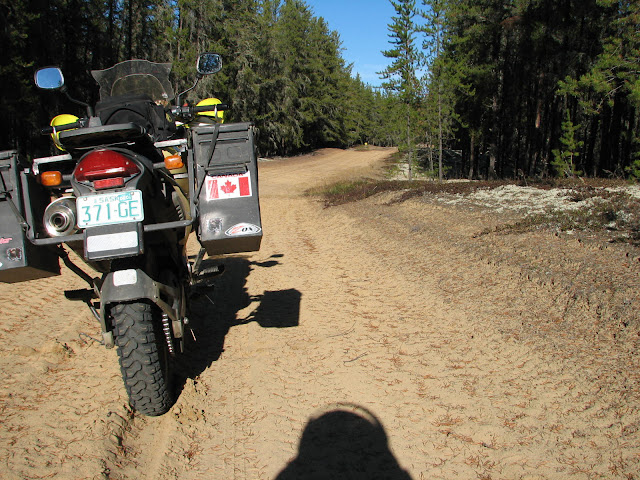
As I mentioned there area kazillion roads/trails up in this area. Getting lost would not be hard. Thanks to Rhino for making the gps route of this section (my gps is broken). We road this section in the reverse direction that the TCAT will take folks down it but I don't believe that will change the difficulty or anything like that. For the most part it's just fun sandy trails, a few spots have an abundance of baby head (round rocks) that need to be ridden.

Dave aka DVD_Scott looking nice and relaxed.

Dan checking out the snowmobile maps. As we have learned you need to be careful when riding in Canada if you plan on using these maps. What's rideable in winter is not always "doable" in the spring.


Rhino on his big GS. The 21 inch front seems to make a big difference, he rode that bike like a 650. It's always fun to ride with someone who keeps a similar pace. Chasing faster riders (although good for the skill enhancement it offers) can be tiring, waiting for people all the time kind of breaks the rhythm. Kudo's to you Rhino, first time I've ever seen a GS travel at those speeds on this time of terrain

A nice long sprint down a wide logging road brought us back to civilization, dakar speeds always make big wide gravel roads fun I'm sure Ko is still tightening nuts and bolts on his Versys.......(insert Yoda voice) "knobby tires does not a dual sport make"......although he did pretty darned well keeping up to us on the rough bits.
The ride home was a hoot. Fast and fun. The 307, 309 and 311 (I think?) roads are a fanatastic set of twisty remote roads. Not much traffic, no cops and great scenery. I got back to Ottawa just as the sun was setting. The last hour from the city back to my place was freezing ! Must have been below freezing, first time my toes started to sting. ANother great day, I enjoyed meeting some new folks, got to ride some fun trails, finished another little section of the route....just about perfect About 800 km round trip, time for new tires.
A quick stop for a smoke while riding through Ottawa, sitting back and watching the sun set over the Rideau canal....

|
8 Feb 2011
|
|
Registered Users
HUBB regular
|
|
Join Date: Aug 2009
Posts: 94
|
|
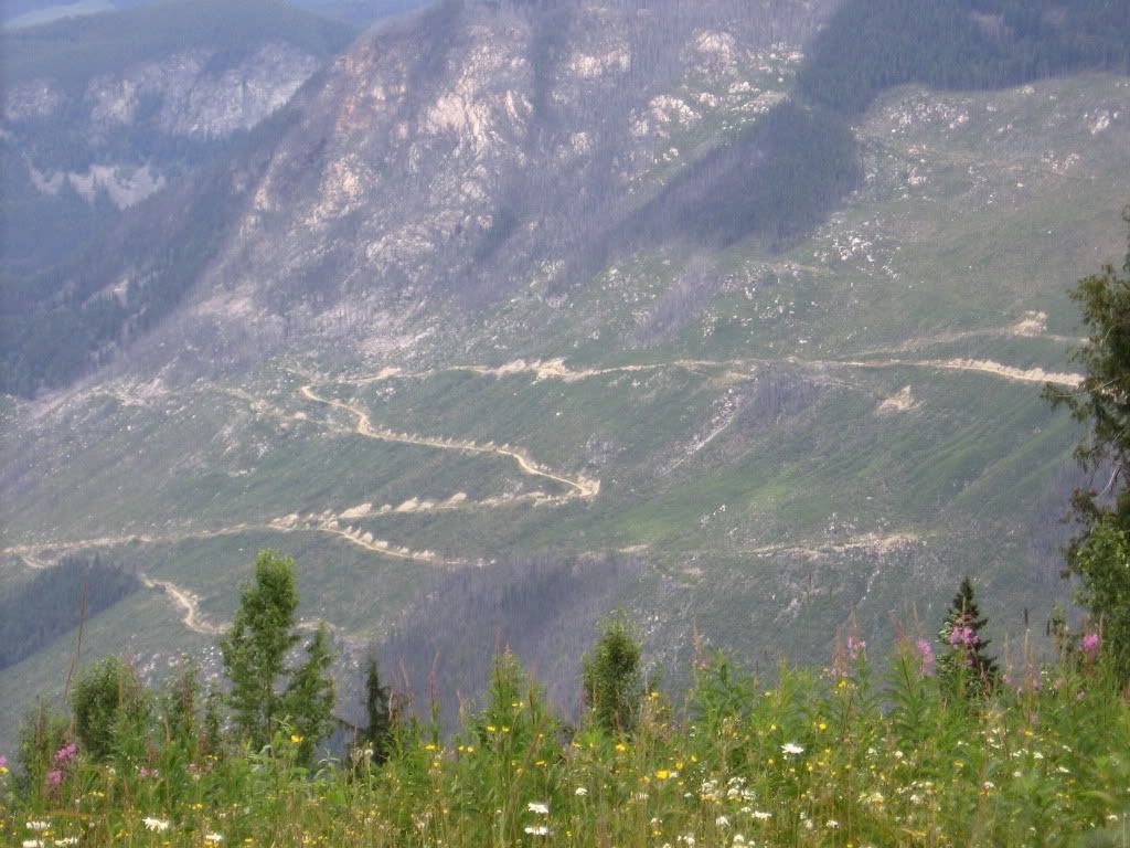
Random pic, exploring the mountains (Chic Choc Mtns) on the Gaspe Bay in Quebec. This is what lead me to get a lighter bike 

|
8 Feb 2011
|
|
Registered Users
HUBB regular
|
|
Join Date: Aug 2009
Posts: 94
|
|
NOTE: a fellow named Fab has adopted a large chunk of Quebec. This is a cross post of his posts in regards to routing eastern Quebec
TCAT's Saguenay section
--------------------------------------------------------------------------------
On august 11 2010 I went on a ride with my buddy Erick (530 exc) to ride a part of the proposed TCAT run.
The section goes through the Parc des Monts Valin (3.50$ crossing fee)which is a nice provincial reserve with a great view and great hillclimb and twisted trails. Not much pictures since we're too busy enjoying the fast riding . but we have a great vid featuring Erick's brake line (first time mounting a camera to the ktm handlebars ) that I may post later sinc windows movie maker is acting right now...
After the parc section it opens up into some ZEC roads. ZEC means zone environementale contrôlée wich means... environementally controled zone... wich means that it's an area controled by a non-profit organization of hunters and fishermen and is protected from the abuses of modern civilisation. Québec is loaded with ZECs. It cost some money (10$ or so) to pass through one of theses zones but in this case we get in higher than the gate so we're saving the fare.


Labrieville (1.50$/Liter gas, hydro plant, logging plant)

Watch out for these guys as they are not going to pull to the side of the road (too heavy)

After that, we headed west for an awsome gravel raod trip that may or may not be included in the TCAT depending on further discussions
Google earth file of that section:

From Labrieville you head east to Forestville which is about a 100 cliks from Baie-Comeau (BC), the actual start of the trans -Lab run.
Strangely my bro in law asked me to join him and some friend for a party in Les Escoumin wich is about 50km from Forestville. I jumped at the chance to
1- get drunk and
2- ride the Forestville - Baie-Comeau proposed part of the TCAT the next day
So off I was with Sylvain, another of my riding buddies.
Pic off the bike in Les escoumins

Pics from the party

The next morning we split with those fudged up mofos and headed to Forestville to ride and have breakfast
Start of the section

A nice gravel road that turns to this

And then to this

and to this

This was next

And we finally had to turn around when facing this swamp

Deadly would've probably tried it but we travel on pig's backs (GS's) so we decided that we would turn around.
Than one on the pigs (the samll one) got stuck in the mud

and after much sweating/swearing we got it out and it was my turn to go on the fat pork but I wisely choosed to fabricate an on-ramp instead of going to the side of the bridge

And I was quickly out of trouble watching Sylvain catch his breath

Map of the (aborted) section

So we headed back home after trying some alternate route that ended in a dead end also.
Now it is getting kind of a challenge to find some gravel or trail between Labrieville and Baie-Comeau since there is like 3-4 big rivers (Berstiamite, Outardes, etc) that only seems to be crossable by riding rd 138 which is paved. I'm waiting for some logger friend to be back this weekend to ask him about an alternate route but any help from anyone knowing the area would be more than welcome.
This weekend we're riding another section and will post the results soon after.
|
8 Feb 2011
|
|
Registered Users
HUBB regular
|
|
Join Date: Aug 2009
Posts: 94
|
|
NOTE: This is cross posted and was done by Fab who is creating a large chunk of the route in Quebec
We intended to do the red section on the following map:

It's connecting to the section that goes toward Parent and that has been layed by Ted (in blue on the map) and it's going to Dolbeau-Mistassini, a decent town (Fast-food chains, Canadian tire, lodging, etc.) around Lac St-Jean.
We had to ride about 275 kms before the real thing and we stopped for lunch at le Margot in Larouche, a nice restaurant with a ton of artwork and collectibles hanging on the wall including the sheep vest worn by Jimmy Hendrix which is worth the visit alone.
The crew: Me riding the usual red pig, Sylvain on the yellow 800GS and Erick on his KTM530.

After the aforementioned 200+kms of pavement, we were finally at the start of the section.

This part is a logging road and goes on for a while (+/-80kms – I forgot to take note) and is really fast (140+kph) and loose sand/gravel.

After that we parted from the main road and entered some smaller gravel roads which where fun and offered a nice view:


Time to refill the ktm:

Then it got a little rougher.
The one thing I don't like about GPS is that it often puts us in the wrong path. The trail was marked by the GPS software as a main trail but we soon found out that it was not the case. Then we ran into some four wheelers and they told us that we should have stayed on the real main trail for a while and we would have been around the nasty section that we went through. Well we where there anyway:
At first it was fun:

But then there was a creek to cross:

But it was deep and filled with football sized rocks which made the crossing quite interesting:

I did go through but Sylvain did not have that much luck.
Funny thing, I got stuck on the uphill on the other side of the creek with the rear wheel stuck on a fat rock.
On of the four wheeler guy offer to winch the pig up the hill but he had to come around me in order to get to the top. He found it appropriate to push himself with his foot resting on my shifter while ascending and what do you know, a broken foot-peg/shifter mount. There is only one on sale on ebay as I write this so there was no way I was going to find one at N49 32 25.1 W73 17 32.7
The winching went all right and my bike was out of the way so Sylvain could try the ascent:

No winch required for a 800:

The 530 went up effortlessly.
So I'm stuck with a broken shifter holding bracket and with +/-350kms to go I wasn't excite about Erick's idea to attach a rope to my boot and use it to shift gears.
The guy who crushed my bracket had a ½ filtered rod about 10 inches long with a couple of assorted nut so I took everything apart and replaced the usual shifter mounting bolt with it and got myself a bike shifting pretty much like new. All the pics are in Erick's cam so I took one today to show:

I also found a way around this trap on the GPS software and according with input from the four wheeler so this should not be a problem in the future.
After this little mishap, we where greeted with some of the nicest trail I ever ridden. The soil was like semi-hard packed sand/yellow earth with absolutely no roots and the trail was a sweeping one car wide with small crests, everything a perfect trail is made off. The it opened uo in some logging roads from a recent forest fire (they harvest burned wood) which was again a blast to ride. I even lost a luggage case, twice  .
This pic was taken after the first case-ejecting incident. Notice the road in the background left

The logging trail widen up as we reached the main forest road at km 46 (they have markers) and we rushed down to Girardville, a really small logging town north of Lake St-Jean.
We then rode again an awesome trail sections going through blueberry fields and some wood on our way to Dolbeau-Mistassini:


These again were some of the nicest trails I've ran so far!
We stopped for lunch in Dolbeau-Mistassini and rode the 200kms separating us from home as the sun was down as was the outside temp (1 Celsius) but we stopped at our local drunk hole for a tall  (yes, a unique feature of this area; la grosse bière!).
Sadly, this is probably one of the last TCAT outing for me until next spring.
|
8 Feb 2011
|
|
Registered Users
HUBB regular
|
|
Join Date: Aug 2009
Posts: 94
|
|
|
BC Teaser
A few pics from BC

The BC portion will be approximtaely 8 days, based on an average speed and average ride/drive day.

More BC and Alberta to come
|
|
Currently Active Users Viewing This Thread: 1 (0 Registered Users and/or Members and 1 guests)
|
|
|
 Posting Rules
|
You may not post new threads
You may not post replies
You may not post attachments
You may not edit your posts
HTML code is Off
|
|
|
|

Check the RAW segments; Grant, your HU host is on every month!
Episodes below to listen to while you, err, pretend to do something or other...

2020 Edition of Chris Scott's Adventure Motorcycling Handbook.
"Ultimate global guide for red-blooded bikers planning overseas exploration. Covers choice & preparation of best bike, shipping overseas, baggage design, riding techniques, travel health, visas, documentation, safety and useful addresses." Recommended. (Grant)

Ripcord Rescue Travel Insurance™ combines into a single integrated program the best evacuation and rescue with the premier travel insurance coverages designed for adventurers.
Led by special operations veterans, Stanford Medicine affiliated physicians, paramedics and other travel experts, Ripcord is perfect for adventure seekers, climbers, skiers, sports enthusiasts, hunters, international travelers, humanitarian efforts, expeditions and more.
Ripcord travel protection is now available for ALL nationalities, and travel is covered on motorcycles of all sizes!
What others say about HU...
"This site is the BIBLE for international bike travelers." Greg, Australia
"Thank you! The web site, The travels, The insight, The inspiration, Everything, just thanks." Colin, UK
"My friend and I are planning a trip from Singapore to England... We found (the HU) site invaluable as an aid to planning and have based a lot of our purchases (bikes, riding gear, etc.) on what we have learned from this site." Phil, Australia
"I for one always had an adventurous spirit, but you and Susan lit the fire for my trip and I'll be forever grateful for what you two do to inspire others to just do it." Brent, USA
"Your website is a mecca of valuable information and the (video) series is informative, entertaining, and inspiring!" Jennifer, Canada
"Your worldwide organisation and events are the Go To places to for all serious touring and aspiring touring bikers." Trevor, South Africa
"This is the answer to all my questions." Haydn, Australia
"Keep going the excellent work you are doing for Horizons Unlimited - I love it!" Thomas, Germany
Lots more comments here!

Diaries of a compulsive traveller
by Graham Field
Book, eBook, Audiobook
"A compelling, honest, inspiring and entertaining writing style with a built-in feel-good factor" Get them NOW from the authors' website and Amazon.com, Amazon.ca, Amazon.co.uk.
Back Road Map Books and Backroad GPS Maps for all of Canada - a must have!
New to Horizons Unlimited?
New to motorcycle travelling? New to the HU site? Confused? Too many options? It's really very simple - just 4 easy steps!
Horizons Unlimited was founded in 1997 by Grant and Susan Johnson following their journey around the world on a BMW R80G/S.
 Read more about Grant & Susan's story
Membership - help keep us going!
Horizons Unlimited is not a big multi-national company, just two people who love motorcycle travel and have grown what started as a hobby in 1997 into a full time job (usually 8-10 hours per day and 7 days a week) and a labour of love. To keep it going and a roof over our heads, we run events all over the world with the help of volunteers; we sell inspirational and informative DVDs; we have a few selected advertisers; and we make a small amount from memberships.
You don't have to be a Member to come to an HU meeting, access the website, or ask questions on the HUBB. What you get for your membership contribution is our sincere gratitude, good karma and knowing that you're helping to keep the motorcycle travel dream alive. Contributing Members and Gold Members do get additional features on the HUBB. Here's a list of all the Member benefits on the HUBB.
|
|
|


 Linear Mode


