 35Likes 35Likes
 |
|

26 Jul 2012
|
|
Registered Users
Veteran HUBBer
|
|
Join Date: Jan 2008
Location: St Louis, MO
Posts: 124
|
|
Quote:
Originally Posted by dlh62c

"LAO Street Map"
"KAZ Street Map"
"KGZ Street Map"
|
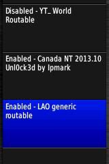
Looks like the OSM file header name has changed to 'OSM generic routable'. But changing the 3 letters should still work.
" LAO generic routable"
" KAZ generic routable"
" KGZ generic routable"
daryl
|
27 Jul 2012
|
|
Contributing Member
Veteran HUBBer
|
|
Join Date: Jul 2007
Location: Rockhampton, Australia
Posts: 868
|
|
Nope, it does not work and is invisible to the unit and BC, although I can see it in the Garmin directory
I had to download the whole thing again because when I changed it back it was faulty 
I will load one at a time, until I can find a better way
I have a thought though, I used Word2007 as my editor, maybe I need something else?
Cheers
TS
Quote:
Originally Posted by dlh62c
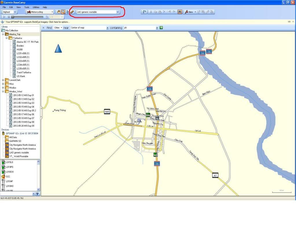
It works on my 62s and I can see it in Basecamp. Make sure the *.img file is in the 'Garmin' directory.
daryl
 |
|
27 Jul 2012
|
|
Registered Users
Veteran HUBBer
|
|
Join Date: Jan 2008
Location: St Louis, MO
Posts: 124
|
|
Quote:
Originally Posted by TravellingStrom
I have a thought though, I used Word2007 as my editor, maybe I need something else?
|
Double check the file name, it could be something like 'filename.img.doc' which won't work.
daryl
|
2 Oct 2012
|
|
Registered Users
Veteran HUBBer
|
|
Join Date: Mar 2007
Location: Brisbane Australia
Posts: 193
|
|
|
Thanks for the info.
I have tried dowloaded some sth american maps, but am not getting any of the activation emails after selecting the tiles. Have tried a couple of different email accounts including gmail, but nothing.
Have also tried searching the help files on the osm site but cant find any info.
Can anyone help?
|
2 Oct 2012
|
|
Registered Users
Veteran HUBBer
|
|
Join Date: Jan 2008
Location: St Louis, MO
Posts: 124
|
|
Quote:
Originally Posted by saab463
Thanks for the info.
I have tried dowloaded some sth american maps, but am not getting any of the activation emails after selecting the tiles. Have tried a couple of different email accounts including gmail, but nothing.
Have also tried searching the help files on the osm site but cant find any info.
Can anyone help?
|
Depending on how many jobs are in the que and the map size, you'll be sent an email when the maps are ready for download. Some maps can be downloaded immediately after your selection.
daryl
|
2 Oct 2012
|
|
Registered Users
Veteran HUBBer
|
|
Join Date: Mar 2007
Location: Brisbane Australia
Posts: 193
|
|
|
Thanks Darryl
Was a bit impatient. Took a couple of hours.
All good now working perfectly.
Thanks you.
|
7 Oct 2012
|
|
Registered Users
Veteran HUBBer
|
|
Join Date: Mar 2007
Location: UK
Posts: 4,343
|
|
Quote:
Originally Posted by Griffdowg
Edit: I think I may be downloading the wrong option.
You get these download options:
The server has generated four different configurations of your map:
* _windows.exe = Installer for Garmin BaseCamp/MapSource (Windows).
* _macosx.zip = Installer for Garmin BaseCamp/RoadTrip (Mac OSX)
* _gmapsupp.zip = Combined image for direct manual placement on the GPS device (gmapsupp.img)
* _tiles.zip = A zip file containing the tiles in the request, especially useful for Linux users (e.g. QLandkarte)
|
No questions about GPS from me today - that makes a change!
I have just completed some experimentation, i.e. new to me, and have downloaded OSM, for the UK only (= about 250 MB zipped).
I can agree with the quote above: in contrast to the excellent description in the OP about how to download from OSM, there seems to be another option (which I didn't even realise I had selected). It provides the options shown above, immediately, without use of email or even providing an email address to OSM; I guess it does this as a consequence of choosing a whole country within the obvious options that the OP describes.
So, I downloaded/unzipped only the gmapsupp.img file for the UK, dragged it across to a clean SD card, placing it into a new folder named "GARMIN".
Then I put this SD card into my Nuvi, switched on and looking under tools, disabled the onboard map in the Nuvi so that only the OSM version is showing.
This has worked fine and the Nuvi now shows a much more detailed map of the UK. For me, that counts as a success for today. 
I hope this is useful to anyone else who is learning to use OSM.
ps As per the OP, all of this applies to the download site http://garmin.openstreetmap.nl/
(there seem to be a few mirror sites for OSM)
pps There is another description of how to do this in this thread:- http://www.horizonsunlimited.com/hub...594#post416795
in post number 4 - essentially the same, but a much more cogent explanation!!
__________________
Dave
Last edited by Walkabout; 26 Mar 2013 at 11:37.
Reason: ps added pps added
|
25 Oct 2012
|
|
Registered Users
Veteran HUBBer
|
|
Join Date: Mar 2007
Location: UK
Posts: 4,343
|
|
As a follow up to my last post in here, I found some "holes" in that last OSM download of the UK and I travelled into one of them when I used the Garmin last. When downloading the 250 Mb I noticed some "tiles" within the UK were not showing on the website, but gave it no further thought.
Sure enough, when I physically travelled toward one of these, the map more or less disappeared (but one major road did stay in the display although it was not plotting correctly - I know this because I was on it at the time).
When I went on a bit further, the full map re-appeared on the Garmin, presumably when I got back onto a tile.
I am now downloading again, and this time the download is 337 Mb and it seems to have tiles to cover the whole of the UK.
Oh, the joys of computers. 
ps And it unzips at well over 400 Mb, but, hey, the whole world is only about 330 Gb 
__________________
Dave
|
16 Dec 2012
|
|
Contributing Member
Veteran HUBBer
|
|
Join Date: Oct 2007
Posts: 374
|
|
|
With these OSM maps it is possible to create multiple sets, but it is probably better to create one that covers all areas you want. Each Garmin map has "number" this determines things like which map has the highest draw order ie if you have say City Nav and OSM for the same area which one will show on top of the other. Having multiple multiple maps with the same could confuse some Garmin units.
Also someone mentioned address searching. OSM is very particular about how the search terms are entered and doesn't wildcard anywhere as well a City Nav map would. For example in City Nav the word Lincoln would be found anywhere in the street name. In OSM if we are searching for Ulica Lenin (a nice common street name in Russia) you may need to search for Ulica Lenin, Ul. Lenin or Lenin Street depending on how it has been entered on the base OSM data, you can't just search for Lenin and have it find all the streets that have the word Lenin somewhere in the title.
Apart from that we found that for Russia, Central Asia and Mongolia that these maps rock! We didn't carry paper maps at all. From what Walter told me it runs all over Garmin's ROR.
|
17 Dec 2012
|
|
Registered Users
Veteran HUBBer
|
|
Join Date: Mar 2007
Location: UK
Posts: 4,343
|
|
Quote:
Originally Posted by Bertrand
Motoreiter
Assuming you have a Garmin Montana - this procedure only works if you have that model of gps.
If you already have downloaded the image (gmapsupp.img) from OSM
- Create a folder on the micro SD card called garmin
- Place the image inside that folder
- Put micro SD in the Montana
- Start Basecamp
- Connect your Montana to your pc and wait a bit
Your pc will first recognise your Montana connected via usb port
then Basecamp will 'hear' the Montana and the map will become visible being imported - look at the green progress line on left hand side in Basecamp.
tip: you can rename the gmapsupp file to the name of the country/ies the .img is made up of- This new name will be visible on the Montana to help select/deseect but it revert to OSM worldmap in basecamp.
Whatever you rename the gmapsupp image, do not rename the extension ! the .img is for the benefit of the electronics not for the nut who connects the saddle to the handlebars!! 
|
My experimentation continues, and this procedure works on my second-hand Nuvi 205W; maybe it works for any Garmin product?
ps; The procedure works OK for the first bit in the quote = the 5 steps. For a Nuvi, the file name can not be changed from "gmapsupp".
I get around this by holding different OSM maps in separate folders in computer memory and/or on sd cards - the folders are named with the countries of relevance but the file names in all of the folders are gmapsupp.img, exactly as downloaded from OSM.
Also, I've done the download again (all as below) but this time I acquired the .exe file which puts the mapping into basecamp.
This has worked just fine, and I can now find the same map from two different locations:-
1. Within basecamp, via this .exe file
2. From the .img file held within the GPS unit (or, for that matter, straight from the SD card of the GPS unit when put into the card reader of the computer).
That's probably enough experimenting by me, for 2012.
Name Last modified Size Description Parent Directory Parent Directory -  tiles.txt tiles.txt 04-Dec-2012 20:22 1.1K Contains a list of tile numbers that are used for the maps in this directory.  osm_generic_windows.exe osm_generic_windows.exe 04-Dec-2012 20:27 370M Map installer for BaseCamp/MapSource on the Windows platform.  osm_generic_tiles.zip osm_generic_tiles.zip 04-Dec-2012 20:24 367M Compressed file that contains the tiles and overview map. This is useful for applications like Qlandkarte and Linux users.  osm_generic_macosx.zip osm_generic_macosx.zip 04-Dec-2012 20:29 365M Map installer for BaseCamp/RoadTrip on the Mac OSX platform.  osm_generic_gmapsupp.zip osm_generic_gmapsupp.zip 04-Dec-2012 20:25 348M Compressed file that contains a single image that can be placed directly onto the SD-card of the GPS. country.txt 04-Dec-2012 20:22 15 Indicates which country this map represents. 63240000_license.txt 04-Dec-2012 20:22 225 License information for OpenStreetMap. Also contains the Mkgmap version used to combine the maps.  63240000.nsi 63240000.nsi 04-Dec-2012 20:22 10K Nullsoft Scriptable Installer script used to create the BaseCamp/MapSource installer.
__________________
Dave
Last edited by Walkabout; 19 Dec 2012 at 18:02.
Reason: ps added for clarity (or just further confusion)
|
18 Dec 2012
|
|
Registered Users
Veteran HUBBer
|
|
Join Date: Mar 2007
Location: UK
Posts: 4,343
|
|
Quote:
Originally Posted by dlh62c
There needs to be a sticky for using Basecamp.
daryl
|
Maybe there does need to be a sticky about basecamp, but there is this:-
http://garmin-mapsource.wikispaces.com/BaseCamp
and I've found it excellent for getting over the first few steps with BaseCamp.
__________________
Dave
|
10 Jan 2013
|
 |
Contributing Member
HUBB regular
|
|
Join Date: Aug 2007
Location: Northern Cali
Posts: 60
|
|
|
No Luck
Maybe I am doing this wrong...
After a few minutes of waiting, in the build folder I only get two text files, tiles.txt and country.txt. No IMG file whatsoever.
Other times I get absolutely nothing but a Parent Directory...
Rather than selecting individual maps I selected a specific country/US State in the pull down and did an override in the tile selection. (First test was Australia, second test was Texas). I also try using individual maps. No joy.
Any ideas what is going on?
~CW
|
10 Jan 2013
|
|
Registered Users
Veteran HUBBer
|
|
Join Date: Mar 2007
Location: UK
Posts: 4,343
|
|
I have just done it again, downloading "Texas" from Free worldwide Garmin maps from OpenStreetMap and it is working OK - in the same way that I have done before (as per my earlier posts).
Of the 5 steps in the web site, marked with question marks in there, I use steps 1, 3 and 5 only:-
1. Choose your map type:
Generic Routable <<<<<<<<<<< I select this
Routable Bicycle (Openfietsmap Lite)
Generic Nautical (non-routable)
2.Include a TYP file (Optional):
3.Choose a predefined country:
4.Perhaps you'd like to add some additional tiles?Enable manual tile selection: , then use the map below to add and remove tiles to the selection.
5. Request your map or download it directly:
Download map now!
The result came back more or less instantly, with a full set of download files like those in my post number 55 of 3 weeks ago.
(I've now deleted them - I'm not going to Texas any time soon).
__________________
Dave
|
11 Jan 2013
|
|
Contributing Member
HUBB regular
|
|
Join Date: Aug 2007
Location: Northern Cali
Posts: 60
|
|
|
Somehow solved
I did the job again from my Linux machine at home, had a lot more luck.
My first attempt was to select an entire country from the pull down. There was no filed for an email, rather just a link to obtain immediately...I am assuming these are pre-built, as the link pointed to a readily available IMG file.
Second attempt, I chose Australia and manually added some NZ sections. This time there was an email address filed, which I filled and requested the build. One different fromt he previous attempts is that the builds took a lot longer to obtain...about 15-20 minutes, rahter than the immediate responses I would get previously.
So all is well as far as download. Now I have to test reliability.
Anyone knows if these maps contain POIs?
|
11 Jan 2013
|
|
Registered Users
Veteran HUBBer
|
|
Join Date: Aug 2012
Location: Australia
Posts: 1,131
|
|
|
Time reduction - smaller map area?
Quote:
Originally Posted by croissant_warrior
Second attempt, I chose Australia and manually added some NZ sections. This time there was an email address filed, which I filled and requested the build. One different fromt he previous attempts is that the builds took a lot longer to obtain...about 15-20 minutes, rahter than the immediate responses I would get previously.
So all is well as far as download. Now I have to test reliability.
Anyone knows if these maps contain POIs?
|
Why don't you download a small map of Oregon? And then you can 'test' from your own memory/tracks? Surely this would be of more use to you? And it would take less computing time on the server ...
Yes there are POI in the maps - in Mapsource or on your GPS use "Find" .. and see.
|
|
Currently Active Users Viewing This Thread: 2 (1 Registered Users and/or Members and 1 guests)
|
|
Lucky
|
 Posting Rules
|
You may not post new threads
You may not post replies
You may not post attachments
You may not edit your posts
HTML code is Off
|
|
|
|

Check the RAW segments; Grant, your HU host is on every month!
Episodes below to listen to while you, err, pretend to do something or other...

2020 Edition of Chris Scott's Adventure Motorcycling Handbook.
"Ultimate global guide for red-blooded bikers planning overseas exploration. Covers choice & preparation of best bike, shipping overseas, baggage design, riding techniques, travel health, visas, documentation, safety and useful addresses." Recommended. (Grant)

Ripcord Rescue Travel Insurance™ combines into a single integrated program the best evacuation and rescue with the premier travel insurance coverages designed for adventurers.
Led by special operations veterans, Stanford Medicine affiliated physicians, paramedics and other travel experts, Ripcord is perfect for adventure seekers, climbers, skiers, sports enthusiasts, hunters, international travelers, humanitarian efforts, expeditions and more.
Ripcord travel protection is now available for ALL nationalities, and travel is covered on motorcycles of all sizes!
What others say about HU...
"This site is the BIBLE for international bike travelers." Greg, Australia
"Thank you! The web site, The travels, The insight, The inspiration, Everything, just thanks." Colin, UK
"My friend and I are planning a trip from Singapore to England... We found (the HU) site invaluable as an aid to planning and have based a lot of our purchases (bikes, riding gear, etc.) on what we have learned from this site." Phil, Australia
"I for one always had an adventurous spirit, but you and Susan lit the fire for my trip and I'll be forever grateful for what you two do to inspire others to just do it." Brent, USA
"Your website is a mecca of valuable information and the (video) series is informative, entertaining, and inspiring!" Jennifer, Canada
"Your worldwide organisation and events are the Go To places to for all serious touring and aspiring touring bikers." Trevor, South Africa
"This is the answer to all my questions." Haydn, Australia
"Keep going the excellent work you are doing for Horizons Unlimited - I love it!" Thomas, Germany
Lots more comments here!

Diaries of a compulsive traveller
by Graham Field
Book, eBook, Audiobook
"A compelling, honest, inspiring and entertaining writing style with a built-in feel-good factor" Get them NOW from the authors' website and Amazon.com, Amazon.ca, Amazon.co.uk.
Back Road Map Books and Backroad GPS Maps for all of Canada - a must have!
New to Horizons Unlimited?
New to motorcycle travelling? New to the HU site? Confused? Too many options? It's really very simple - just 4 easy steps!
Horizons Unlimited was founded in 1997 by Grant and Susan Johnson following their journey around the world on a BMW R80G/S.
 Read more about Grant & Susan's story
Membership - help keep us going!
Horizons Unlimited is not a big multi-national company, just two people who love motorcycle travel and have grown what started as a hobby in 1997 into a full time job (usually 8-10 hours per day and 7 days a week) and a labour of love. To keep it going and a roof over our heads, we run events all over the world with the help of volunteers; we sell inspirational and informative DVDs; we have a few selected advertisers; and we make a small amount from memberships.
You don't have to be a Member to come to an HU meeting, access the website, or ask questions on the HUBB. What you get for your membership contribution is our sincere gratitude, good karma and knowing that you're helping to keep the motorcycle travel dream alive. Contributing Members and Gold Members do get additional features on the HUBB. Here's a list of all the Member benefits on the HUBB.
|
|
|


 Linear Mode


