 11Likes 11Likes
 |
|

13 May 2015
|
|
Registered Users
HUBB regular
|
|
Join Date: Jan 2006
Location: Lisbon
Posts: 68
|
|
|
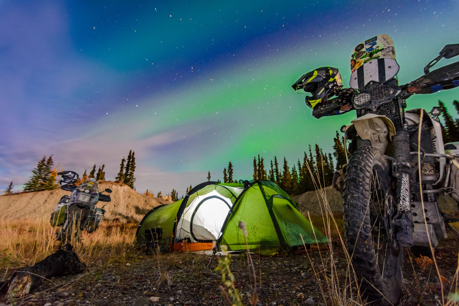
Western Sahara (and some more) in 17 days
Me and 2 friends crossed the Western Sahara inland.
From Bou-Jerif to Smara (around 500 kms), then (for the Western Sahara part of it…) from Smara to Barbas (around 1000 kms) and back north nearer the ocean, refueling near Dakhla, and in Boujdour, Laayoune and Tantan.
2800 kms of off-road riding, except for going in and out of the cities.
2 motorcycles: a 2001 Bmw F650gs (with the Touratech tanks, plus 10 liters in 2 fuel containers), a 1987 Honda Dominator (with a 26 L tank, plus 4 Roto-pax packs), and a Suzuki 800 King Quad (packed with 130 liters of fuel for the Smara / Barbas 1000km route).
What a great trip! Fantastic landscape, wonderful pistes…

You can see photos
here
and I am uploading my iphotos here
|
13 May 2015
|
|
Registered Users
HUBB regular
|
|
Join Date: Feb 2010
Location: Slovenia
Posts: 59
|
|
|
Fantastic trip!
Bravo!
(It seems the PicassaWeb pictures link is broken, though).
__________________
I'm just a soul whose intentions are good
Oh Lord, please don't let me be misunderstood ...
|
13 May 2015
|
|
Registered Users
Veteran HUBBer
|
|
Join Date: Jul 2011
Location: Somewhere
Posts: 1,472
|
|
|
Nice photos, everythings so green since my last trip
|
14 May 2015
|
|
Registered Users
HUBB regular
|
|
Join Date: Jan 2006
Location: Lisbon
Posts: 68
|
|
Quote:
Originally Posted by vrecha

Fantastic trip!
Bravo!
(It seems the PicassaWeb pictures link is broken, though).
|
Try this one
|
8 Dec 2015
|
|
Registered Users
New on the HUBB
|
|
Join Date: Jun 2015
Posts: 14
|
|
|
Fantastic trip, fantastic pictures! In January I want to try the part between Smara and Bir Anzarane (and then go for Dahkla) I guess you passed it on your way to Barbas. Are there any fuel drums in this area? Thanks for informations!
best regards
Chronist
|
9 Dec 2015
|
|
Registered Users
New on the HUBB
|
|
Join Date: Nov 2015
Posts: 6
|
|
|
Nice pictures, and clearly a lot of pretty tricky riding...
Like the quad idea!
|
10 Dec 2015
|
|
Registered Users
HUBB regular
|
|
Join Date: Jan 2006
Location: Lisbon
Posts: 68
|
|

We didn't pass by Bir Anzarane. We went down some 60 km east of it, closer to the Berm.
There was nothing there, except for some military when we passed west of Oum Dreyga. A 4x4 chase us for some time and we were escorted to a basic camp. We could see a major military settlement on the horizon, that must have been Oum Dreyga, which we were trying to avoid earlier... They checked our documents, contact their superiors via radio and let us go after some time, when we finished drinking the tea they served us.
The all trip from Smara to Barbas was all about void, emptiness, and vastitude. Very few human contact.
The guy that traveled on the quad did it that way just because he did't have a bike that could make the 1000km leg form Barbas to Smara.
He did the Smara - Barbas route before on a motorcycle (albeit on a different track), but at the time with a 4x4 companion.
He didn't carry any water or fuel for us the riders...
(the track above is on a OpenStreetMaps map)
|
12 Dec 2015
|
|
Registered Users
Veteran HUBBer
|
|
Join Date: Dec 2003
Location: granada,spain
Posts: 342
|
|
|
Dunes
Hi 834,
I see some dunes in your photos.
Could you give me some idea of how much of the pistes in this area are soft dune sand as opposed to other surfaces.
I would be driving a LR Defender so its a hard drive in dunes plus need for fuel calcs etc.
Cheers.
|
15 Dec 2015
|
|
Registered Users
HUBB regular
|
|
Join Date: Jun 2008
Location: ireland
Posts: 72
|
|
|
Waypoints
Hi
We would like to do this route in two 4x4 in March 2016
do you have any Waypoints that I could use for my GPS or have you any further details to help us with the route remember we are 4x4 not bikes
Thanks
Maurice
|
16 Dec 2015
|
|
Registered Users
HUBB regular
|
|
Join Date: Jan 2006
Location: Lisbon
Posts: 68
|
|
|
Our trip was made using Gandini’s book as a reference.
It took many hours of work to design the all trip, making the gps tracks. Most of the way was clear on Google, but in some areas the pistes were faint and we used Gandini’s waypoints to make routes and make our way.
Most of the trip was made on clear, well marked pistes, but at times the tracks did in fact disappear. Maybe, some of them they were old and unused pistes. On the south, near the RIM border, where there’s a sandier area, they also vanished for time to time under the sand. And just before getting to Barbas the all area was quite difficult as far as navigation, if you tried to follow the track, because of the sand / camel grass terrain.
The mines were on the back of our mind all the time, even knowing that the mines weren’t randomly placed. Sometimes we took risks riding off-piste just because there was no piste to follow, but that was rare.
Here are some waypoints of the trip.
Heading south out of Smara, there was some works going on a corrugated large road, that’s on OSM.
N26° 19.273' W11° 45.742’
After around 45k head west out of the main road. Soon after you join a track coming from Smara. An old Paris - Dakar track, on OSM.
N25° 58.578' W12° 05.673’
More or less at the north right angle border line between Morocco and the RIM, the OSM piste goes southwest to cross the road to Guelta Zemmour, marked as N5 . We took a (OSM unmarked) track, parallel and very close to the Berm, on a southern direction.
N25° 19.137' W12° 28.646’
Crossing of N5 road
N24° 41.619' W12° 58.381'
Well
N24° 05.625' W13° 40.757’
Military Post
(I mentioned it on an earlier post, that's about 30km west of Oum Dreyga)
N24° 04.408' W13° 47.200’
After 320 km on an OSM unmarked track we rejoin the piste that’s on OSM all the way from Smara, the Dakar piste. From the N5 road to here there were some places without a clear piste. We did ride off-piste some parts, trying to get to the right track.
N23° 30.223' W14° 10.625'
Military barracks
On the OSM map you can see pistes going southwest, here, and a bit further south, but we didn’t take them, we went south instead, as we wanted to go as close to the Berm as possible.
N23° 05.907' W14° 08.989’
Tower with a military control
We were so close to the border that the military escorted us from here to the nearer tarmac road, 70km west. Just before that military post there’s a piste that passes beyond the tower, maybe it’s possible to get trough. Our idea was to get to the town of Aousserd, just south of this point, on an unmarked track.
N22° 54.547' W14° 44.336'
Tarmac Road to Aousserd
N22° 55.688' W14° 45.902'
Abandoned house by the road, 3km NW from the last waypoint
From here we took a sandy piste from Gandini’s book, (M - La boucle archeologique) roughly heading 200º. (my friend on the quad had his computer with him and he improvised a track that night).
N22° 41.710' W14° 52.404’
Well
Soon after this point the Gandini’s route goes westward, but we went directly south, instead of doing the loop, and rejoined the Dakar piste roughly at
N22º 24’ W14º 57
the one that’s on the OSM map.
N21° 49.704' W15° 03.716’
Houses on a very sandy area.
Mobile network works! We saw some old Land Rovers, but we didn’t see anybody. A little to hot to be outside, maybe...
From here it’s westward until Barbas. Very sandy at times. It’s a track marked on the OSM, and we roughly followed it.
N21° 51.025' W15° 38.223’
House
N21° 38.286' W16° 10.973’
Camping spot
Around this area it’s difficult to follow the OSM track. The sand and the camel grass makes it really difficult to ride and navigate at the same time.
N21° 57.420' W16° 31.685’
There’s a fence with barbed wire on the piste! No more sand.
You have to go around, off-piste to west and then north to find the piste 1 km away
N22° 00.237' W16° 36.466’
Instead of follow the OSM track North we deviate westwards, and then NW on a old rocky piste (as far as I remember) until we got to the tarmac road at
N22° 03.019' W16° 44.141’
just 1 km away from the Barbas roundabout and gas station.
Some parts of the southern pistes were soft sand but you could always avoid the dunes. Apart from the camel grass bits it was ok. But along the way I remember stretches of what appeared to be hard terrain but it was soft underneath. The bike was in 5th, in low rotation, and all of sudden the soil kind of sucked the bike and one had to pull the 4th, or even the 3rd, to get speed again.
I can't say exactly how much of soft sand pistes we did, but I would say that there's no more than 150 km.
I hope this info will help you.
If you have any doubts, jus ask.
|
16 Dec 2015
|
|
Registered Users
HUBB regular
|
|
Join Date: Jun 2008
Location: ireland
Posts: 72
|
|
|
Thank you very much for taking the time to reply in such detail the GPS points will be very helpful
One last question was Diesel fuel available inland ?
Thanks
Maurice
|
17 Dec 2015
|
|
Registered Users
Veteran HUBBer
|
|
Join Date: Dec 2003
Location: granada,spain
Posts: 342
|
|
|
Thanks
As Maurice says,many thanks for taking time to do this for us.Very useful info.
|
17 Dec 2015
|
|
Registered Users
HUBB regular
|
|
Join Date: Jan 2006
Location: Lisbon
Posts: 68
|
|
One of the challenges of this trip was the length of the Smara / Barbas stage.
Ridding it with our unsupported bikes meant that we had to take all the fuel and water for the 1000 km. That was part of the adventure.
We fill up our bikes in Smara, adding more fuel in different containers for each of us, and that was it. We didn’t look for any fuel during the journey, and we didn’t pass any villages.

 N21° 49.704' W15° 03.716’
Houses on a very sandy area.
This is the closest thing we got resembling a village. Looking back in one direction and looking forward in the other.
Maybe there’s fuel in Guelta Zemmour, in Bir Anzarane, or in Aousserd, bit I don’t know. We never passed those.
|
17 Dec 2015
|
|
Registered Users
HUBB regular
|
|
Join Date: Jun 2008
Location: ireland
Posts: 72
|
|
|
Thanks again
We will be driving few old Land Rover Disco so needs lots of fuel but we could make 1000km as we have 160Lt Diesel tanks , and could take some extra cans
Did you feel safe ?
Was there any time you were worried about Land Mines and or personal security ?
Maurice
|
22 Dec 2015
|
|
Registered Users
HUBB regular
|
|
Join Date: Jan 2006
Location: Lisbon
Posts: 68
|
|
|
I always felt safe in Morocco. Also in WS.
As we left Smara, we knew that we were going for a 3 or 4 days remote desert traverse, and I remember I had that strange feeling in the stomach you get whenever big thing are about to happen…
We had a satellite phone, just in case, and we exchanged family phone numbers.
As for the land mines, there are lots of informations and insights, here on the Hubb.
As I wrote before, we took some risks ridding off-piste, and that was sometimes stupid, but at the same time unavoidable.
|
|
Currently Active Users Viewing This Thread: 1 (0 Registered Users and/or Members and 1 guests)
|
|
|
 Posting Rules
|
You may not post new threads
You may not post replies
You may not post attachments
You may not edit your posts
HTML code is Off
|
|
|
|

Check the RAW segments; Grant, your HU host is on every month!
Episodes below to listen to while you, err, pretend to do something or other...

2020 Edition of Chris Scott's Adventure Motorcycling Handbook.
"Ultimate global guide for red-blooded bikers planning overseas exploration. Covers choice & preparation of best bike, shipping overseas, baggage design, riding techniques, travel health, visas, documentation, safety and useful addresses." Recommended. (Grant)

Ripcord Rescue Travel Insurance™ combines into a single integrated program the best evacuation and rescue with the premier travel insurance coverages designed for adventurers.
Led by special operations veterans, Stanford Medicine affiliated physicians, paramedics and other travel experts, Ripcord is perfect for adventure seekers, climbers, skiers, sports enthusiasts, hunters, international travelers, humanitarian efforts, expeditions and more.
Ripcord travel protection is now available for ALL nationalities, and travel is covered on motorcycles of all sizes!
What others say about HU...
"This site is the BIBLE for international bike travelers." Greg, Australia
"Thank you! The web site, The travels, The insight, The inspiration, Everything, just thanks." Colin, UK
"My friend and I are planning a trip from Singapore to England... We found (the HU) site invaluable as an aid to planning and have based a lot of our purchases (bikes, riding gear, etc.) on what we have learned from this site." Phil, Australia
"I for one always had an adventurous spirit, but you and Susan lit the fire for my trip and I'll be forever grateful for what you two do to inspire others to just do it." Brent, USA
"Your website is a mecca of valuable information and the (video) series is informative, entertaining, and inspiring!" Jennifer, Canada
"Your worldwide organisation and events are the Go To places to for all serious touring and aspiring touring bikers." Trevor, South Africa
"This is the answer to all my questions." Haydn, Australia
"Keep going the excellent work you are doing for Horizons Unlimited - I love it!" Thomas, Germany
Lots more comments here!

Diaries of a compulsive traveller
by Graham Field
Book, eBook, Audiobook
"A compelling, honest, inspiring and entertaining writing style with a built-in feel-good factor" Get them NOW from the authors' website and Amazon.com, Amazon.ca, Amazon.co.uk.
Back Road Map Books and Backroad GPS Maps for all of Canada - a must have!
New to Horizons Unlimited?
New to motorcycle travelling? New to the HU site? Confused? Too many options? It's really very simple - just 4 easy steps!
Horizons Unlimited was founded in 1997 by Grant and Susan Johnson following their journey around the world on a BMW R80G/S.
 Read more about Grant & Susan's story
Membership - help keep us going!
Horizons Unlimited is not a big multi-national company, just two people who love motorcycle travel and have grown what started as a hobby in 1997 into a full time job (usually 8-10 hours per day and 7 days a week) and a labour of love. To keep it going and a roof over our heads, we run events all over the world with the help of volunteers; we sell inspirational and informative DVDs; we have a few selected advertisers; and we make a small amount from memberships.
You don't have to be a Member to come to an HU meeting, access the website, or ask questions on the HUBB. What you get for your membership contribution is our sincere gratitude, good karma and knowing that you're helping to keep the motorcycle travel dream alive. Contributing Members and Gold Members do get additional features on the HUBB. Here's a list of all the Member benefits on the HUBB.
|
|
|


 Linear Mode


