 2Likes 2Likes
 |
|

10 Feb 2012
|
 |
Super Moderator
Veteran HUBBer
|
|
Join Date: Jun 2000
Posts: 4,991
|
|
|
Morocco GPS map - new alternative to Olaf
Someone sent me this today:
Quote:
|
there exists a better mk map than Olafs. You can get this from viagens4x4.com. This map is also routable and includes an enormous number of pistes and tracks.
|
Mapa Garmin Marrocos
Havent seen it mentioned here before, but looks good.
I will try and load and use it later.
Ch
|
10 Feb 2012
|
|
Registered Users
Veteran HUBBer
|
|
Join Date: Jul 2011
Location: Ljubljana, Slovenia
Posts: 104
|
|
|
@Chris: When try to follow upper link got this reply: Forbidden - Users from your country are not permitted to browse this site.
|
10 Feb 2012
|
|
Super Moderator
Veteran HUBBer
|
|
Join Date: Jun 2000
Posts: 4,991
|
|
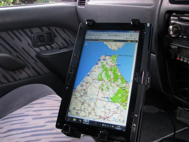
Well all I know is it worked for me in the UK.
It looks as below - a Portuguese www but in English
Is Ljubljana in a bad country ;-)
I have not tried it yet, instead am bogged down relearning how to load the latest OSM Moroccos into the Garmin.
Ch
Last edited by Chris Scott; 10 Feb 2012 at 18:43.
|
10 Feb 2012
|
|
Registered Users
Veteran HUBBer
|
|
Join Date: Aug 2008
Location: Dorset, UK
Posts: 339
|
|
I have been using this map for a while now, although not in Morocco, just planning with it loaded into Mapsource and nRoute and it's well worth having, loads of fuel stations (although I'm not sure all are there) and the pistes match up with the ones I have done so far and Olaf.
One of the nice things about nRoute is you can switch between maps in an instant on a drop down menu, so you can use the best map for the area / piste you are on at the time.
EDIT, just in case anyone missed that other maps are Here
Last edited by twenty4seven; 10 Feb 2012 at 18:10.
|
10 Feb 2012
|
|
Registered Users
Veteran HUBBer
|
|
Join Date: Jul 2011
Location: Ljubljana, Slovenia
Posts: 104
|
|
As far as I know Slovenia should not be on any black list 
|
10 Feb 2012
|
|
Registered Users
Veteran HUBBer
|
|
Join Date: Aug 2008
Location: Dorset, UK
Posts: 339
|
|
Quote:
Originally Posted by Whiskey

As far as I know Slovenia should not be on any black list |
PM me your email and I will send it to you, if you wish.
|
10 Feb 2012
|
|
Registered Users
Veteran HUBBer
|
|
Join Date: Mar 2007
Location: from Portugal, living in Germany
Posts: 121
|
|
Good evening from Portugal 
Same here, if you need the map please PM me.
BR,
CaBRita
__________________
Luis Cabrita, Honda XRV 750 Africa Twin '97
Flickr & PolarSteps
|
10 Feb 2012
|
 |
Registered Users
HUBB regular
|
|
Join Date: Jan 2010
Location: sLOVEnia
Posts: 43
|
|
|
Hi
can someone tell me how much Mb we are talking about?Thnx
|
10 Feb 2012
|
|
Super Moderator
Veteran HUBBer
|
|
Join Date: Jun 2000
Posts: 4,991
|
|
|
import jpg maps - at last
24/7 just sent me the .exe of 3.7mb and someone else said the map itself was 6mb.
I could not open the .exe as Mapsource (req'd) is not Mac'd and BaseCamp (replaces MapS?) is Mac'd but didn't like .exe.
But - fyi - in the intervening hours lost in Garminworld I have learned that with Garmin CustomMaps you can finally import any scanned or digi jpg map into a GPS unit by 'calibrating' it against Google Earth as an opaque layer, and then saving as a kmz to import into a unit's /directory which, with a sat image .kmz could sort of = GE in a GPS... Possibly very nice.
This has always been the holy grail in the central Sahara (maybe not so much Morocco) where detailed digi mapping (free or otherwise) is scarce but the excellent IGN maps (1m, 500k and 200k) needed to be hooked up to a laptop). Directly off a big screened GPS would also be nice. You could look at the screen IGN, relate it to a paper IGN and get the big picture in a flash.
Problem is, my old 76csx hasn't got the poke for CustomMaps but the newer 78 does - as do all the touchy Dakotas, Montanas, etc.
stop me if I'm going on...
Ch
|
11 Feb 2012
|
|
Registered Users
HUBB regular
|
|
Join Date: Dec 2009
Posts: 48
|
|
|
Take care downloading Viagens maps. I just did for comparison , and it wiped out about 30 other maps I had in Mapsource. Got them back after a system restore, but not very reassuring. Of course, this may just be my system...
|
11 Feb 2012
|
|
-
Veteran HUBBer
|
|
Join Date: Apr 2006
Posts: 2,399
|
|
Quote:
Originally Posted by Chris Scott
But - fyi - in the intervening hours lost in Garminworld I have learned that with Garmin CustomMaps you can finally import any scanned or digi jpg map into a GPS unit by 'calibrating' it against Google Earth as an opaque layer, and then saving as a kmz to import into a unit's /directory which, with a sat image .kmz could sort of = GE in a GPS... Possibly very nice.
This has always been the holy grail in the central Sahara (maybe not so much Morocco) where detailed digi mapping (free or otherwise) is scarce but the excellent IGN maps (1m, 500k and 200k) needed to be hooked up to a laptop). Directly off a big screened GPS would also be nice. You could look at the screen IGN, relate it to a paper IGN and get the big picture in a flash. Ch
|
I have been giving presentations at the German HU meets on this and it works well - although of limited use to long haul overlanders. Very useful for those wishing for GE 'mapping' images in a smaller area due to the number of images required - as well as gps model limitations (storage/processing/etc)
As 24/7 says, one great advantage is using Nroute so as to have the wide screen effect based on your notebook. It's a shame Garmin discontinued this and replaced it with a product that is not free. Note: I have not been able to get N-Route to work under windows 7 - only on XP.
==> 24/7 what op.sys are you running your N-route under?
Quote:
Originally Posted by Barrie Dunbar
Take care downloading Viagens maps. I just did for comparison , and it wiped out about 30 other maps I had in Mapsource. Got them back after a system restore, but not very reassuring. Of course, this may just be my system...
|
No Barry you are right and trying to install these causes a lot of grief - these maps are best avoided IMHO.
Best either keep nice treat from Olaf with his maps, or invest in the Garmin maps which are not free - Topo Maroc has been out for over 2 years now but still the best there is.
|
11 Feb 2012
|
|
Registered Users
Veteran HUBBer
|
|
Join Date: Aug 2008
Location: Dorset, UK
Posts: 339
|
|
Quote:
Originally Posted by Bertrand
I have been giving presentations on how to do this at the HU Germany meetings Chris. You should come one day!
No Barry, you are right and these will cause you grief and are best avoided IMHO.
Stick to Olaf's maps which are a treat as they are free, or for more detail/serious navigation invest in the now 2 year + old Garmin Maroc topo map.
|
I don't have any problem here, been using the map for 3 months or so now, on various PC's.
What are the dates on your IMG files? Mine are Oct 2009 I'm waiting for another log in, just in case I'm using an older version.
|
11 Feb 2012
|
|
Registered Users
Veteran HUBBer
|
|
Join Date: Aug 2008
Location: Dorset, UK
Posts: 339
|
|
Quote:
Originally Posted by Bertrand
==> 24/7 what op.sys are you running your N-route under?
|
Win 7
and in the past Win XP
|
11 Feb 2012
|
|
Registered Users
Veteran HUBBer
|
|
Join Date: Aug 2008
Location: Dorset, UK
Posts: 339
|
|
I did not do anything special, just installed it as normal, it's on my desktop (Win7) as well.
I'm using version 2.7.4 btw.
Mapsource Ver 6.16.2
I have just downloaded another copy of MARROCOS map and it is the same as the version I have.
Like I said, it never caused me any problems, both on my deck top or laptop, both have multiple maps installed, but I have not yet used it in anger in Morocco in nRoute over an extend time.
It will get a full test in April though 
|
11 Feb 2012
|
|
-
Veteran HUBBer
|
|
Join Date: Apr 2006
Posts: 2,399
|
|
it was the 'exe' that gave me grief-
Might catch up in Maroc then- in a 4x4 I take it? !
|
|
Currently Active Users Viewing This Thread: 1 (0 Registered Users and/or Members and 1 guests)
|
|
|
 Posting Rules
|
You may not post new threads
You may not post replies
You may not post attachments
You may not edit your posts
HTML code is Off
|
|
|
|

Check the RAW segments; Grant, your HU host is on every month!
Episodes below to listen to while you, err, pretend to do something or other...

2020 Edition of Chris Scott's Adventure Motorcycling Handbook.
"Ultimate global guide for red-blooded bikers planning overseas exploration. Covers choice & preparation of best bike, shipping overseas, baggage design, riding techniques, travel health, visas, documentation, safety and useful addresses." Recommended. (Grant)

Led by special operations veterans, Stanford Medicine affiliated physicians, paramedics and other travel experts, Ripcord is perfect for adventure seekers, climbers, skiers, sports enthusiasts, hunters, international travelers, humanitarian efforts, expeditions and more.
Ripcord Rescue Travel Insurance™ combines into a single integrated program the best evacuation and rescue with the premier travel insurance coverages designed for adventurers and travel is covered on motorcycles of all sizes.
(ONLY US RESIDENTS and currently has a limit of 60 days.)
Ripcord Evacuation Insurance is available for ALL nationalities.
What others say about HU...
"This site is the BIBLE for international bike travelers." Greg, Australia
"Thank you! The web site, The travels, The insight, The inspiration, Everything, just thanks." Colin, UK
"My friend and I are planning a trip from Singapore to England... We found (the HU) site invaluable as an aid to planning and have based a lot of our purchases (bikes, riding gear, etc.) on what we have learned from this site." Phil, Australia
"I for one always had an adventurous spirit, but you and Susan lit the fire for my trip and I'll be forever grateful for what you two do to inspire others to just do it." Brent, USA
"Your website is a mecca of valuable information and the (video) series is informative, entertaining, and inspiring!" Jennifer, Canada
"Your worldwide organisation and events are the Go To places to for all serious touring and aspiring touring bikers." Trevor, South Africa
"This is the answer to all my questions." Haydn, Australia
"Keep going the excellent work you are doing for Horizons Unlimited - I love it!" Thomas, Germany
Lots more comments here!

Every book a diary
Every chapter a day
Every day a journey
Refreshingly honest and compelling tales: the hights and lows of a life on the road. Solo, unsupported, budget journeys of discovery.
Authentic, engaging and evocative travel memoirs, overland, around the world and through life.
All 8 books available from the author or as eBooks and audio books
Back Road Map Books and Backroad GPS Maps for all of Canada - a must have!
New to Horizons Unlimited?
New to motorcycle travelling? New to the HU site? Confused? Too many options? It's really very simple - just 4 easy steps!
Horizons Unlimited was founded in 1997 by Grant and Susan Johnson following their journey around the world on a BMW R80G/S.
 Read more about Grant & Susan's story
Membership - help keep us going!
Horizons Unlimited is not a big multi-national company, just two people who love motorcycle travel and have grown what started as a hobby in 1997 into a full time job (usually 8-10 hours per day and 7 days a week) and a labour of love. To keep it going and a roof over our heads, we run events all over the world with the help of volunteers; we sell inspirational and informative DVDs; we have a few selected advertisers; and we make a small amount from memberships.
You don't have to be a Member to come to an HU meeting, access the website, or ask questions on the HUBB. What you get for your membership contribution is our sincere gratitude, good karma and knowing that you're helping to keep the motorcycle travel dream alive. Contributing Members and Gold Members do get additional features on the HUBB. Here's a list of all the Member benefits on the HUBB.
|
|
|


 Linear Mode


