 |
|

19 Jul 2009
|
|
Registered Users
Veteran HUBBer
|
|
Join Date: Jun 2009
Location: Ottawa
Posts: 100
|
|
|
Journey to Iceland - Land of Ice and Fire Day 1
Iceland is a motorcycle destination that I have talked about doing for a number of years, but whenever I looked into trying to organize a trip over there I could never seem to find a local company that would rent a motor bike out to me for a few weeks. Anyone who had done a motorcycle trip to Iceland seemed to have come over by ferry boat from one of the Scandinavia countries with their own vehicles.
For North Americans, this did not leave us with many options except to air freight (very expensive) a bike over to the island. Also anyone familiar with Iceland previous to their economic meltdown knows that Iceland was a really really expensive place to visit.
Times have changed, in the last few years a number of companies have sprung up offering to hire out motorcycles to the mass of tourists who can now afford to visit Iceland.
The company that I contacted for planning my trip over to Iceland was
Ridingiceland ( Riding Iceland :: Home) The owner of the company Haddi
had a number of bikes for hire, from Kawasaki KLR650, Suzuki VStrom 650
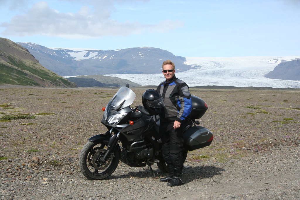
as well as some recent Yamaha XT 660. After some discussion on what would be a suitable bike for my ride around Iceland, I eventually settled on a Suzuki VStrom outfitted with some dual purpose tires. (I will discuss later in my ride report on whether or not this was the right choice or not for the trip)
I had originally planned on doing this trip with a brother or mine who is also afflicted with the motorcycle bug but a few weeks before we were to leave on the trip he came down with some health issues, so my journey to Iceland would be a solo effort.
From other ride reports I had read about touring in Iceland, I learned that there was a road that went around the circumference of the country - The Ring Road. Most of it is paved or hard surfaced gravel. There are a series of roads that cross into the interior of the country but these are dirt and graveled roads, with water crossings and other hazards more suited for more serious off road bikes and riders.
The Journey begins
I would be flying from Ottawa Canada to Reykjavik Iceland.
Icelandair has daily flights out of Halifax. My flight itinerary for this trip would be
Air Canada - Ottawa to Halifax
Halifax to Reykjavik Iceland (Keflavik International Airport)
The flight to Iceland from Halifax Nova Scotia is an overnight flight
The flight leaves Halifax at 10:00 Maritime time and arrives into Reykavik
at 5:15 the next morning. (Flying time 4:15)
The Icelandair flight over to Iceland was aboard a cramped Boeing 757.
I am not sure if there was some kind of Icelandic youth group affair going on, because the plane was full of Icelandic teenagers on their way back home to Iceland. Contrary to my fears about being on a plane with 150 teenagers, it turned out to be a very quiet flight over to Iceland.
As our flight departure had been delayed 30 - 40 minutes we did not arrive to Reykjavik until 5:45 that morning.
The main international airport in Iceland is not in Reykjavik but in the town of Keflavik some 35 - 40 km west of the capital city of Reykjavik
The main terminal is called Leifur Eir�*ksson Air Terminal
The Keflavikairport only services international routes. There is another local airport in Reykjavik that provides domestic service to Greenland, Faroe Islands and other points in Iceland.
As we were the only flight arriving that early in the morning, claiming my baggage and getting through customs and immigration was pretty much just a walked through and getting your passport stamped.
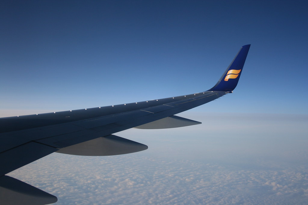
Geting ready to land in Iceland - Wing tip of Boeing 757 Icelandair
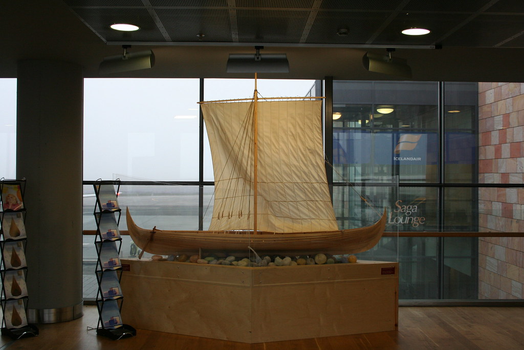
 Leifur Eir�*ksson Air Terminal
 - Display model of Viking boat
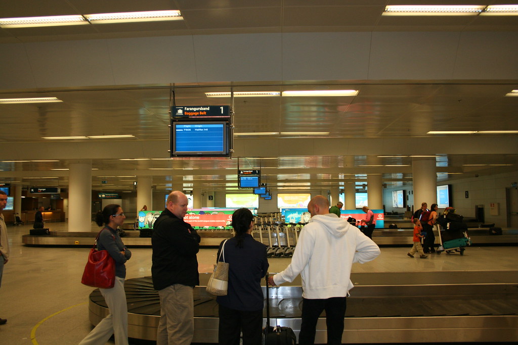
Following the crowd to baggage claim area

Hoping that all my motorcycle gear came over on plane
Last edited by Ride4Adventure; 13 Mar 2010 at 01:52.
|
19 Jul 2009
|
|
Registered Users
Veteran HUBBer
|
|
Join Date: Jun 2009
Location: Ottawa
Posts: 100
|
|
|
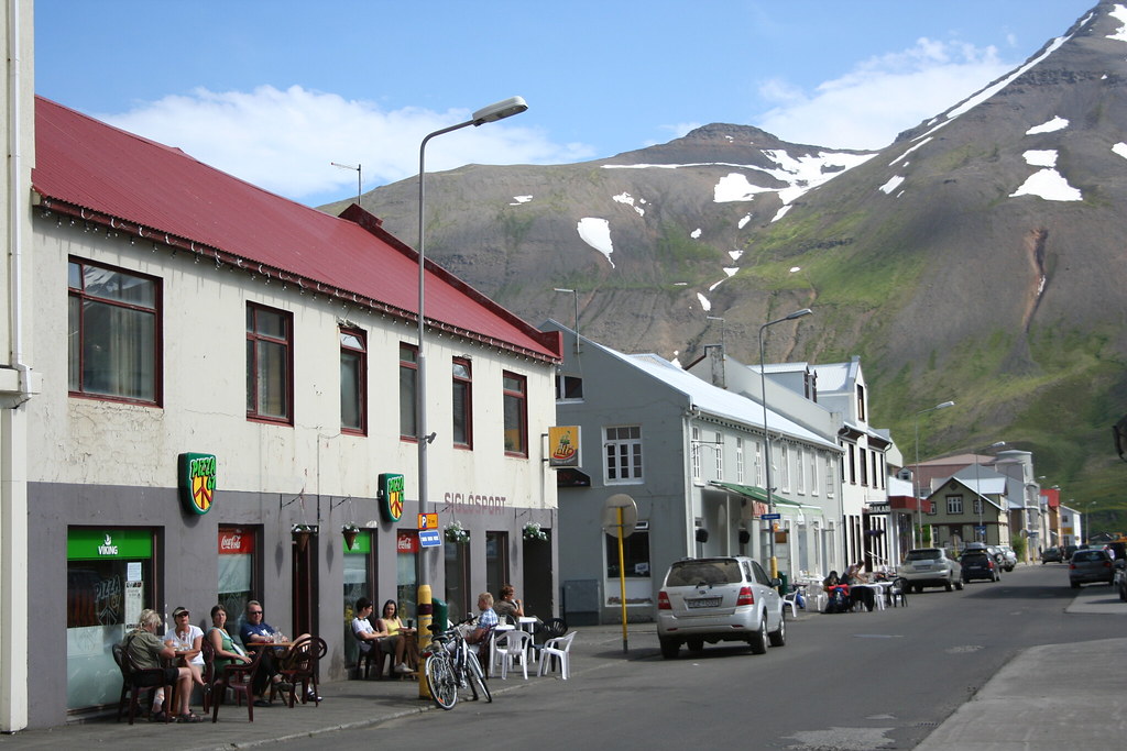
Journey to Iceland Land of Ice and Fire Day 1 Continue
The main Keflavik International airport is about 40 kms or more from Reykjavik and a pretty hefty taxi fare to get you from the airport to the city.
From my copy of the Lonely planet guide to Iceland I read that there was a bus service from the airport to the main bus station and to the major hotels in town. As you come out of the customs and immigration area there is a money exchange to the left and a kiosk for the Fly Bus company that provides bus service into town from the airport. After exchanging some of my Canadian dollars into Icelandic krónur (106 krónur/Cdn dollar) I made my over to the ticket kiosk. My timing was perfect there was a bus leaving in five minutes.
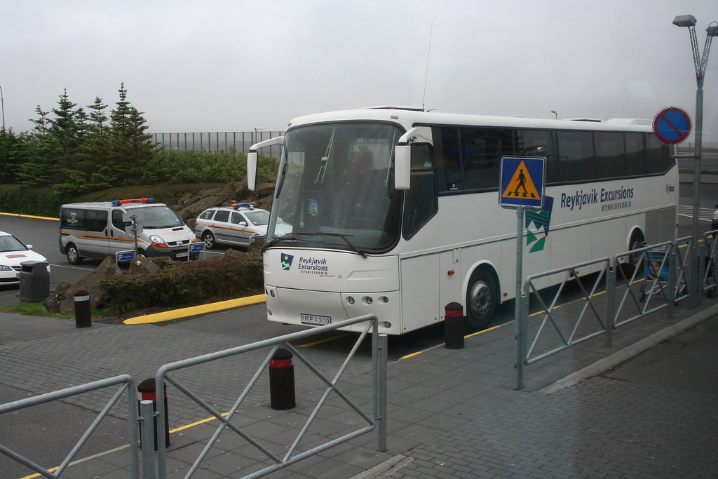
Photo of Fly Bus to bring me into city
I had made arrangements to meet Haddi at the bus terminal that morning, but I was not sure exactly when I would be arriving.
As it turns out Haddi was waiting for me at the bus terminal, he had recognized me from a photo of myself from my web site ride4adventure.com.
Haddi has an office and storage facility in Hafnarfjordur about 10 minutes drive south of Reykjavik.
Here is a photo of Haddi in his shop surrounded by some of his motorcycles.

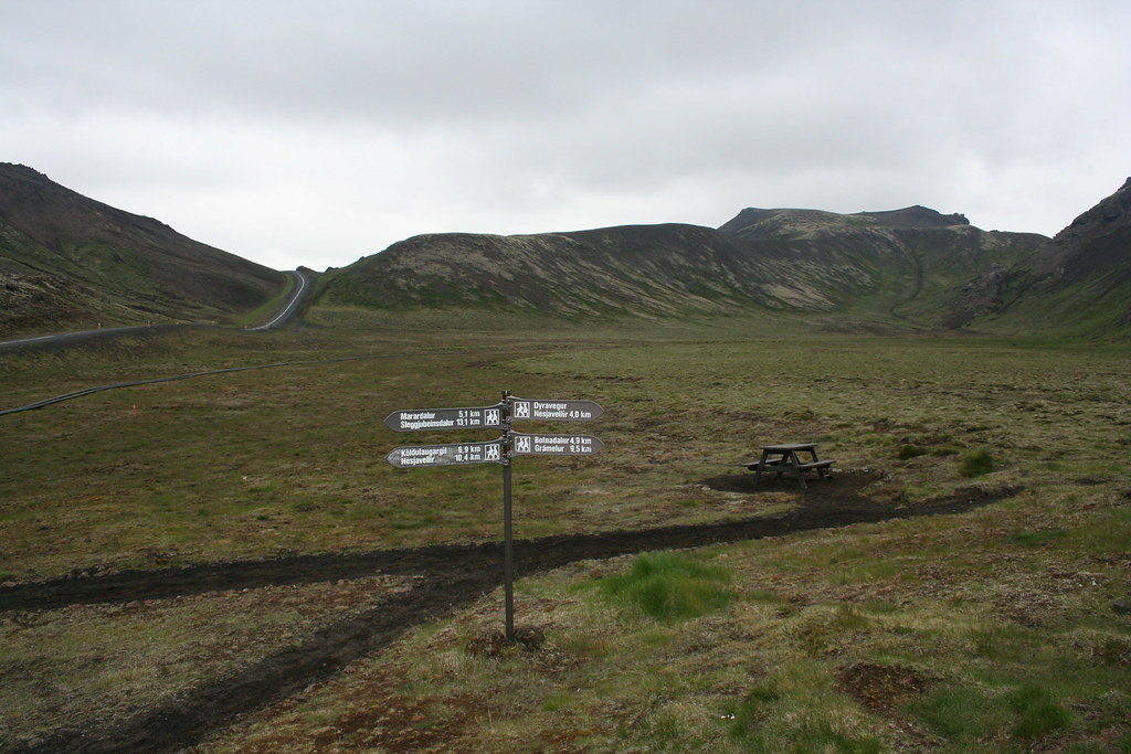
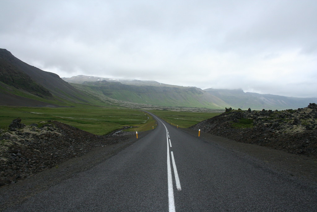
Between organizing and packing the gear on the Suzuki VStrom and filling out the paper work. By 8:30 I was ready to hit the road. I told Haddi that I had planned on heading out to Vik that day and would be first going up to Thingvellir for the start of my trip. Haddi was good enough to lead me out of town and on to route 36 and get me pointed in the right direction for the start of my trip.
Photo from side of road on Hwy 36 on way to Thingvellir
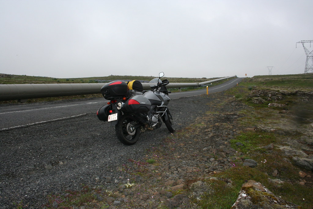
Suzuki Vstrom DL650 with my gear
 First pee stop
Grey overcast skies, forecast is for sunnier weather today.
 The kind of signs that motorcyclists like to see curves ahead
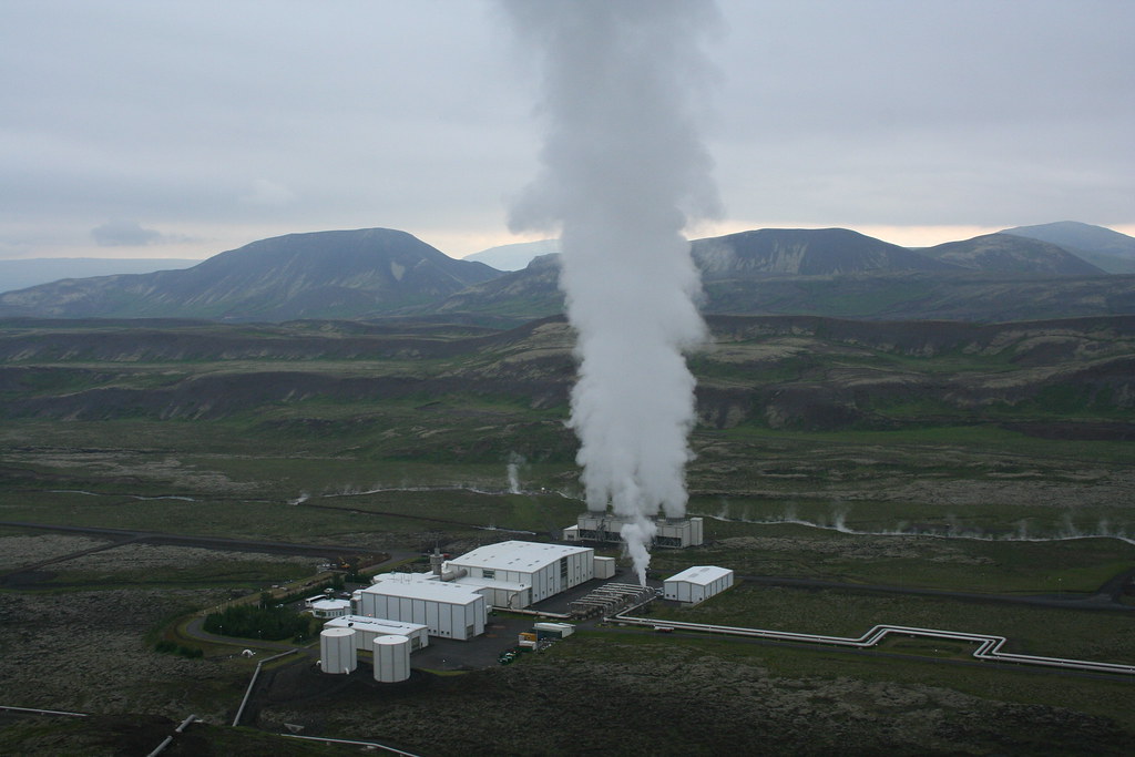
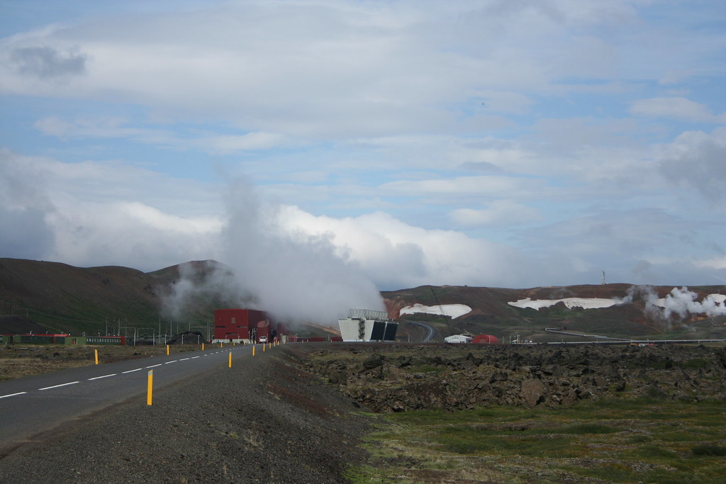
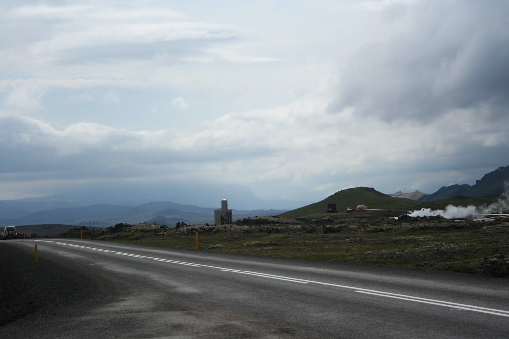
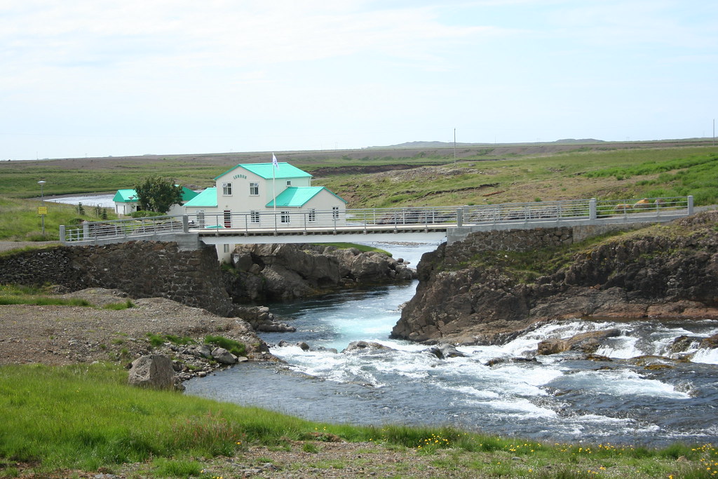
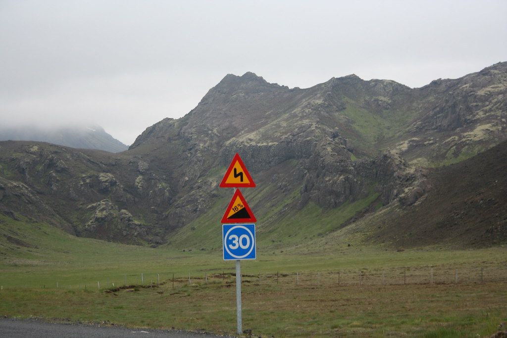 Photo of geothermal pipeline along Hwy 30
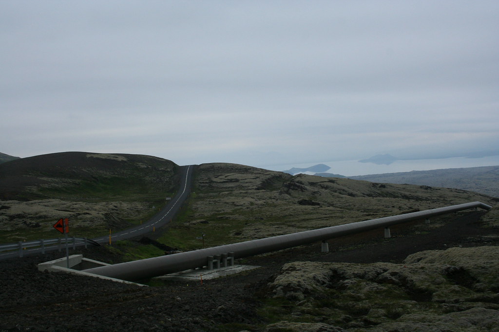 Stop near one of the local geothermal power plants
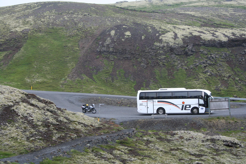
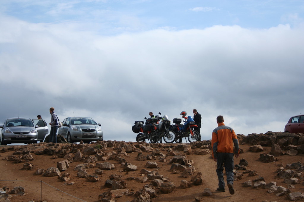
One common sight while touring around Iceland is the omnipresent tour bus, they are everywhere in Iceland.
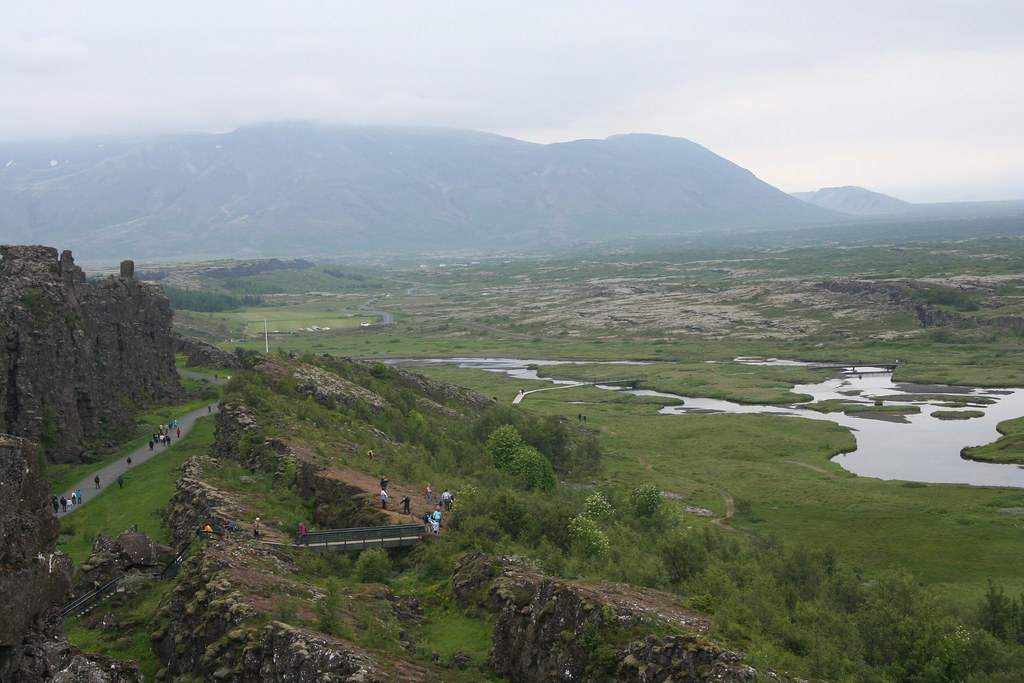
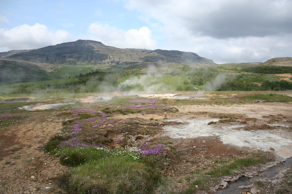
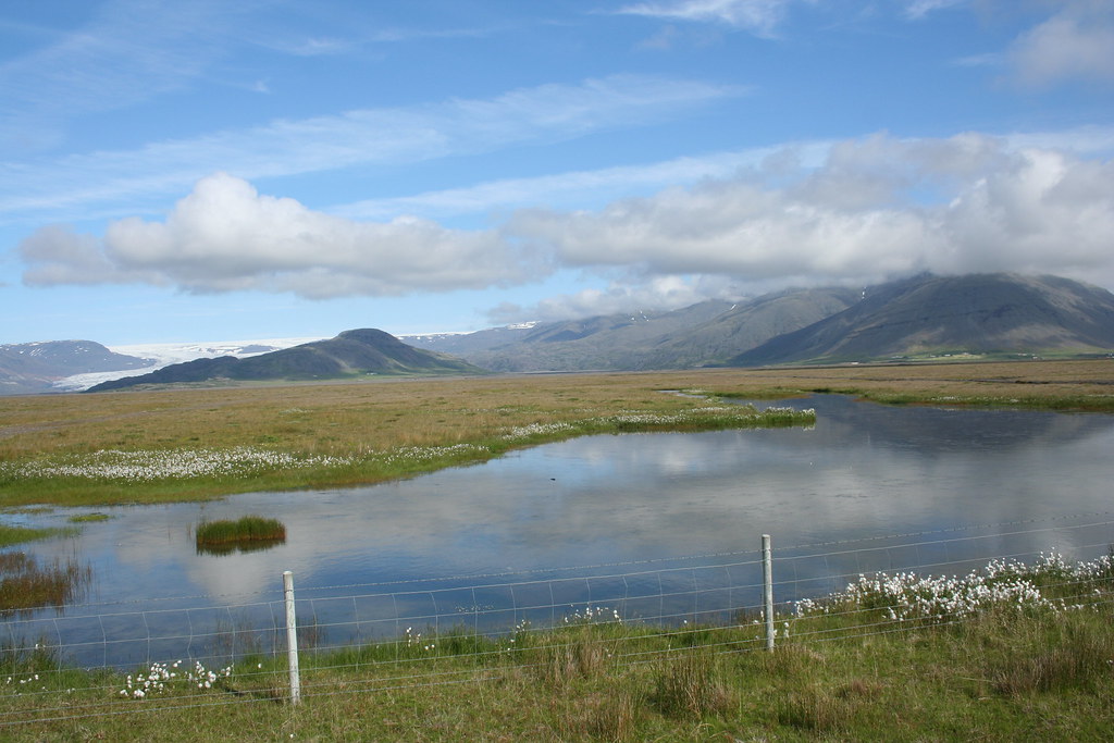
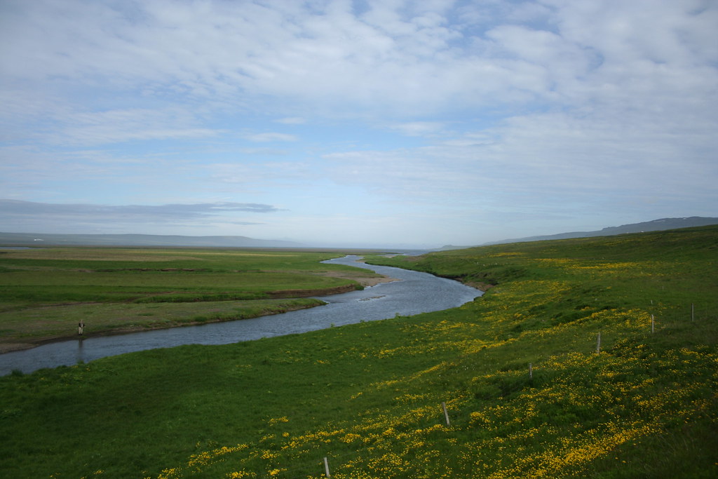
 Some photos overlooking Pingvallavatn Lake - Largest lake in Iceland
title=
Some photos overlooking Pingvallavatn Lake - Largest lake in Iceland
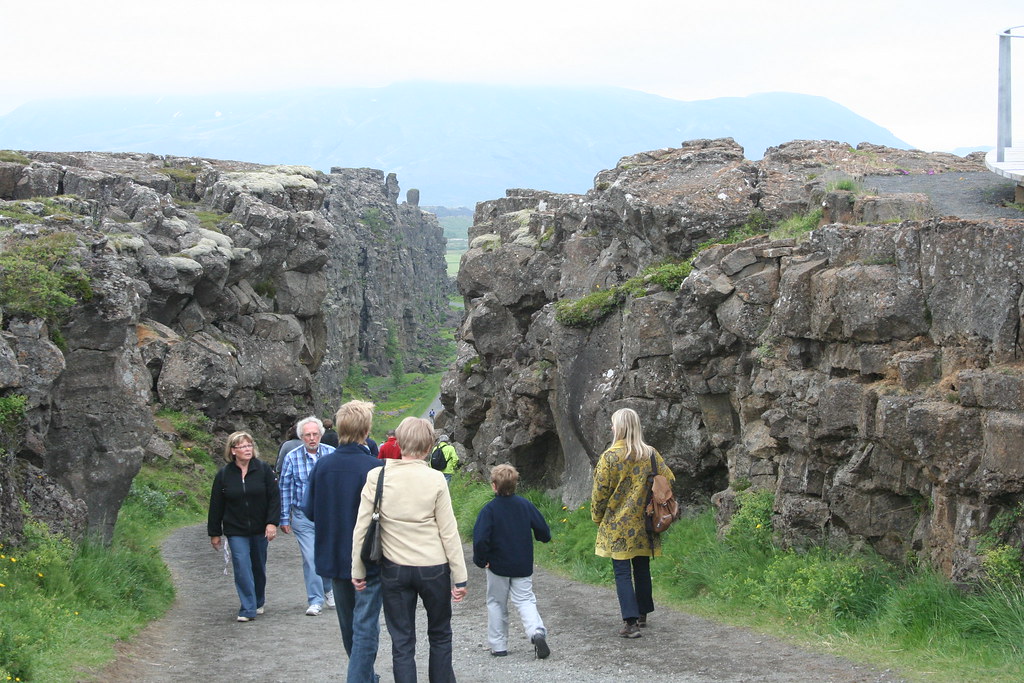
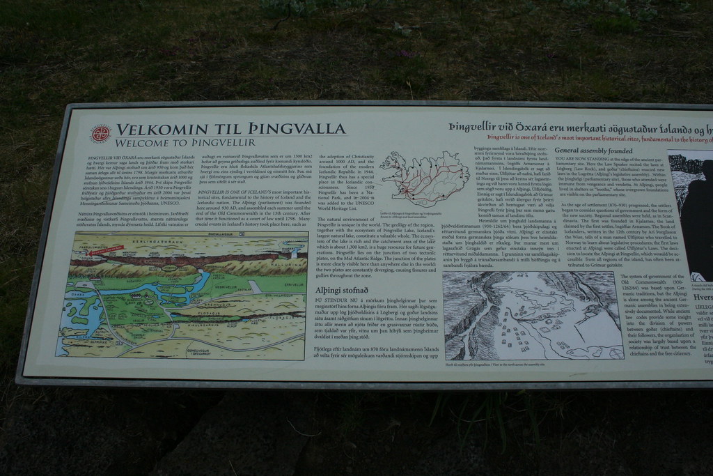
title= This next set of photos is from Þingvellir
Excerpt from Wikipedia arcticle on ÞinTgvellirÞingvellir (Icelandic: Þing: 'parliament', vellir: 'meadows')(sometimes transliterated Thingvellir), is a place in Bláskógarbyggð in southwestern Iceland, near the peninsula of Reykjanes and the Hengill volcanic area. Þingvellir is a site of historical, cultural, and geological importance and is one of the most popular tourist destinations in Iceland. Þingvellir National Park was founded in 1930 to protect the remains of the parliament site and was later expanded to protect natural phenomena in the surrounding area. Þingvellir National Park was the first national park in Iceland and was decreed "a protected national shrine for all Icelanders, the perpetual property of the Icelandic nation under the preservation of parliament, never to be sold or mortgaged."Parliament or Alþingi was established at Þingvellir in 930 and remained there until 1789. Þingvellir is the site of a rift valley and home to Þingvallavatn, the largest natural lake in Iceland.
Leaving the Þingvellirarea and headed out for Geysir
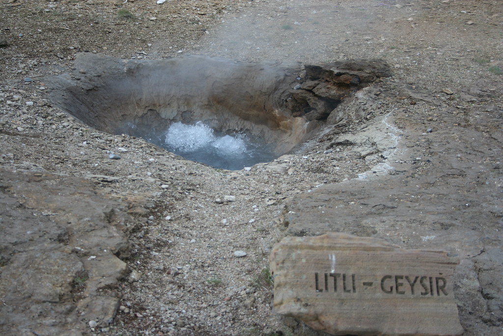
One of the must see areas when visiting Iceland is Geysir Park.
There are a number of hot springs and active geysers in the park. There is a geyser here called the "Great Geyser" that user to sprout steam and water 180 - 200 feet in the air but it has remained dormant for many years now, some say because of tourist over the years throwing junk into the vent hole. Another smaller geyser close by is the Strokkur (The Churn) It erupts every 5 - 6 minutes throwing steam and water 70 - 100 feet into the air. My photo is of this lesser geyser. Having been to Yellowstone Park on a number of occasions, I thought Old Faithful was more spectacular

Eruption of Strokkur geyser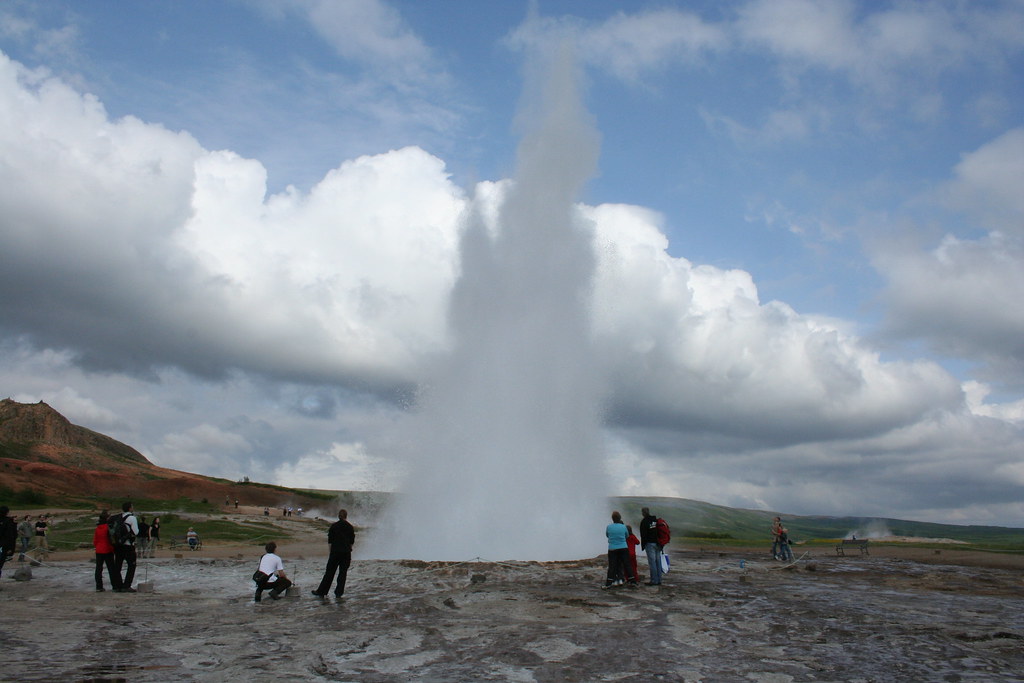
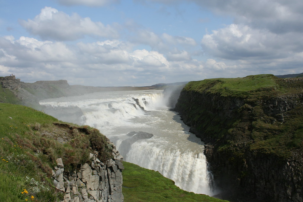
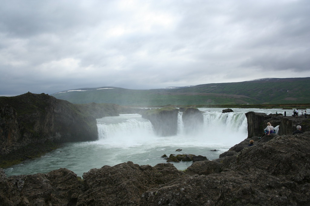
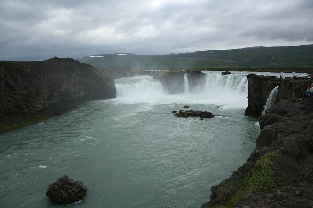
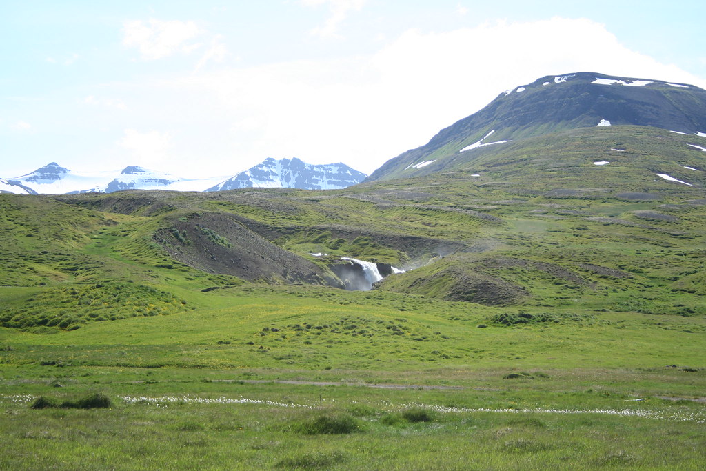
Next set of images is from visit to GullFoss. These waterfalls are one of the iconic images of Iceland.
Here is a web description of the falls
The Golden Waterfalls (Gullfoss) are situated in the upper part of River Hvita. The water cascades down two steps, one 11 m high, and the other 22 m, into the 2,5 km long canyon below. This canyon was created at the end of the Ice Age by catastrophic flood waves and is lengthened by 25 cm a year by the constant erosion 
Last edited by Ride4Adventure; 11 Jan 2015 at 01:45.
|
19 Jul 2009
|
|
Registered Users
Veteran HUBBer
|
|
Join Date: Jun 2009
Location: Ottawa
Posts: 100
|
|
|
Journey to Iceland Land of Ice and Fire Day 1 Continue
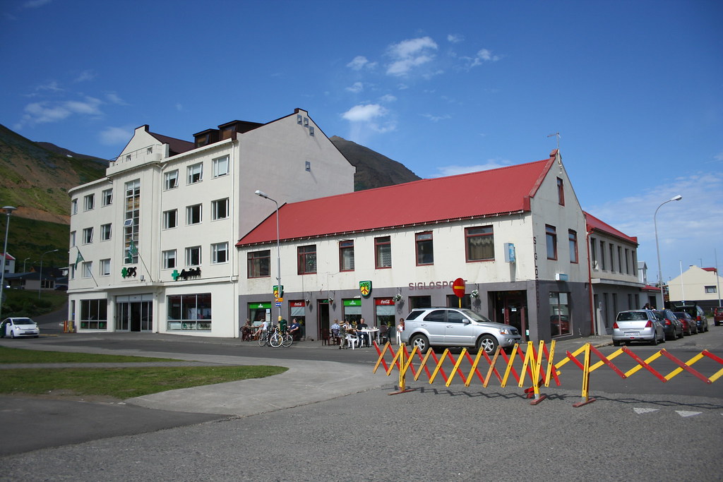
I stopped in Geysir (yes that is how it is spelled) again for lunch after coming back from viewing the falls at Gullfoss. This route out from Reykjavik to Þingvellir,Geysir and Gullfoss is called the Golden Circle and is pretty much what 90% of tourist see and only experience when they come to Iceland for a visit.
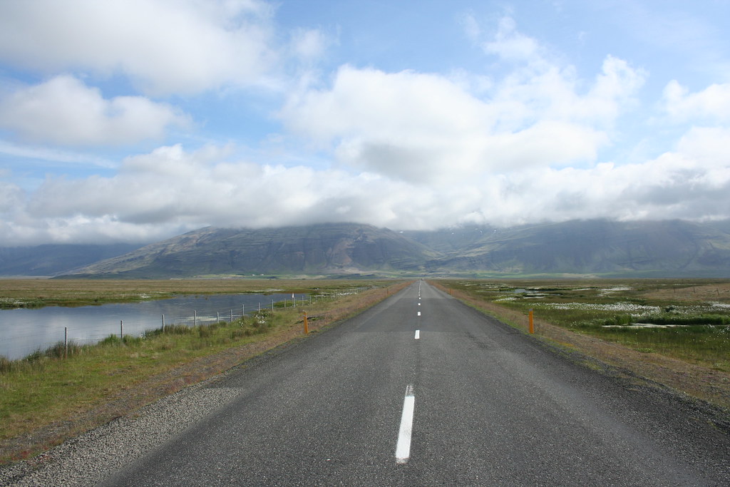
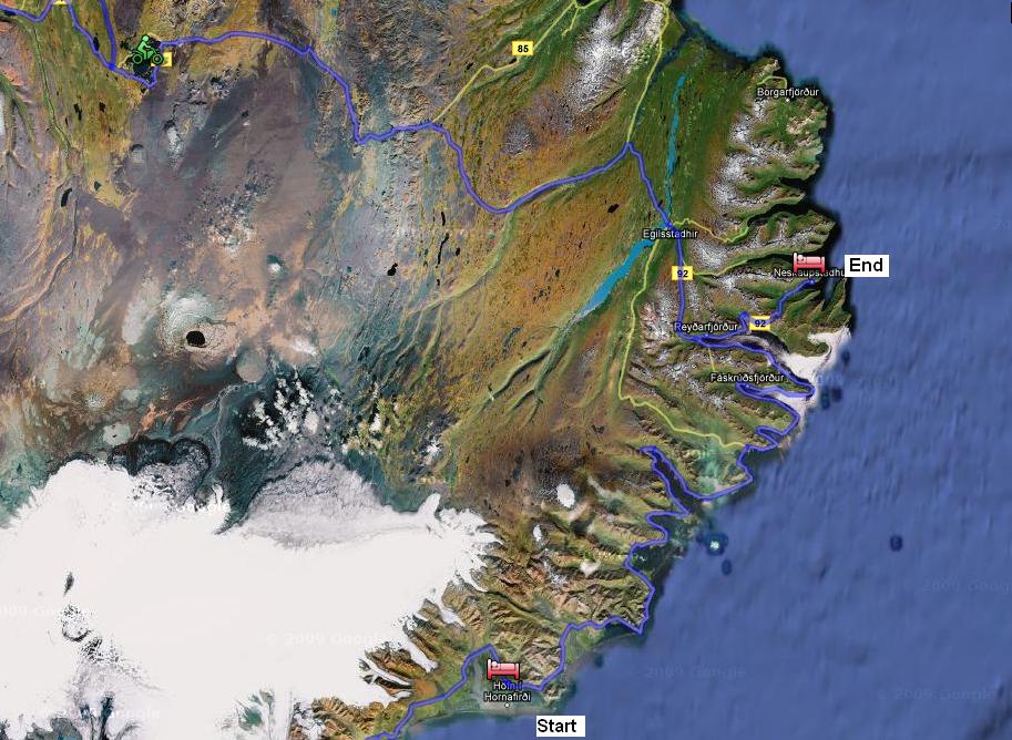
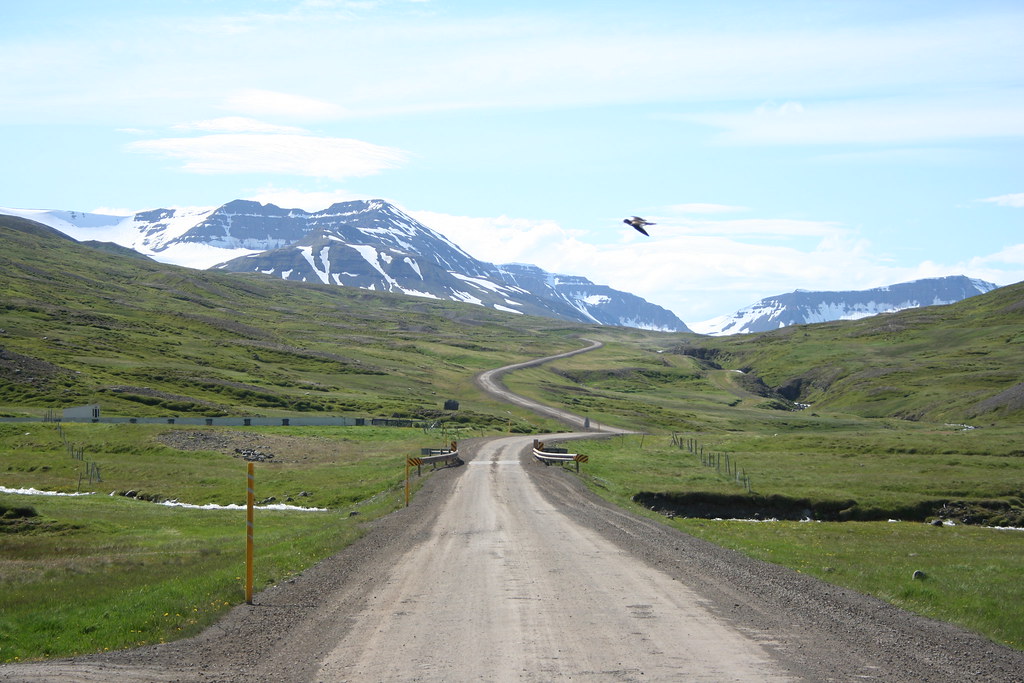
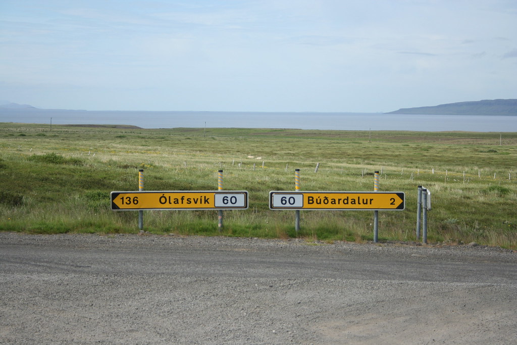
My plans for this first day are to ride down to the town of Vik, which is some 250 kms away.The route I choose for my trip, is to follow the Ring Road (Hwy 1) around Iceland, following the main road counter clockwise around the island. In total the distance around the island is about 1500 - 1600 kms, it should take me a 8 days or so to get around the island.
From Geysir I took route 30 down to where it meets up with the main Hwy 1. It was a ride of 40 - 50 kms over hard packed dirt and gravel. The VStrom had no problems handling the road conditions. Although in some places they had dumped a load of fresh gravel on the road surface.This is when you discover that putting trail tires on a street bike does not turn a street bike into a trail bike.
Here is a note about fueling up in Iceland. Although there appears to be a lots of petrol stations around Iceland especially on the Ring-Road, most stations outside of the main towns are "Pay at the Pump facilities"
The gas pumps only take credit cards and if you are like me and have no idea what your pin numbers are for your credit cards then you are in trouble. What some of the main petrol chains do and sell a prepaid gas card (3000 kr) You can then use these cards at the pump. While I was over there fuel was selling for about 175 ISK - 178 ISK per liter, which works out to be around $5.25 per US gallon. Over the course of my 8 days of riding on the Suzuki VStrom, I average about 55- 56 mpg with a high of nearly 60 mpg. Unless you are planning to ride through the interior of the country off the main route, gas is not really an issue. My rules of the road when traveling through an unknown country is, if the gas gauge is at the halfway point then its time to fill up.
The 200 km or so from the turn off on Hwy 1 to Vik was uneventful. The main Hwy #1 is in great condition, I am not sure how they manged to keep their roads in such great shape considering the extreme weather conditions that they face.
In the two hour ride down to Vik I think the weather conditions changed about a dozen times. It would be nice and sunny one minute then the winds would kick up, then the clouds would roll in, then the sun would reappear. One of my concerns when coming over to Iceland was how cold would it be. After all Iceland is just south of the Arctic circle (Lat 60 deg)
During the day time I don't think that it got colder than about 8-10 deg Celsius and maybe a few degrees lower at night. I was comfortable riding around with my normal riding gear. I did bring a set of heavy duty thermals in case. If I had come a month earlier or later in the yearthen perhaps I would have needed warmer clothing, but for the first week of July it felt like early spring weather.
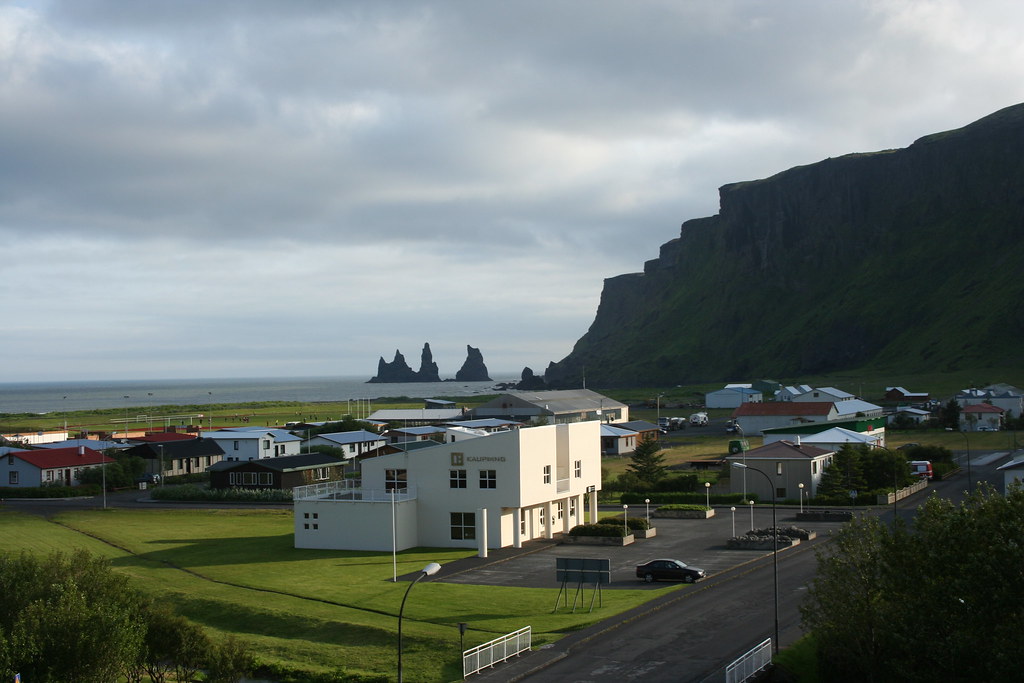
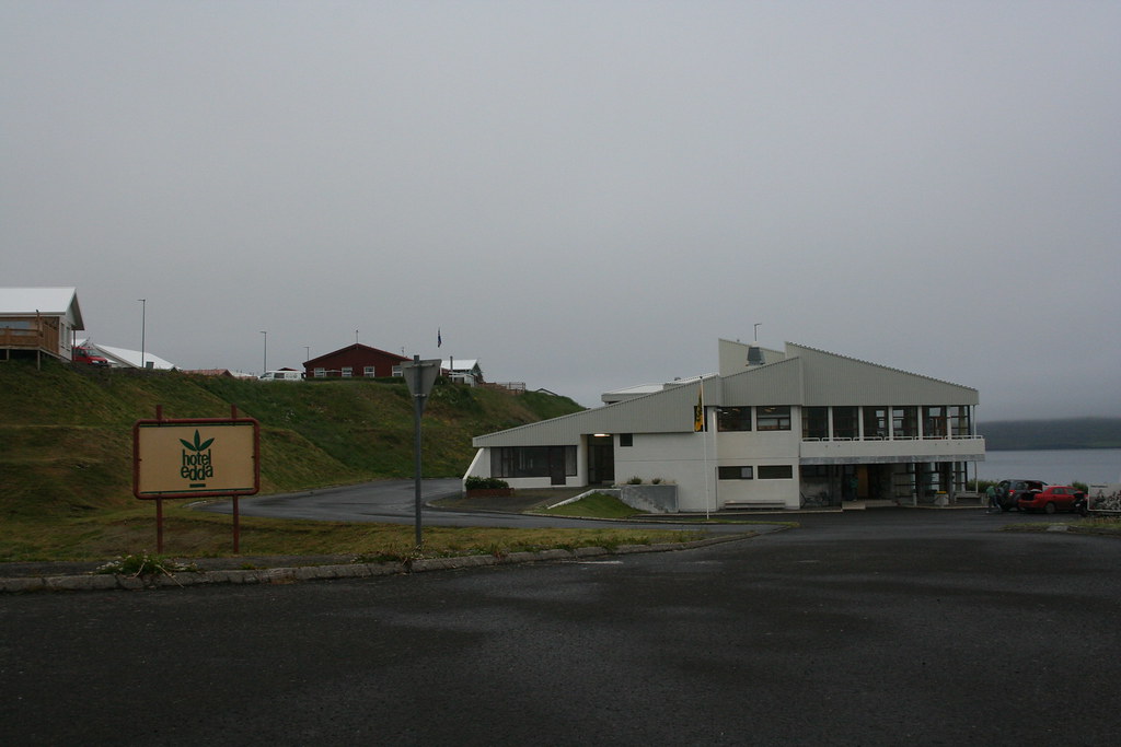
I finally arrived in Vik around 5:00 that afternoon. My plans was to stay at a camp site in Vik but after not having really slept in about 36 hours I was not too inclined to be sleeping on the ground that night. In Vik there is the Hotel Edda, a youth Hostel and a campground. There is also a number of guest farms in the area that you can stay at. I checked into the Edda Hotel
They had one summer cabin available for the night.
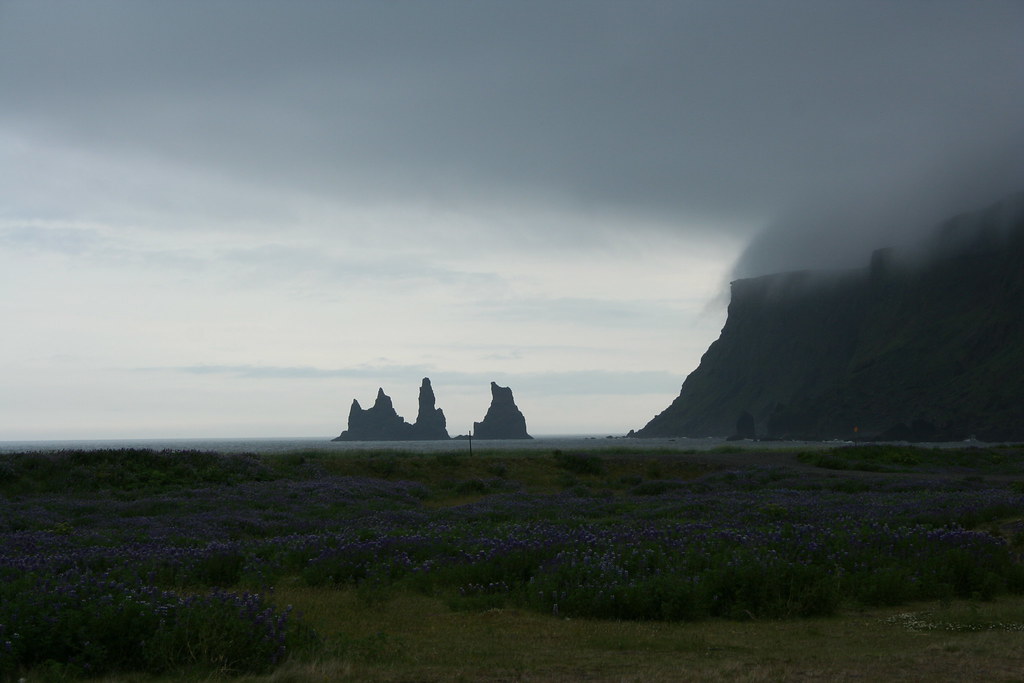
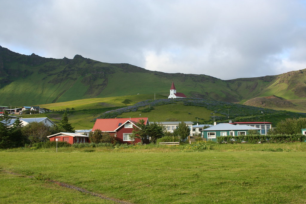
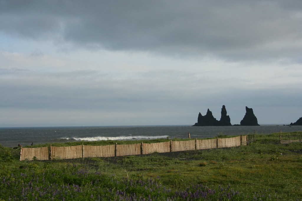
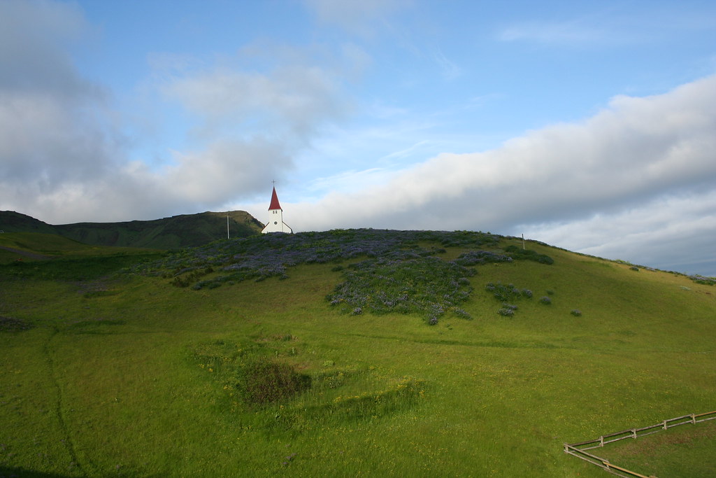
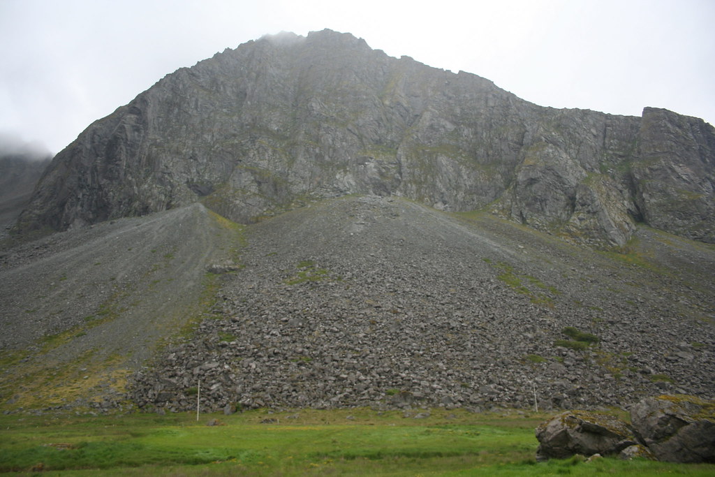
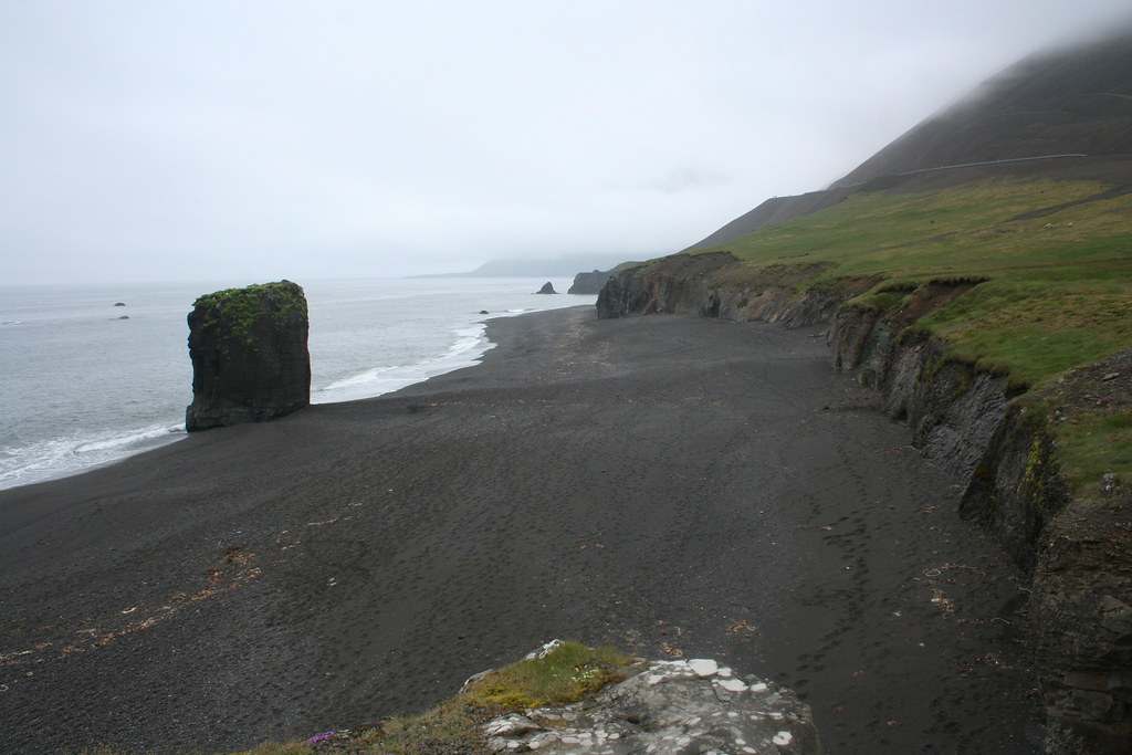
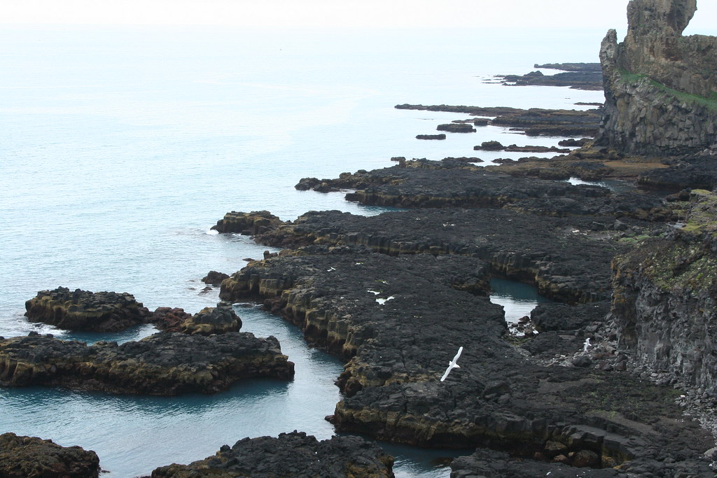
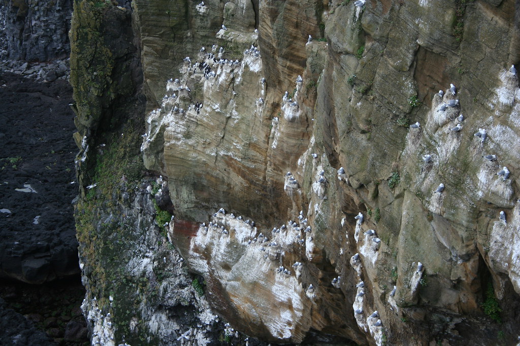
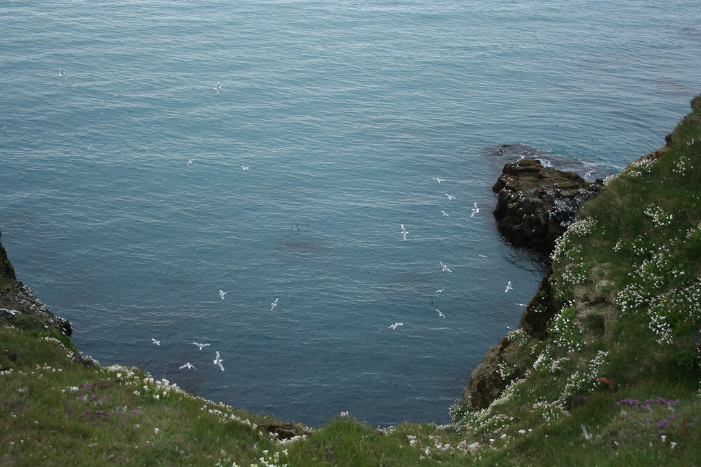
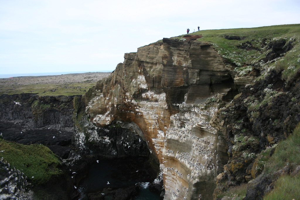
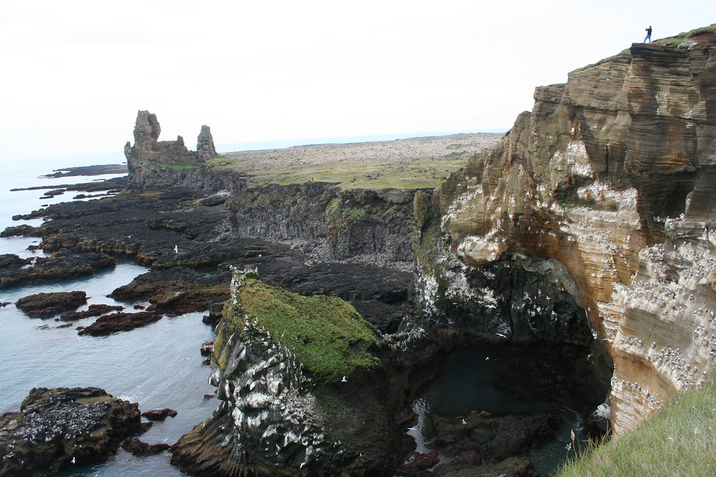
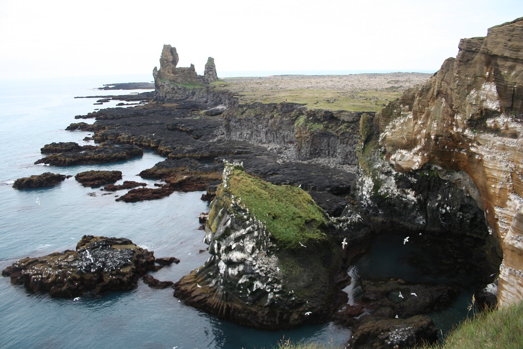
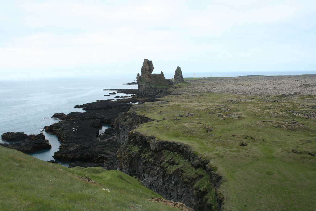
Vik is a cool town. The Hotel is next to basalt cliffs, near to a bird colony. The sand on the beach is made of black volcanic sand. The most prominent feature in Vik is a set of rock formations just off shore called the Reynisdrangar basalt sea stacks. I believe that the local call them "The Needles". A folk tale says that they are former trolls who were caught outside at dawn and were turned to stone.
Photo of the Reynisdrangar basalt sea stacks
 My accomodations in Vik. There was another fellow there from England touring around on a Honda Goldwing
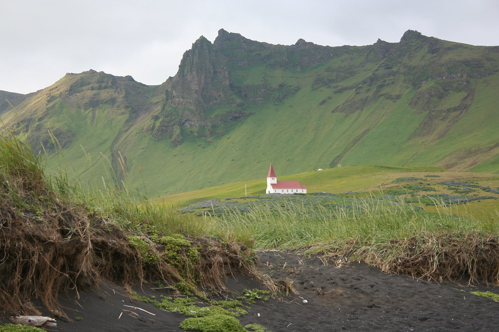
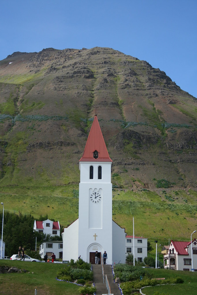
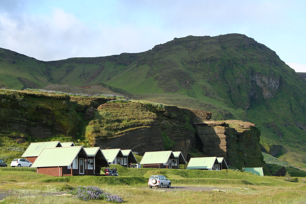 Photo of church in Vik
 Looking down on town of Vik
 Town of Vik
 Town of Vik down by seashore
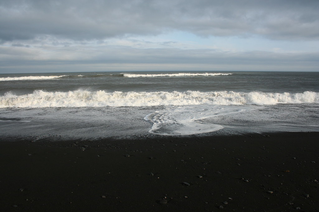 Down by the seashore in Vik. Beach composed of black volcanic sand
 Now for some artsy photography
Its 11:00 at night and it still looks like mid afternoon. At this time of year they have 24 hour of light. I hope I can get to sleep tonight with all this light.
End of day 1
Last edited by Ride4Adventure; 13 Jan 2015 at 01:56.
|
20 Jul 2009
|
|
Registered Users
Veteran HUBBer
|
|
Join Date: Jun 2009
Location: Ottawa
Posts: 100
|
|
|
Journey to Iceland - Land of Ice and Fire Day 2
Day 2 of my Iceland adventure saw me up early that morning. I had no idea if it was 7:00 am in the morning or 7:00 pm in the evening, when you have 24 hours of light, it is hard to make out what time of day it is, I wasn't sure if I had slept for 7 hours or 19.
I have to warn you about showering in Iceland. Just about every household and business in Iceland get their hot water from a geothermic source and it is hot, scolding hot ( ~ 70 deg Celsius) and since the source of the water is from geothermal wells it has a certain aroma to it, like sulfur or rotten eggs. The cold water comes from a different source than the hot water and is usually from a spring. No filtering or chemicals added to the water. They must have the purest source of drinking water in the world.
It must have been morning because they were serving breakfast in the Hotel dinning room. Most of the guests at the Hotel were with a tour group, most of them appeared to be from Europe. The buffet breakfast was a choice of cold cuts,cheese, museli, dry cereals, fruit and pickled herring. This is pretty well what you get served everywhere in Iceland. Somehow the thought of having a bowel of corn flakes with pickled herring
didn't really agree with me.
I checked the weather forecast on the Hotel computer, cloudy in the morning with some clearing in the afternoon. Just about everywhere you go in Iceland you will find that you have access to the internet. Iceland is a very modern and wired country. There is cell phone coverage for the entire country even for remote parts of the interior. Most of the phones here are based on GSM for the European system, so NA cell phones will not work (or that is what I was told). Someone said that you could buy a cheap disposable phone at the airport but I wasn't able to do so.
It must of been a good omen because as I started to pack my gear onto the bike, the clouds started to clear up and the sun began to shine through. As I mentioned in my first report the Hotel is at the base of a cliff face with a colony of birds nearby. Well some of those feathered creatures must of been checking out my bike this morning because they crapped all over it.
My destination for today is the town of Hofn, another coastal seaside town. Its about 250 km up the coast, its only a couple of hours ride, but there are lots of sights to see along the route so I plan to take my time.
Lets ride
This was an interesting sight when I first came upon it. At first I could not make out what I was looking at, thinking that maybe it was some kind of volcanic rock formation. There was a field filled with volcanic rock arranged in little piles, hundreds of them. It turns out that this was the remains of a farm site destroyed by one of the glacial burst (flood) of the MyrdalsJokull glacier. Travelers use to put a stone on a cairn while passing this place. The tradition has continued for many years and the road crews still provide piles of rock for traveler passing travelers to create their own stone cairn.
Photos from Laufskalavarda
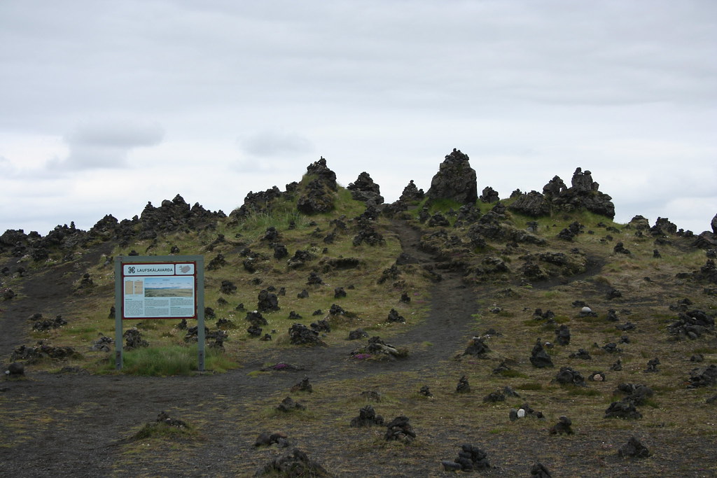
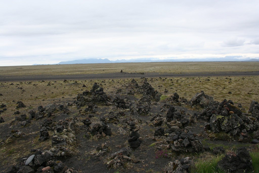 Photo of Hwy # 1 just east of Vik
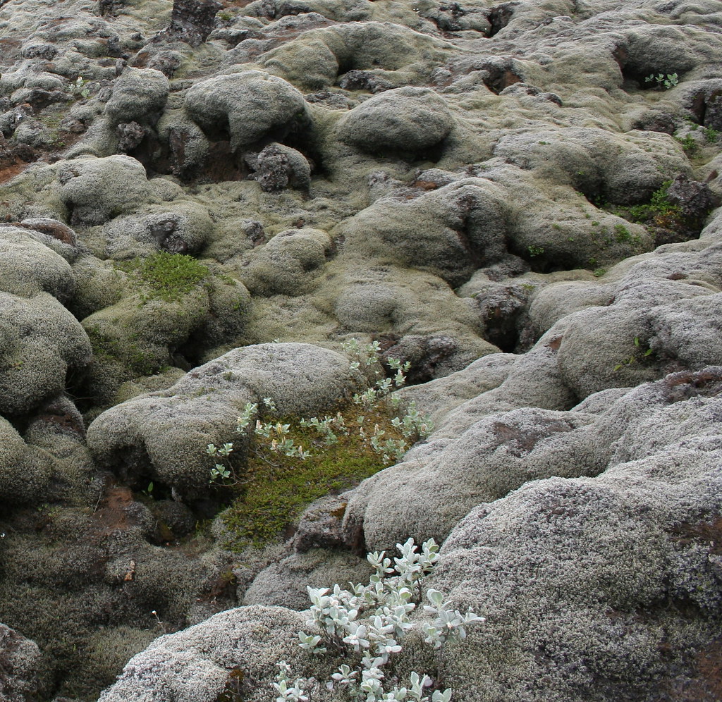
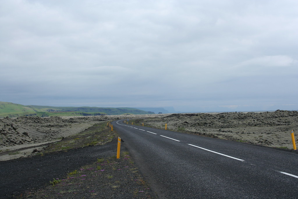 Photo of plants growing on the volcanic outcrops
 Yes there are a few trees to be found in Iceland even in the desolated
Myrdalssandur region
This region just east of Vik along the coast is called Myradalssandur.
It is a empty bleak and desolate expanse of desert covering over 700 sq-km. The desert was produced by the glacial outwash/flooding from the glaciers to the North. When you drive along this area it is surprising to see the vast desert area with little or no vegetation. When the wind blows, which it does a lot in these parts, sandstorms can get real nasty and become a real concern for people.
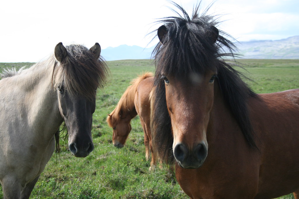
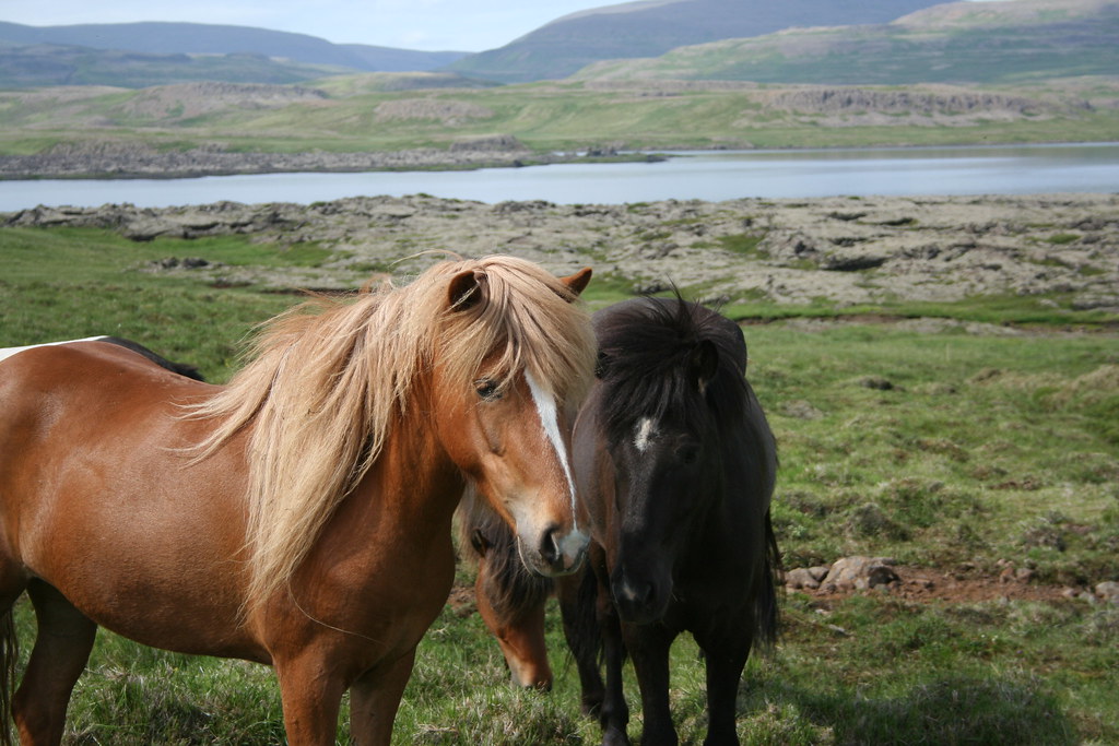
Photo of sheep on hillside
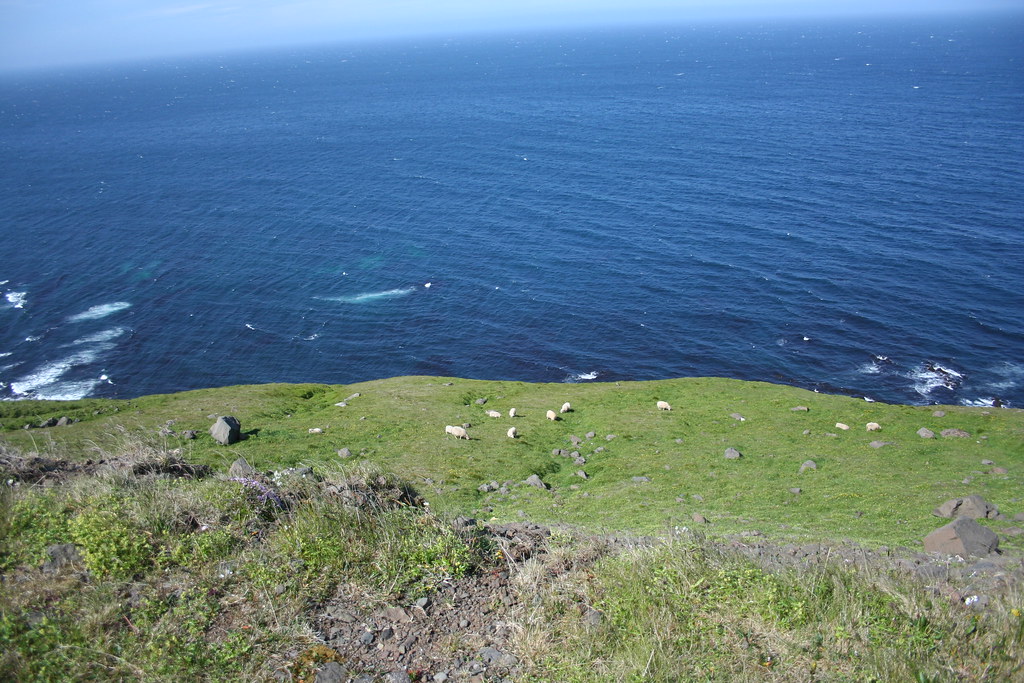
Up on the hillside you can see some sheep. There is not much in the way of wild life on the island aside from domesticated animals such as sheep, cattle and horses. The sheep are everywhere and often times grazing on the side of the road. They don't usually pose much of a road hazard except if there is a young lamb about, they seem to get startled easily by passing vehicles and then tend to run out into the middle of the roadway, mama sheep who should know better, then chases after her young.
There were a few times that I was glade that the Suzuki Vstrom was equipped with ABS brakes.
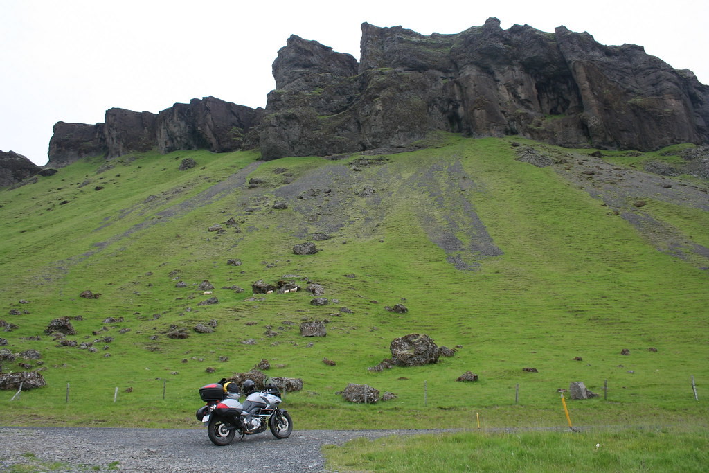 Photo of barn built into the hillside
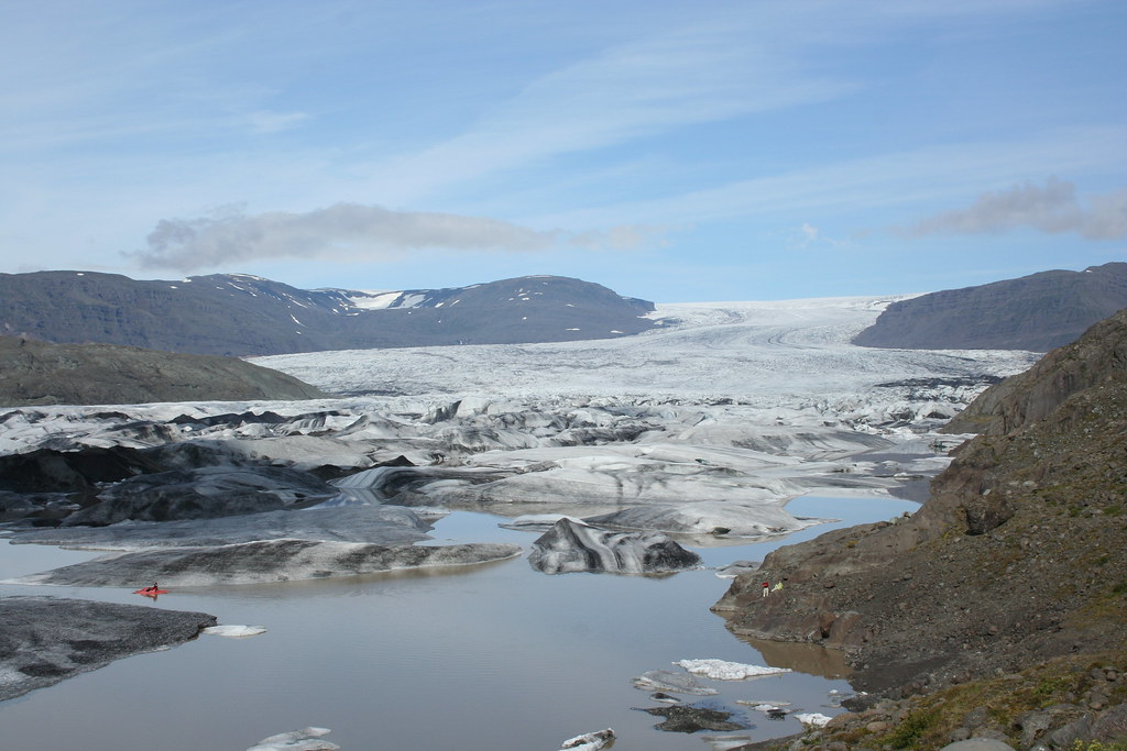
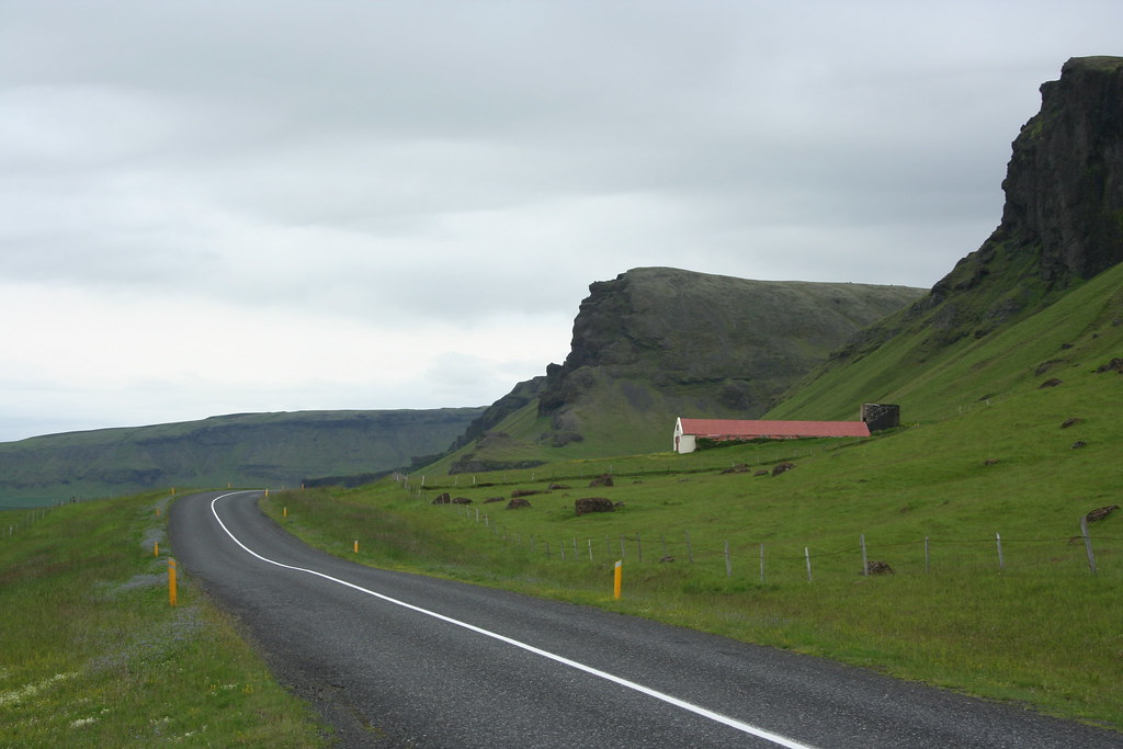 Photo of Kviarjokull Glacier
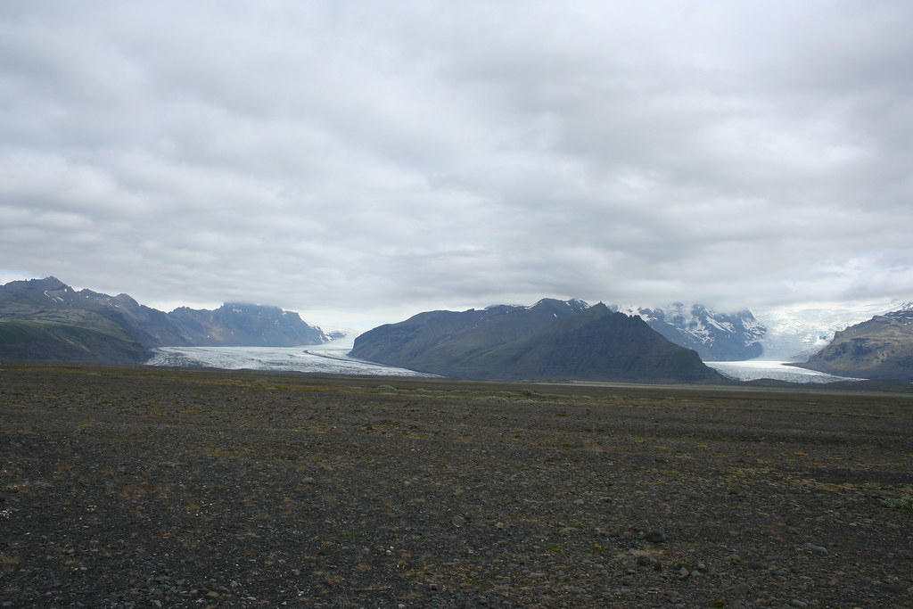
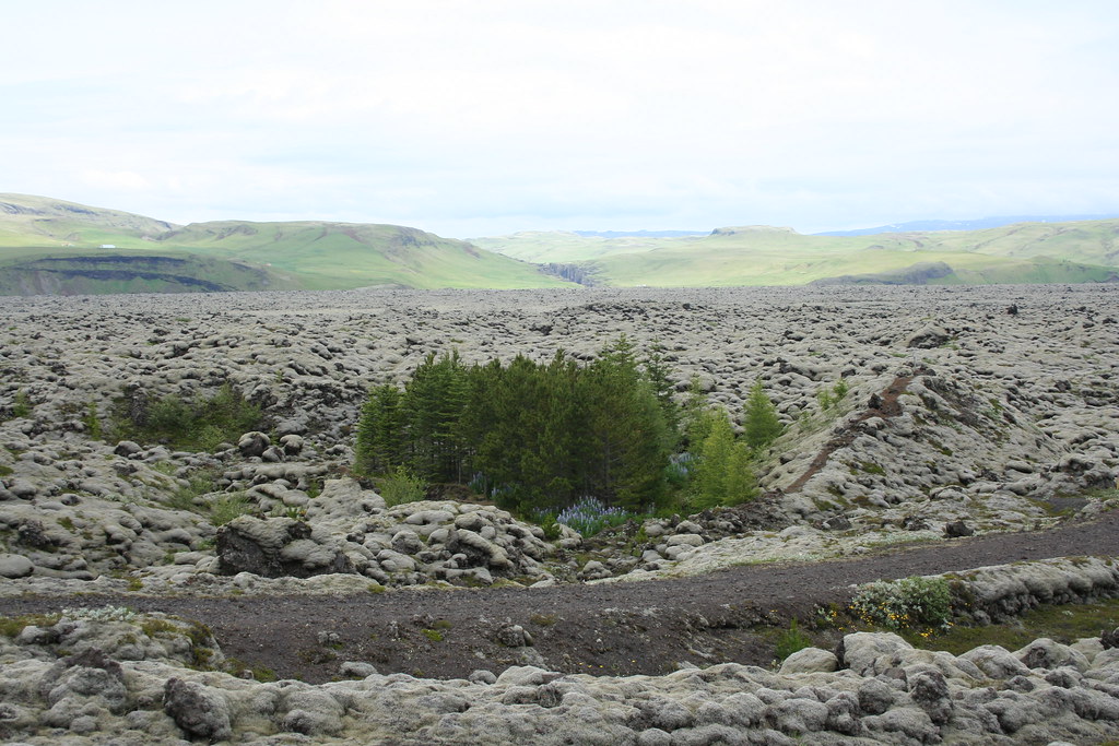
 Photos of Skeidararsandur Region in Iceland
The Vatnajokull ice field is the largest glacier in Iceland. To the south of Vatnajokull is a glacier outwash/flood zone called the Skeidararsandur sand flats. It covers an area of about 1000 sq-kms and is probably one of the largest sandur in the world. The whole area is cress crossed by a tight network of tributaries with 3 or 4 larger channels that drain off the Skeidararjokull glacier. To construct a road through this area required that they build many bridges across the many streams and channels
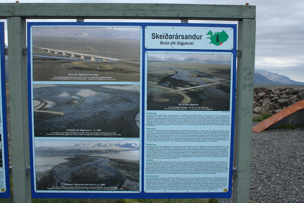
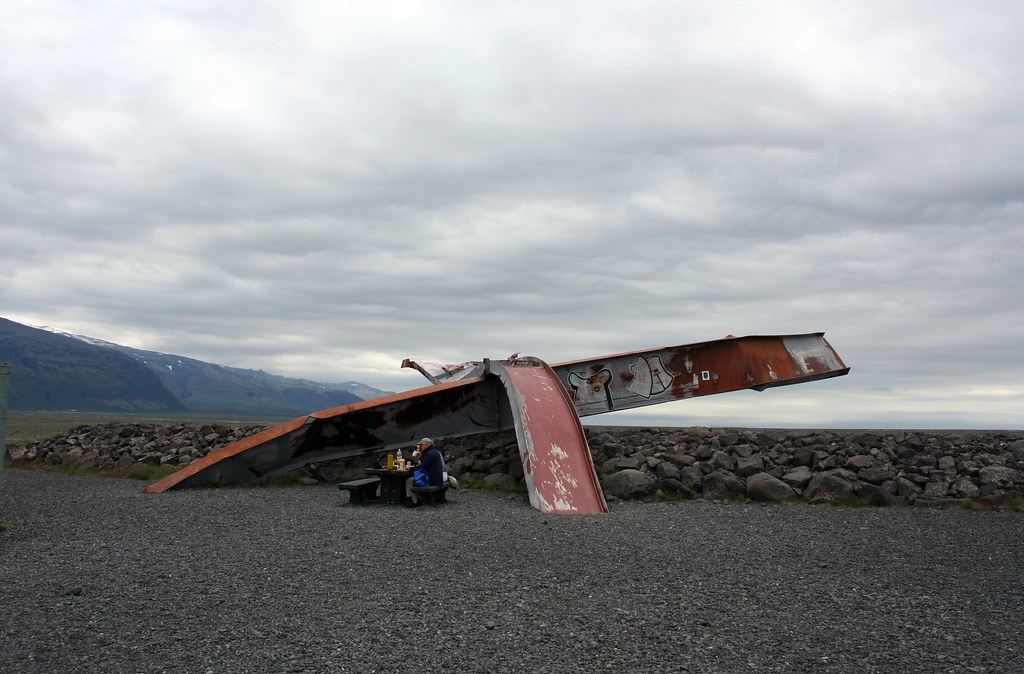
The photo below shows the remains of one of the major bridges that was washed out by the huge glacial flood that occurred back in November of 1996. At that time the Grinsvotn volcano which is buried under the Vatnajokull glacier erupted causing a glacial flood burst off the main glacier. The estimated flow rates for the flooded was about 50 000 m3/s which is an incredible amount of water. The flooding waters carried down icebergs from Vatnajokull the size of 3-storey buildings with a mass of over a 1000 - 2000 tons. After the flooding there was not much left of the ring road in the area. Since then you can see that they have engineered a number of giant earthen dikes over the region to try and channel the out flow of water from any future flood disaster.
Trying to get closer to the one of the glaciers
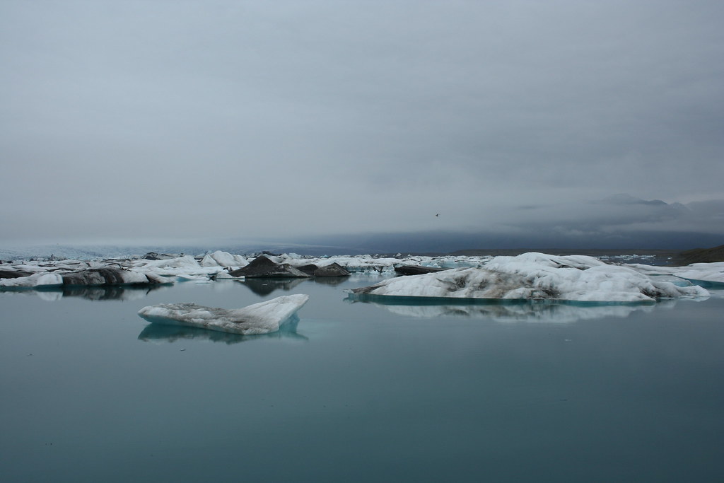
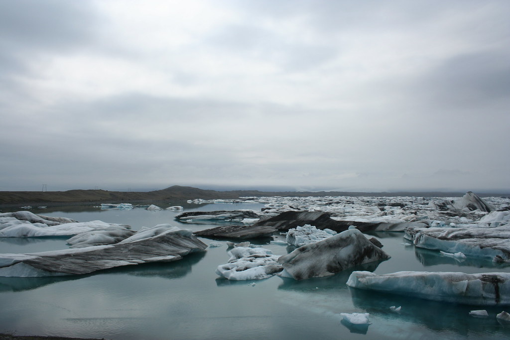
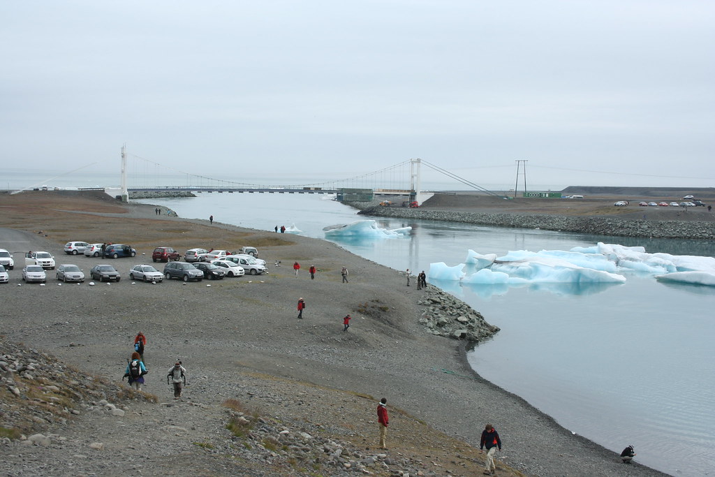
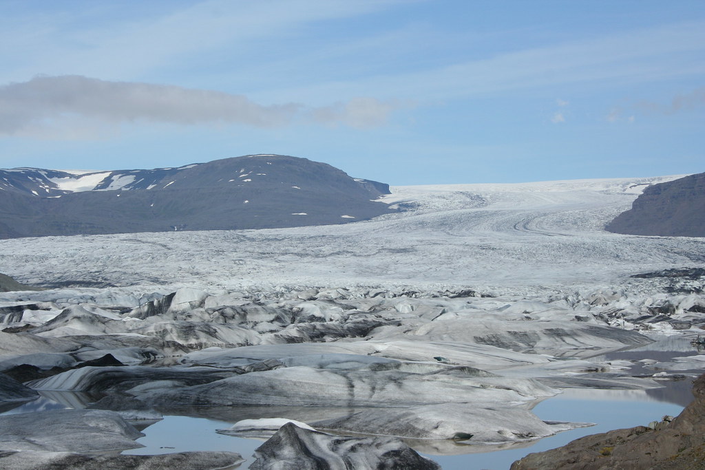
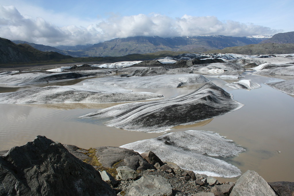
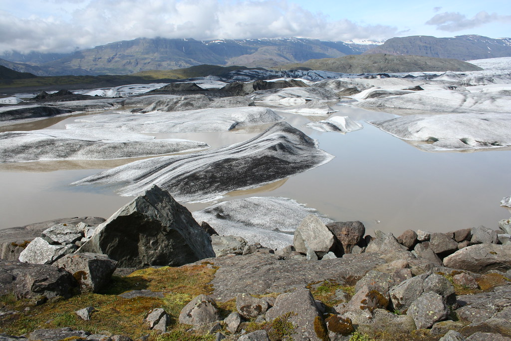
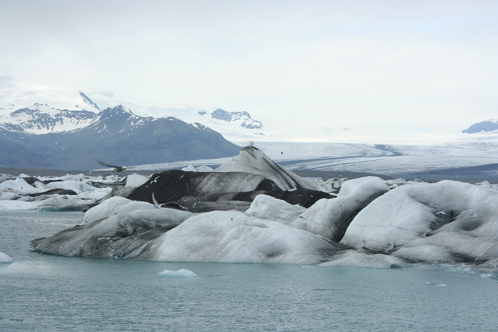
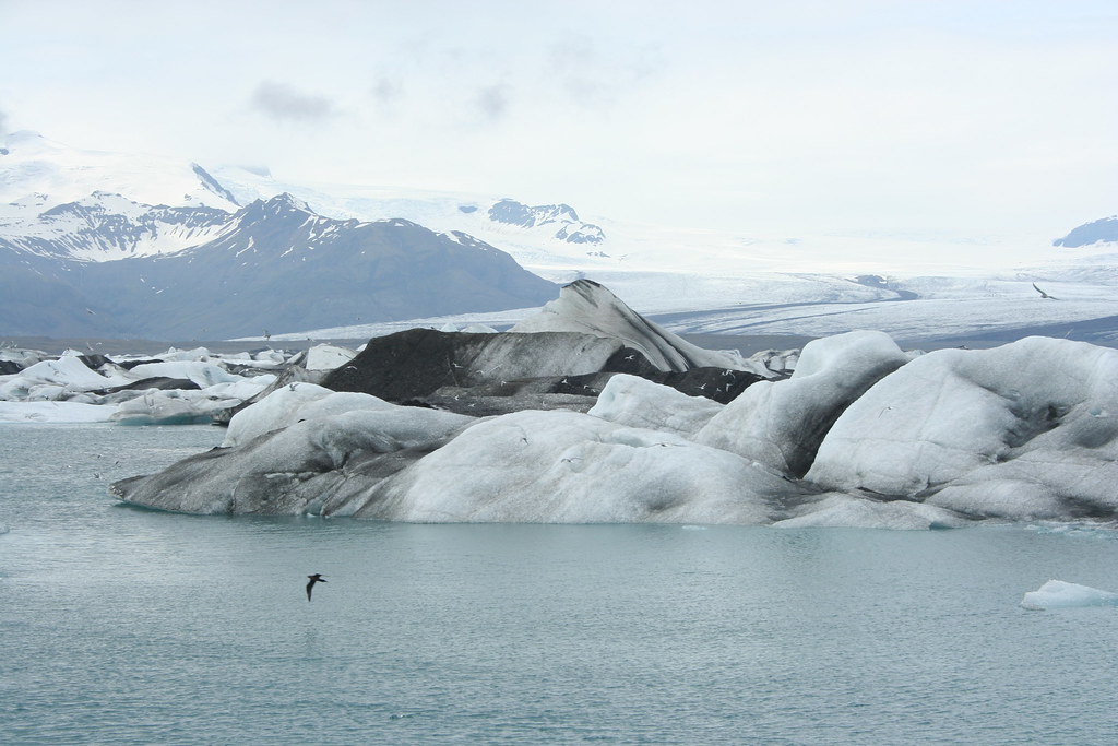
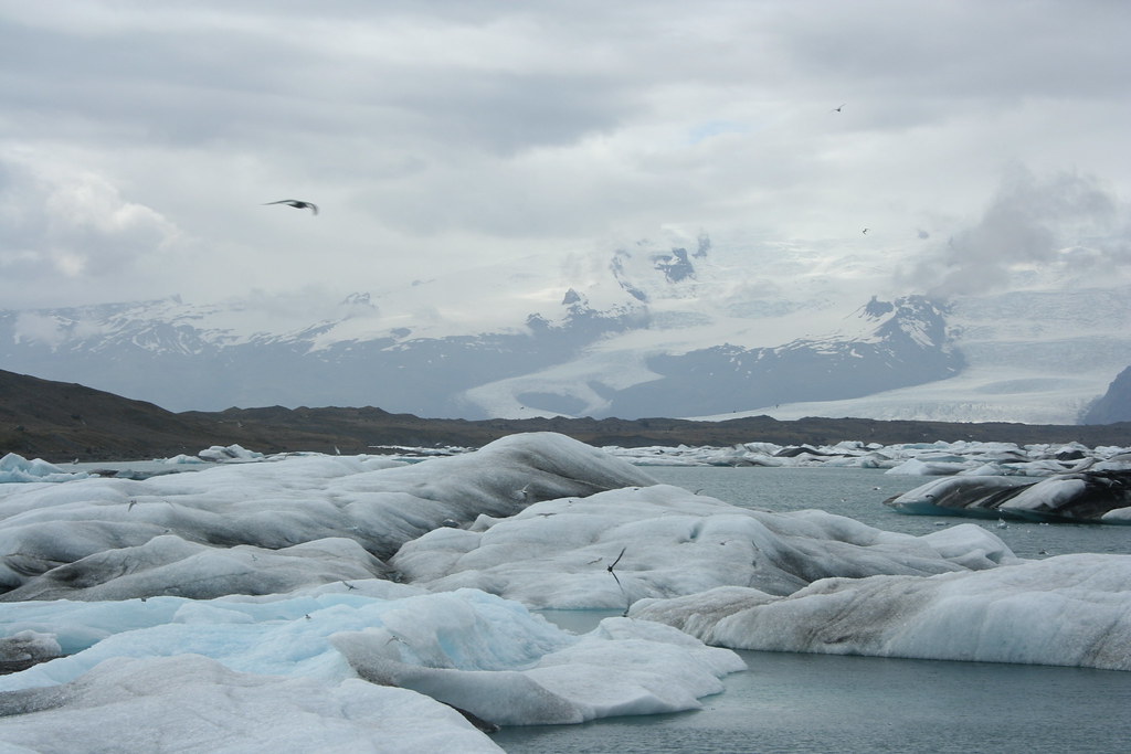
 Photos of the Jökulsárlón Iceberg Lagoon:
This is one of the most popular tourist stops in Iceland. Its a lake filled with icebergs that calf off the Vatnajokull glacier and float down the lake into the sea.
A number of films have had scenes shot at Jökulsárlón, including Beowulf and Grendel, Tomb Raider, Die Another Day (James Bond), Batman Begins and A View to a Kill (James Bond)
Here is Wikipedia description of the lake
Jökulsárlón is the best known and the largest of a number of glacial lakes in Iceland. It is situated at the south end of the glacier Vatnajökull Skaftafell National Park and Höfn. Appearing first only in 1934-1935, the lake grew from 7.9 km² in 1975 to at least 18 km² today because of heavy melting of the Icelandic glaciers. Approaching a depth of 200 m, Jökulsárlón is now probably the second deepest lake in Iceland. in between
Jökulsárlón is separated from the sea by only a short distance, and the combined action of the glacier, the river that empties from the lake, and the ocean may eventually transform it into an inlet of the sea. There are plans to prevent this from happening, since the only road in the area passes over the narrow isthmus.
It is not far from the Icelandic Ring Road, and buses travelling between Höfn and Reykjav�*k usually stop there. The lake is filled with icebergs, which are calving off the Breiðamerkurjökull glacier.
At its shore, in the summertime, one has to watch out for the skuas, big seagulls which have their nests on the ground around the lake and which can occasionally become aggressive.

One of those amphibious "duck" vehicles used for brings tourist close up and personal with the icebergs.
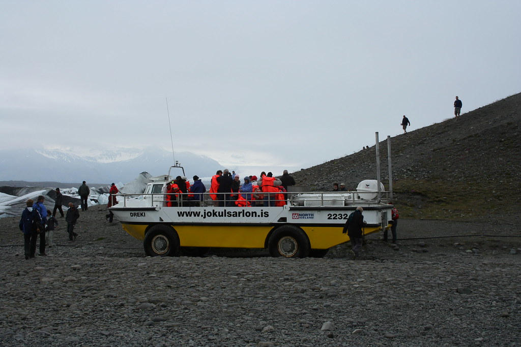
I think this guy's job is to catch any tourist that fall in the lake
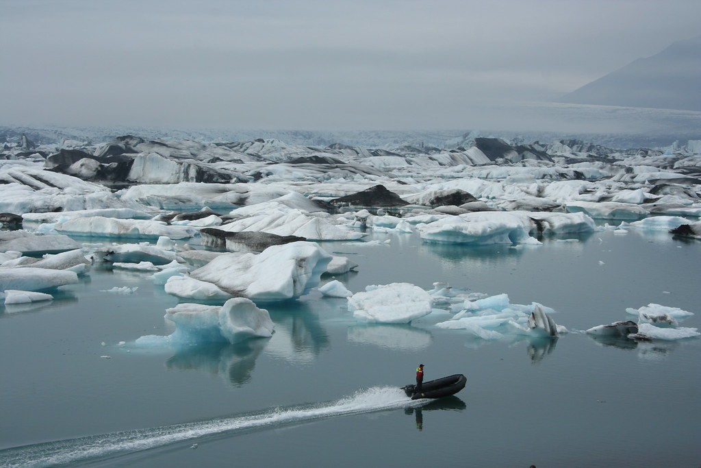
The icebergs eventually float down the lake (17 kms from Vatnajokull)
and find their way out into the ocean. You can see a few bergs floating near the bridge
the Atlantic ocean is on the other side.
That was my last stop for the day. I stayed overnight in a Hotel in Nesjakoli a little town just west of Hofn.
End of day 2
Last edited by Ride4Adventure; 13 Jan 2015 at 02:10.
|
21 Jul 2009
|
|
Registered Users
Veteran HUBBer
|
|
Join Date: Jun 2009
Location: Ottawa
Posts: 100
|
|
|
Journey to Iceland - Land of Ice and Fire Day 3
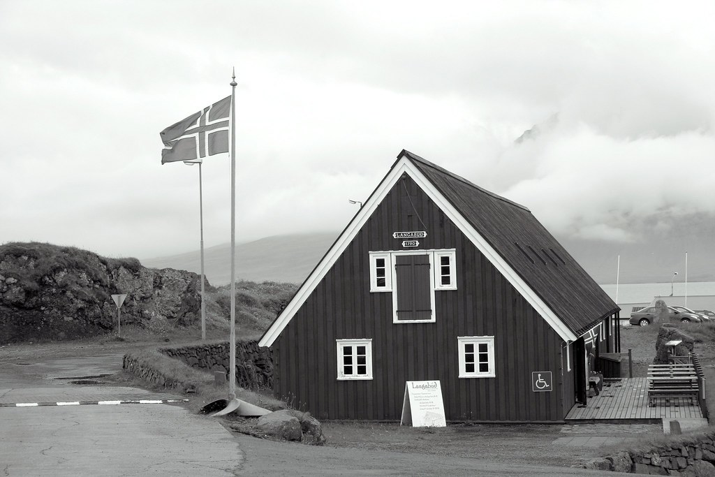
I had a late start today, didn't get up until 8:00. I plan on spending another day here in Nesjum and go explore the Vatnajokull glacier.
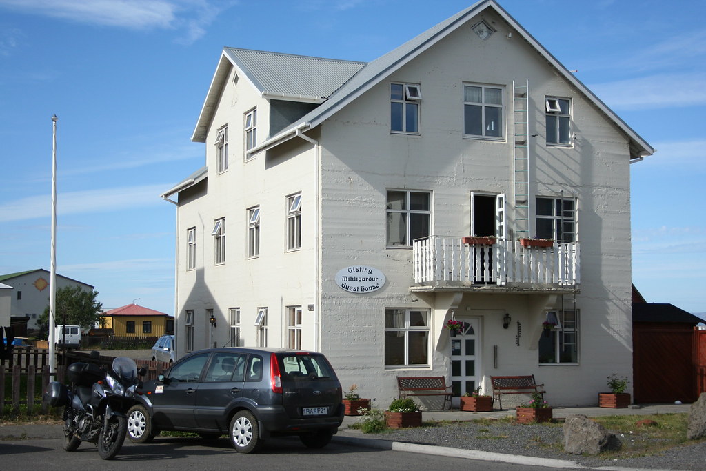
My accommodations for the next couple of days would be at the Hotel EDDA in Nesjum. For most of the year this place is a boarding school, during the summer months the school gets converted into a Hotel. The Hotel has a number of choices for lodging, from rooms without bedding (you bring your own sleeping bag) to rooms with and without a bathroom. Mine just came with a wash sink. The rooms are pretty small and spartan
No TV in the rooms, for entertainment, there is a playground with a swings outside .
After breakfast the usualy Icelandic fare of code tongue and pickled herring
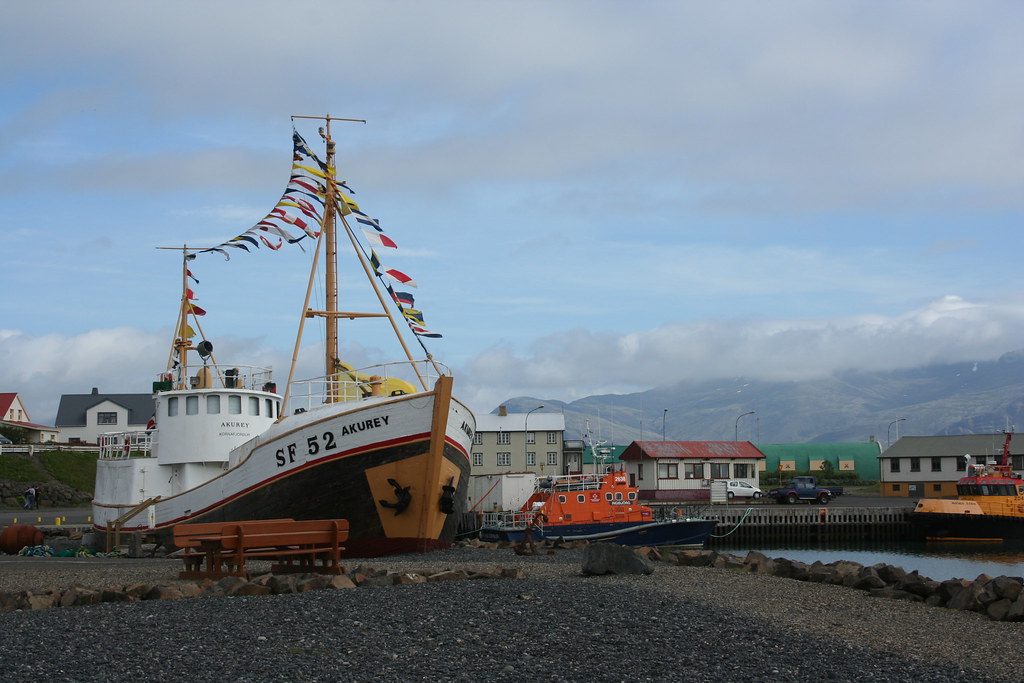
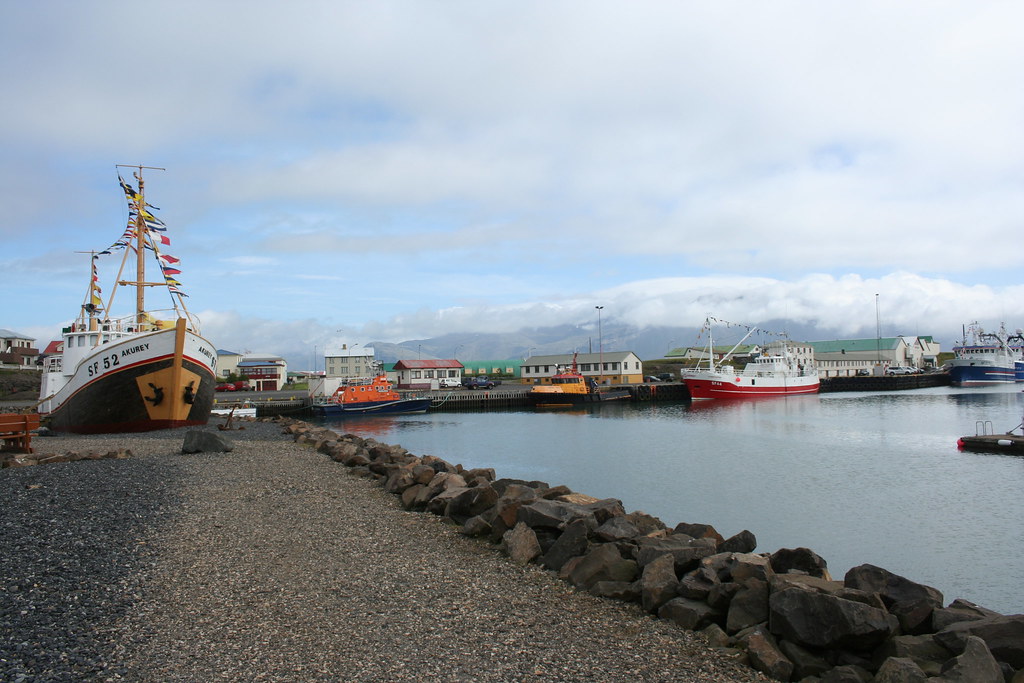
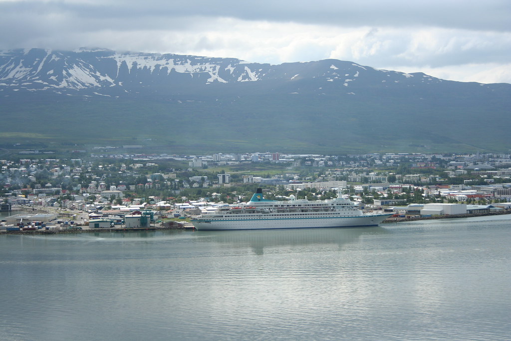
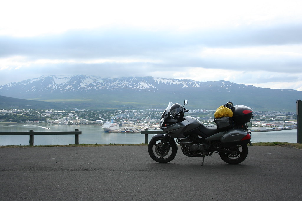
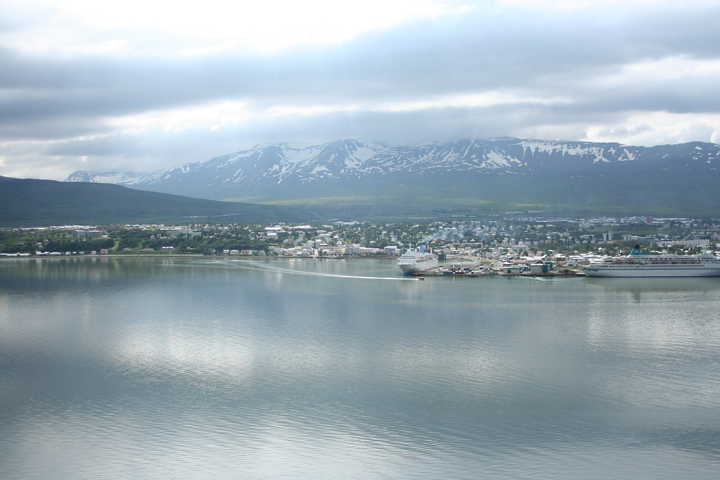
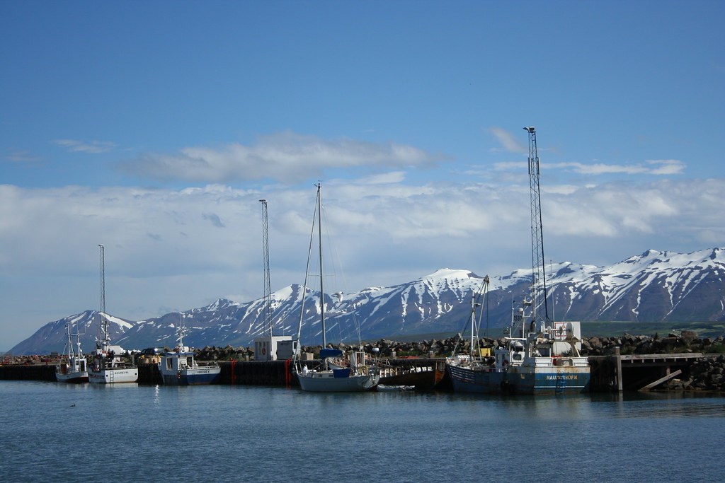
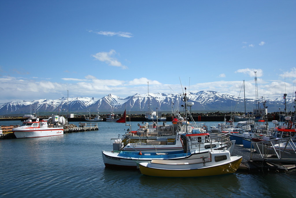
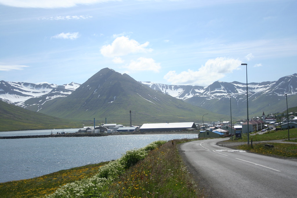
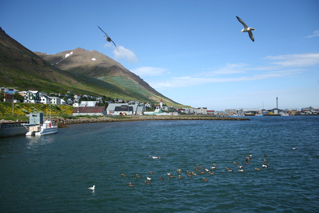
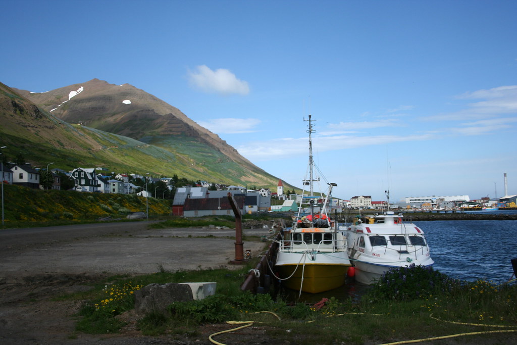
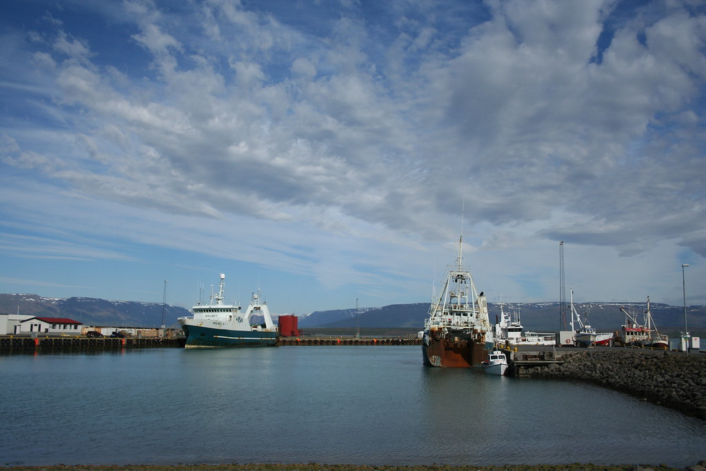
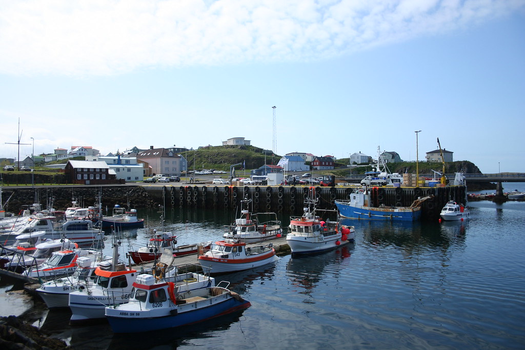
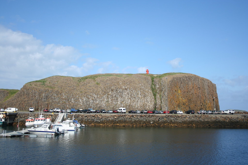
I headed into Hofn (name pronunced as hope) to see what was there. Its one of the larger towns in the south eastern part of Iceland (pop 1600)
The village is a major fishing port. There is a large fish processing plant in town.
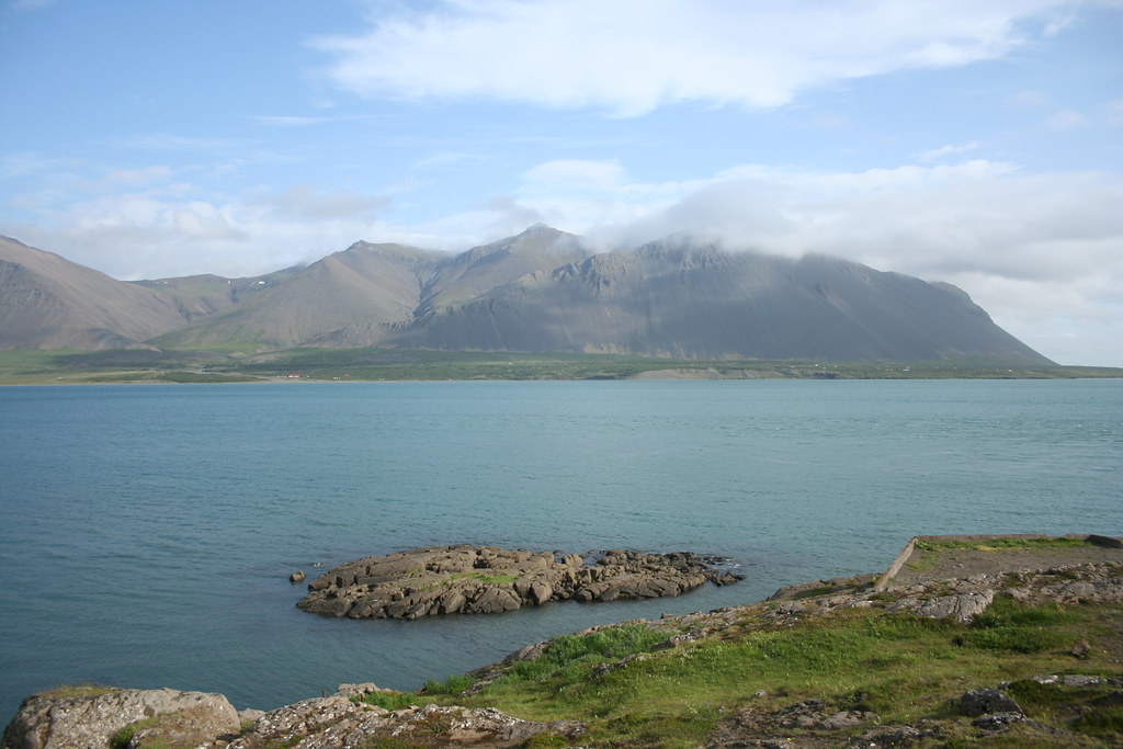
I went down to the harbor to see the fishing boats. When I first arrived into Hofn it was overcast and could not see to much. Once the skies cleared up you were presented with a very impressive view of the Vatnajokull glacier to the north. The sight of the glacier just dominates the whole town..
Photo of harbor down in village of Hofn
width="1024" height="683" alt="IMG_1473" />
You can just make out Vatnajokull glacier in the background
Riding along Hwy #1 just outside of Hofn looking over to Vatnajokull
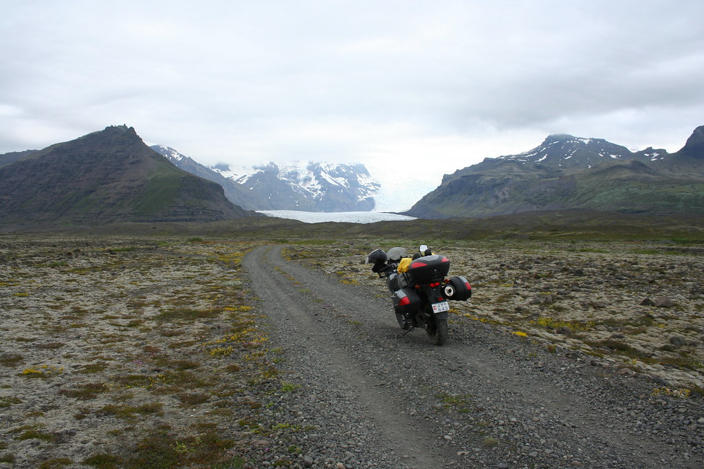
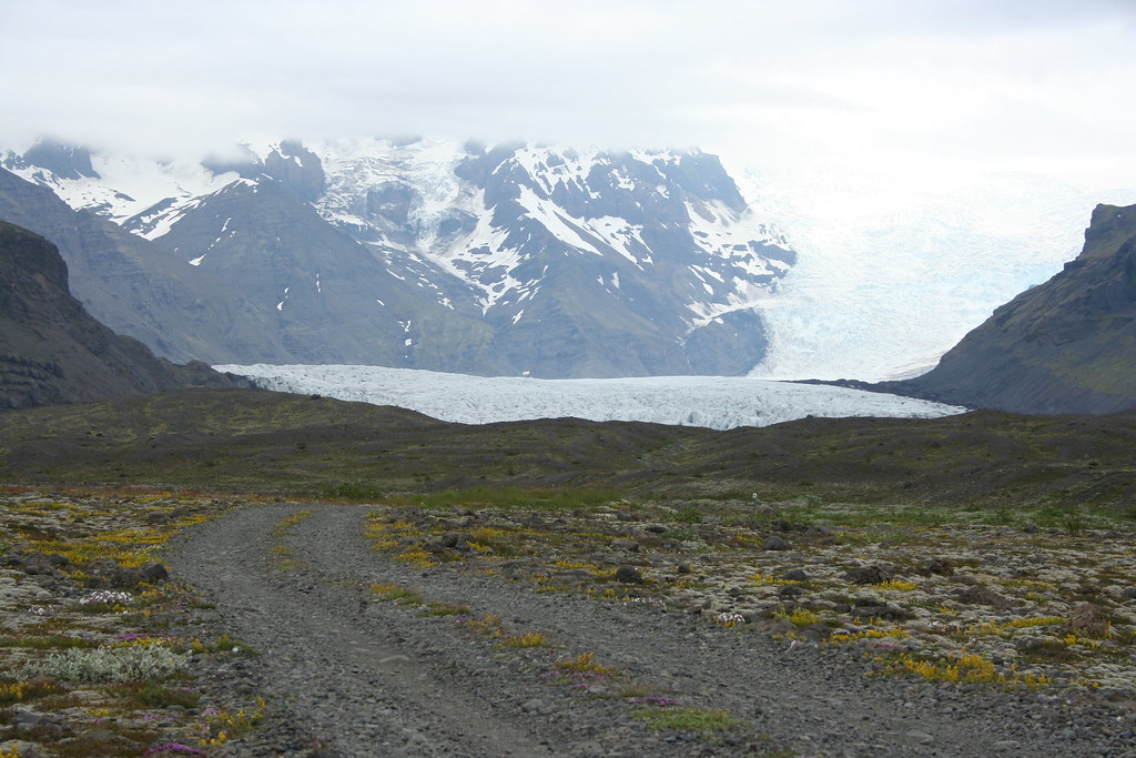
I checked my map looking for a trail that would get me closer to the glacier field. About 20 km back west along Hwy #1 I found what looked to be a trail leading north towards one of the glaciers ( Flaajokull ??) It didn't really matter what glacier it was, just so I could get up and close to it.
Photo of road to my glacier
The road did go to one of the glaciers. The trail was 6 -7 kms from the main road. Most of the road in fairly good shape a few areas the trail was covered in large rocks so had to be a little careful choosing a route. There were a few stream crossings, water depth was no more than 12 - 16 inches deep. No problem for the little Vstrom

First look at the Flaajokull glacier - One of the tongues of the main Vatnajokull glacier
If you look in the middle of this next photo you will see someone paddling around the lagoon in a paddle boat. Looks like someone just brought their paddle boat down to the glacier lagoon and setup business.
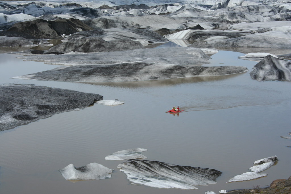
Photo of bike at glacier

Another view of the glacier lagoon
Heading back - What happened to my trail ?
Posing with bike in front of Flaajokull glacier
 Example of a Sandur ( glacial outwash/flood plain)
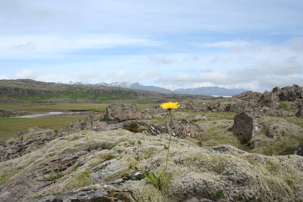
 More Icelandic plant life - Icelandic Dandelion
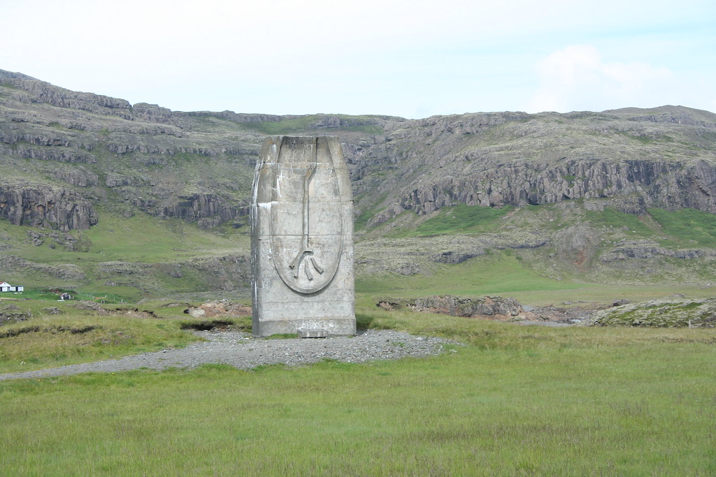
 Some big rock sculpture in the middle of nowhere - Memorable to some dead Icelandic guy
. I have no idea what it is suppose to represent. Looks like something out of Lord of the Rings
I had a little more difficulty crossing back over one of the streams that I had passed earlier in the day. For thing, the stream looked a lot bigger than it did this morning and the spot where I had chosen to cross over earlier was now chewed up from a number of other vehicles that had crossed over since then. The stream crossing was only 15 - 20 feet across, so it should have been fairly trivial to get across. I was about half way across the stream when the front tire of bike got struck in a groove left by another vehicle, next I struck a rock or something causing the bike to veer off in another direction, before I knew it I was riding in water about two feet deep. I eventually got to the other side without incident, one of my boots got filled with water. Those street tires just are meant for this kind of riding.
The other day on my drive down to Hofn I had stopped at a road intersection between Hwy #1 and F985. The F roads in Iceland are jeep trails and not the sort of road that you would normally drive on without a 4 x 4 vehicle. There were some signs at the crossing indicating that the road would bring you up to the top of Vatnajokoll. There is cafe up there and I thought it would be a good idea to ride up to the top of the glacier
for lunch. There are number of tour group that run excursions up to the top of the glacier in one of their specially modified super jeeps. These
4 x 4 vehicle look like a jeep on steroids. They are equipped with 32 " tires
which look to be about 2 feet wide. I had a copy of the Lonely Planet guide to Iceland. (great guidebook for trip) They had a special section in the book about Vatnajokull and about getting to the top of the ice fields.
it says " Please do not even think of attempting to ride up this road in a 2wd car - You wil die". Since they didn't mention motorcycles I figured I should be alright. I finally got to the turn off for F985 ( Its about 55 km west of Hofn).
The first part of the road along F985 is pretty easy riding ,then the road turns into a single track trail with a lot of steep graded switch backs (25%-30%) that climb up and down and over the mountains and valleys. The riding was more technical than what I had experienced over the last few days but the Suzuki Vstrom managed. Coming down some of the steeper descents on a few road sections was a bit unnerving, those trail tires fitted to the VStrom don't give the bike much traction especially in deep gravel. After about 10 kms of this I thought I would make it to the top until I came to "The Wall". I stopped the bike at the top of a mountain crest and was about to make my descent when one of those super jeep vehicles appeared over the top of the hill. As the driver passed me by, he stopped and gave me a long look and shook his head. I inched the front wheel of the bike a another foot or two to the edge of the hill just to get a better look at what sort of descent I was facing. It was like standing on the precipice of a 500 foot cliff. Who would build a road like this, its nuts. After a few internal conversations with myself. " If you damage the bike you wil have to pay for all repairs, Ok.. I have seen enough of this place, other places to see".
This one thing I can say about riding a motorcycle up a mountains trail, its
a lot easier riding up the maintain than coming down.
From here I decided to head back over to the Iceberg Lagoon at Jokulsarlon for lunch and take another look at the floating Icebergs
Photos of Jokulsarlon Ice Lagoon

There was a really interesting spectacle over at the Ice lagoon when I arrived. There were hundreds of birds flying and diving in around the waters of the lagoon. If I was one of the early explorers to have first discovered Iceland, I would not have called it Iceland, I would have called it Birdland. I have never seen a place where there are so many birds. At the lagoon there were three species of birds that I could identify.
The most common bird and one that you see all over Iceland is the Arctic Tern. They look a bit like a seagull, about he same size. The amazing fact about these birds is that they migrate from one polar region to another each year (migration of 24,000 miles). These birds are very territorial and if you come near their nesting area they will attach you. On my trip i was constantly harassed by these birds even while riding on the motorcycle
they would dive bomb me and chase after me.
Another bird species in Iceland is the Great Skua. Its a very large bird
2 feet long with up to a 48" wing span, has a hooked beak, they are like the Darth Vader of the seagull world. They are very aggressive species and will attach and eat other smaller birds like sea gulls and arctic terns. I spent a hour at the lagoon watching a pair of Skau attaching and harassing some of the other smaller arctic terns and gulls.
End of day 3
|
22 Jul 2009
|
|
Registered Users
Veteran HUBBer
|
|
Join Date: Jun 2009
Location: Ottawa
Posts: 100
|
|
|
Journey to Iceland - Land of Ice and Fire Day 4
My agenda today was continue following the Ring Road north of Hofn to the
community of Neskaupstadhur situated in the Eastfjords region of Iceland.
Neskaupstadhur is the furthest most eastern community in Iceland.
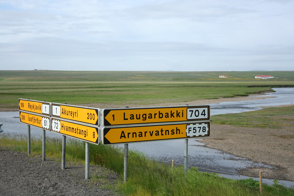
Anyone who has looked at a map of Iceland will quickly come to the same conclusion as myself. All the names of places and geographic features in Iceland are for the lack of a better term verbose. Its seems to have been a tradition here that when giving a name to a village or mountain or stream, try and incorporate as many letters of the alphabet as possible. Icelanders like to combine a number of descriptive words compounded together for their place names. It may make perfect sense to someone who understands Old Norse but for the outsider it is completely bewildering. What I found most vexing when traveling around Iceland was that names of a town or other geographic feature would be spelled one way on a map and then be spelled completely differently on a sign post.
While I was checking out of the Hotel Edda this morning, I asked the girl at the front desk if she knew what the weather forecast was for the day, she check on line at the Icelandic meteorological web site, forecast today was for light showers with things clearing up mid afternoon. Long range forecast for the next 4 - 5 days was for clearing skies.
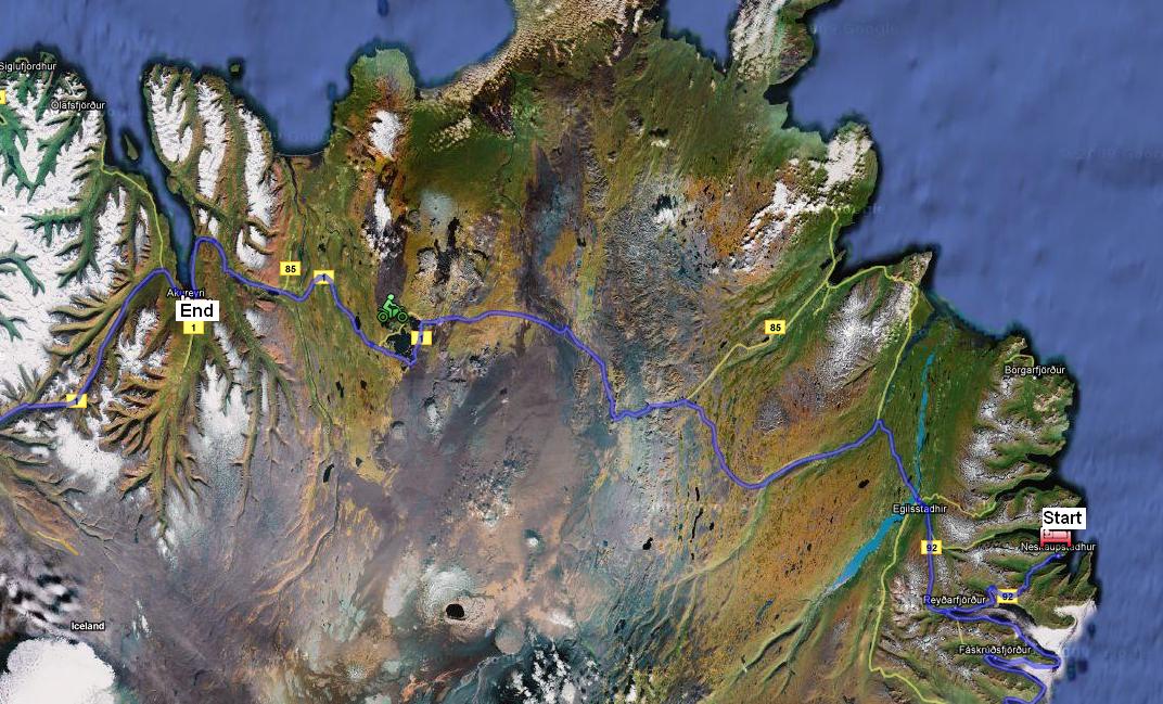
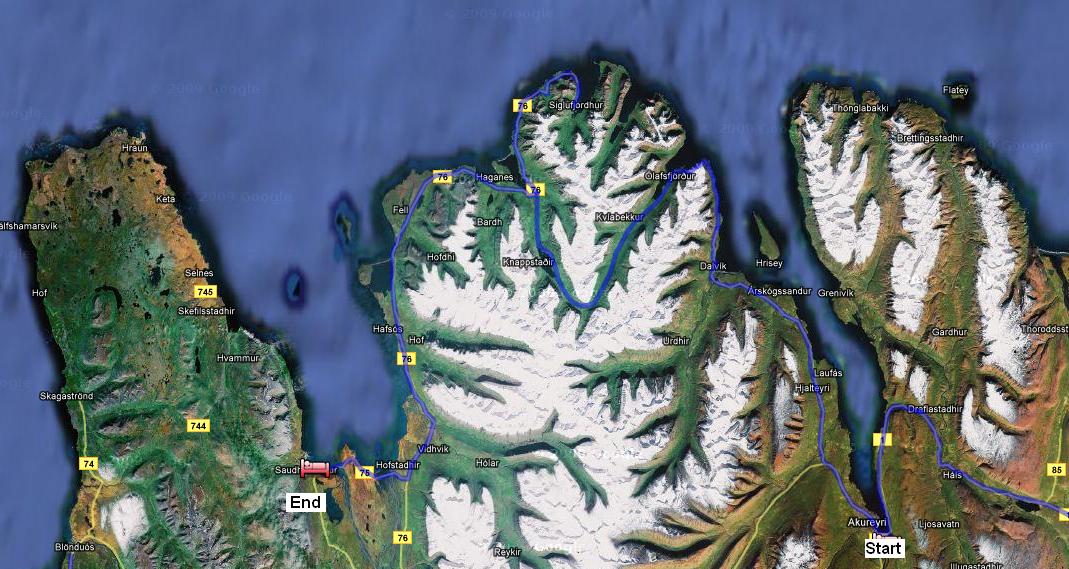
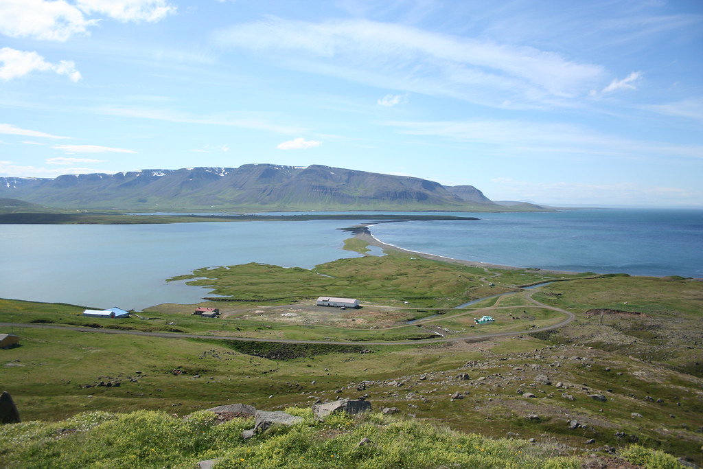
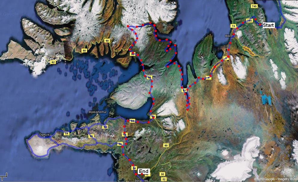
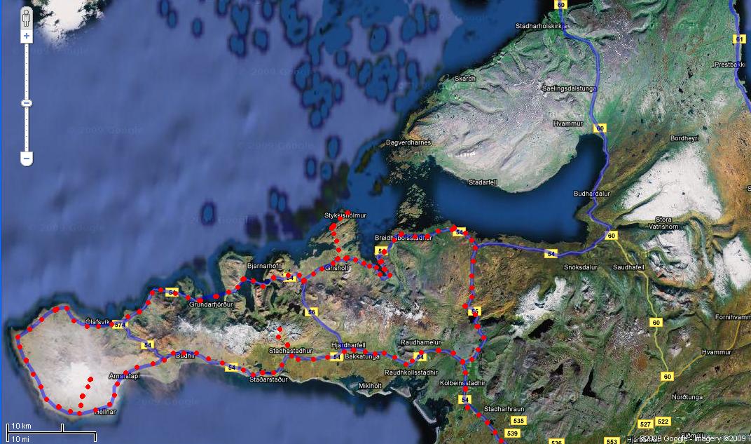
The map below shows my planned route for today. This would be one of my longer rides for this trip ~ 270 km. Not a long distance if you are on an interstate back home, but between all my stops for photos and sigh seeing it will probably take me most of the day to get to Neskaupstadhur
Route map for day 4
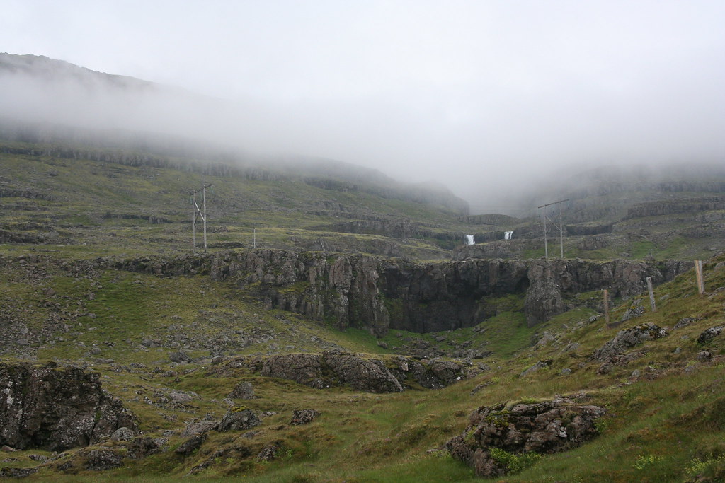
 Geology stop to look at some hillside gullies and Basaltic Talus slope

 Weather check - Doesn't look like its clearing up yet
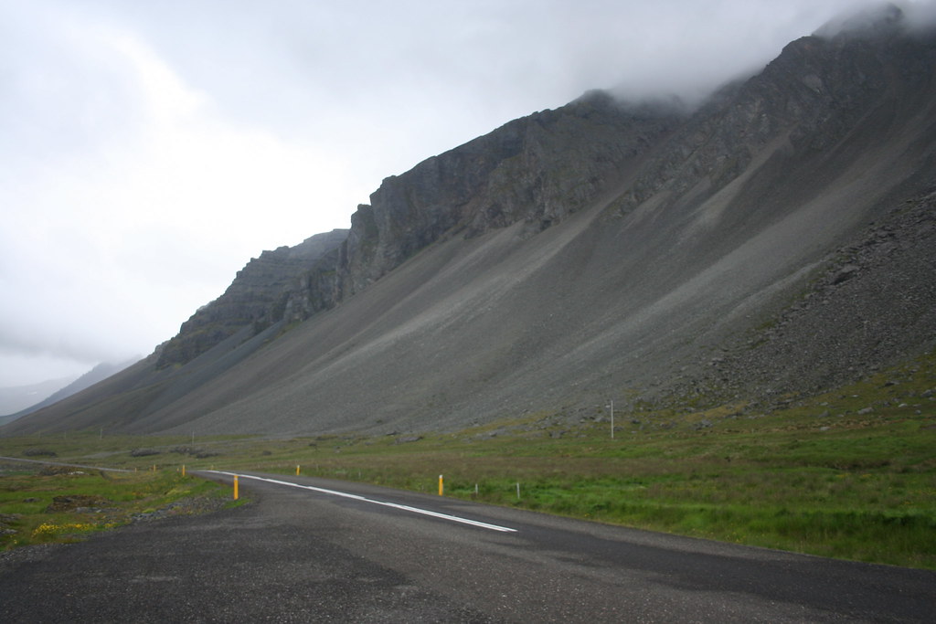
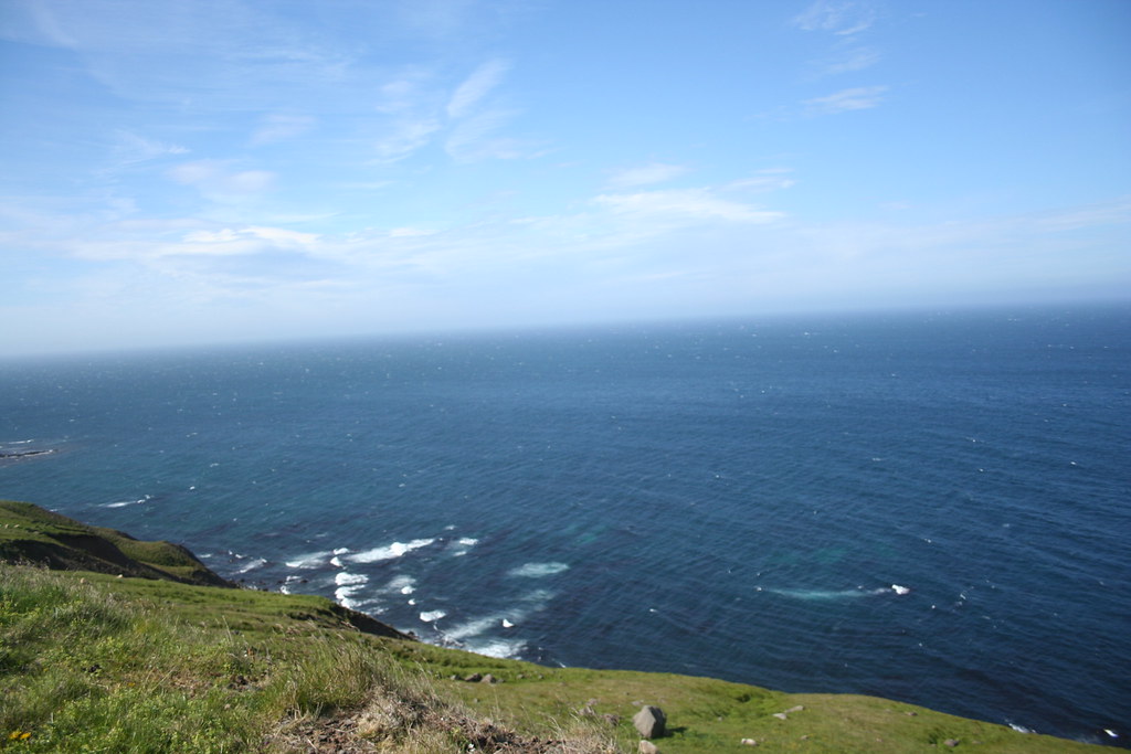
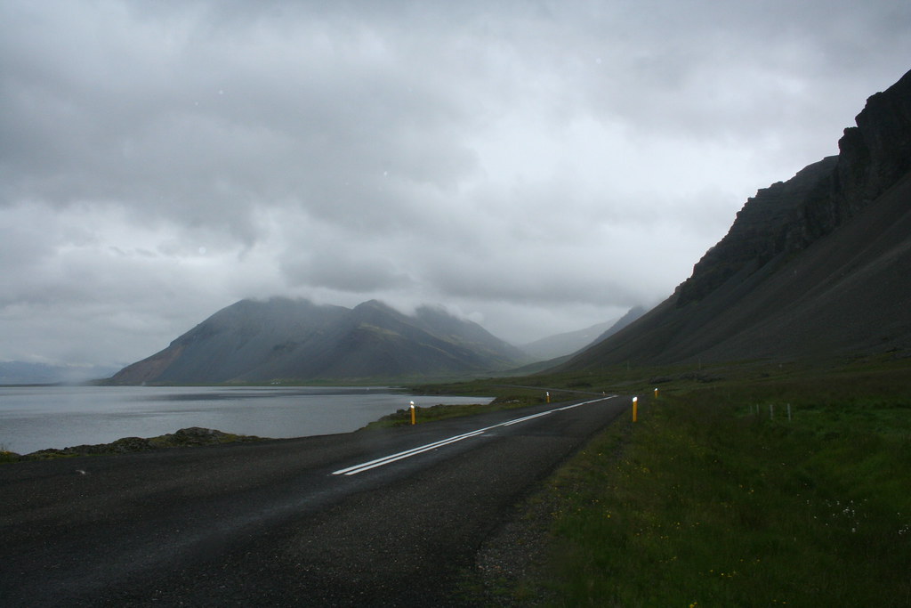 Photo of coastline in Eastfjords
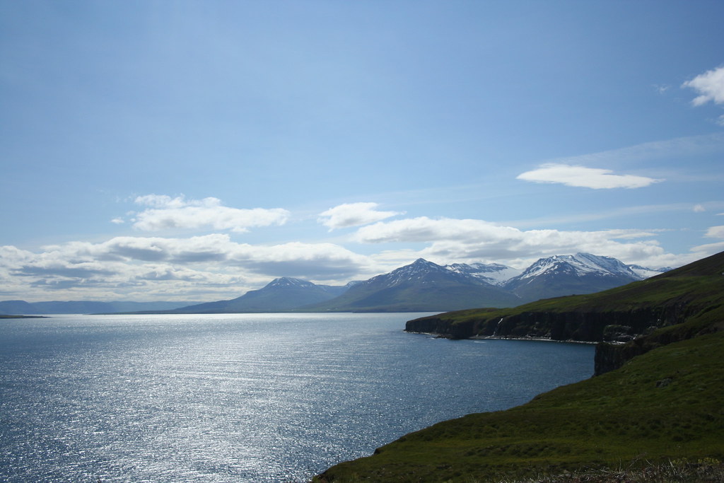
I am sure that on a clearer day, the ride up the coast of the EastFjords would have been spectacular

 The next set of photos were taken around the town of Djupivogur.
I had the camera set to one of the special effect modes.
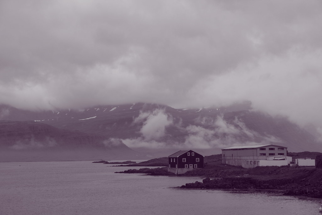
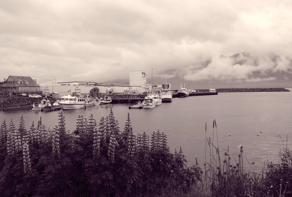 Photo in BW

Last edited by Ride4Adventure; 14 Jan 2015 at 01:04.
|
22 Jul 2009
|
|
Registered Users
Veteran HUBBer
|
|
Join Date: Jun 2009
Location: Ottawa
Posts: 100
|
|
|
Journey to Iceland Land of Ice and Fire Day 4 Continue
Continue Day 4
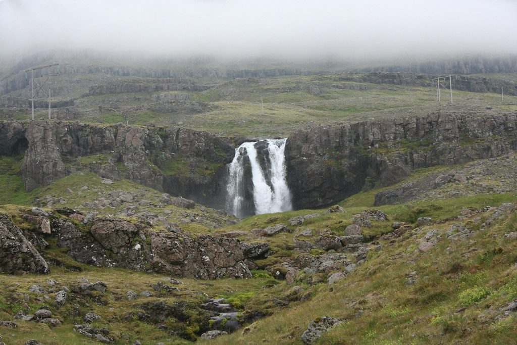
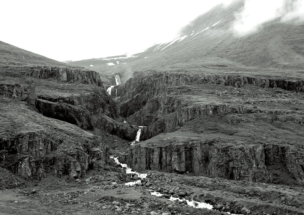
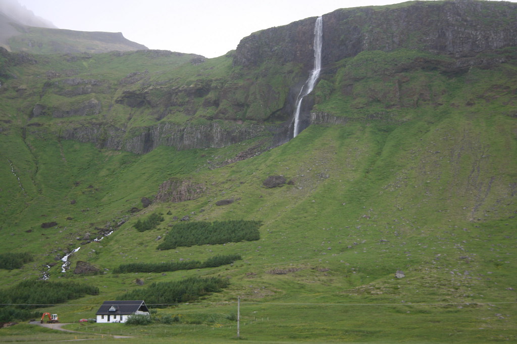
Photo of waterfalls
Waterfalls are everywhere. After a while you become a bit blase about them.In most other countries even one of the minor waterfalls to be found in Iceland would be a major natural attraction. In Iceland there are hundreds of them to be found when driving around the island
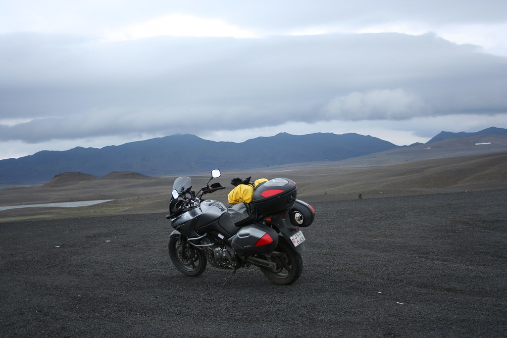
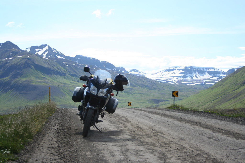
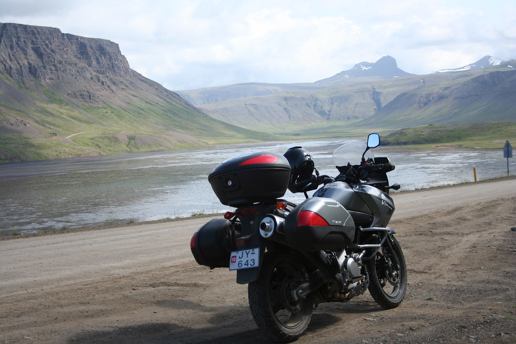
 My motorized transportation while touring through Iceland Suzuki Vstrom DL 650
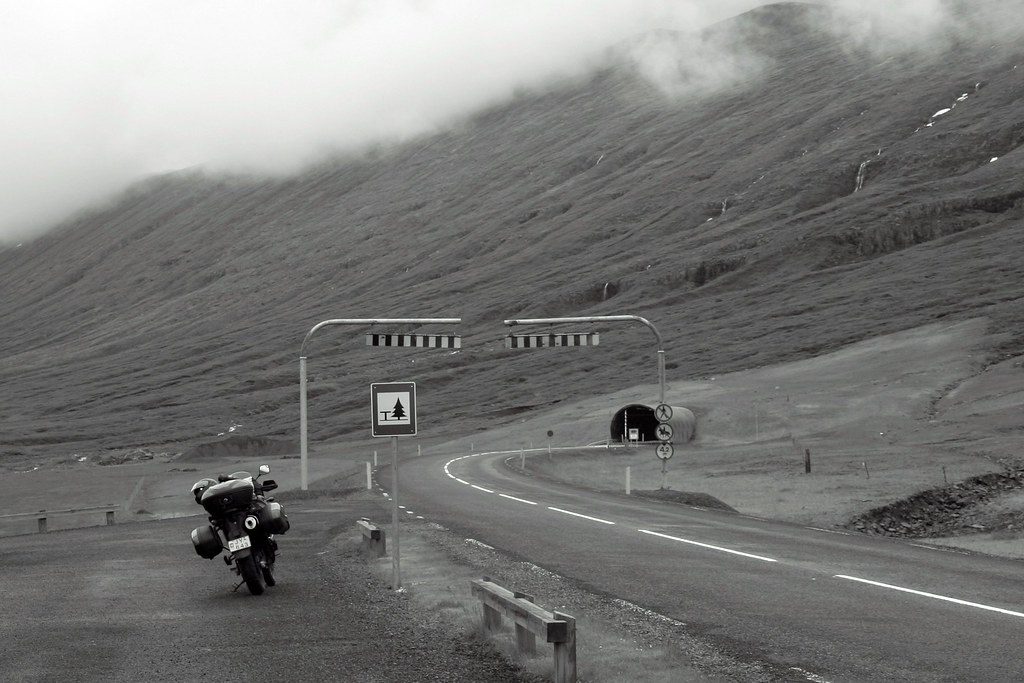
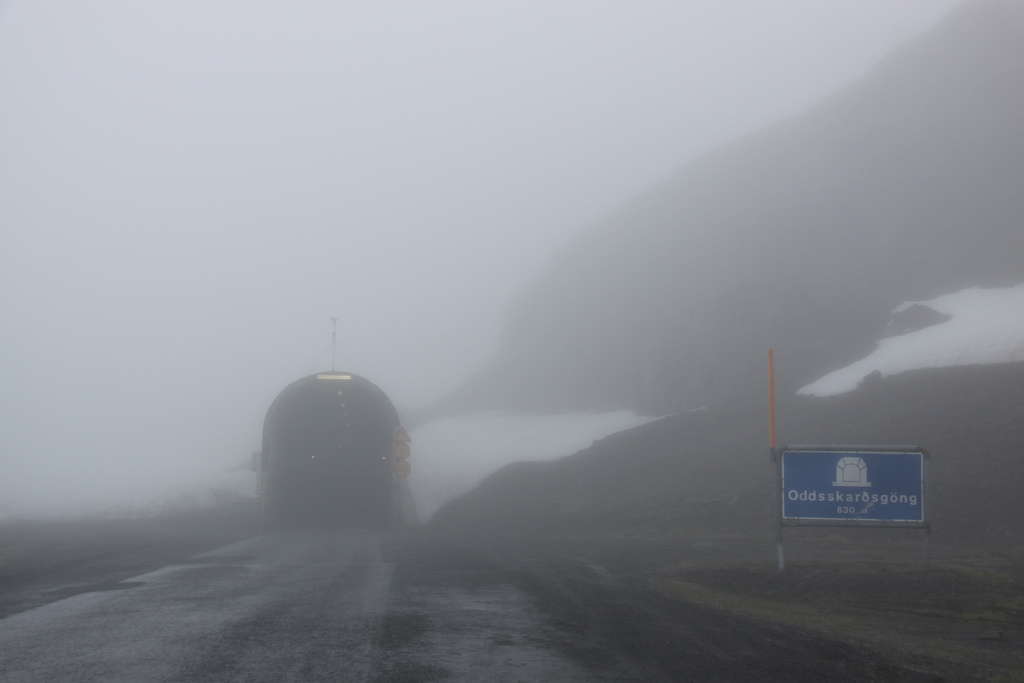
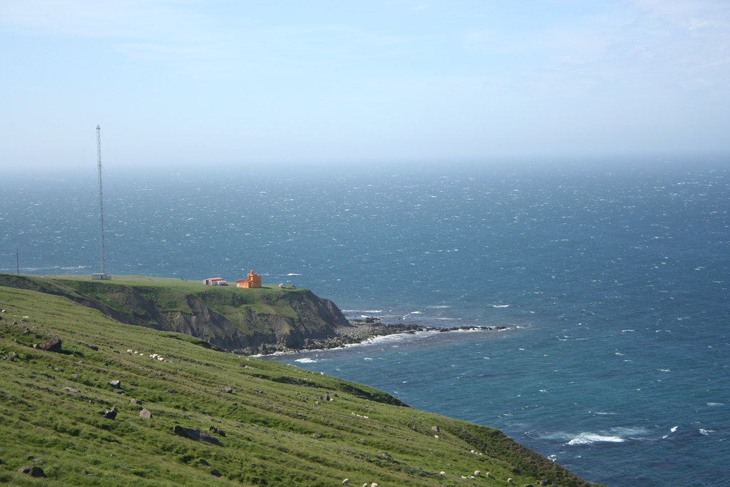
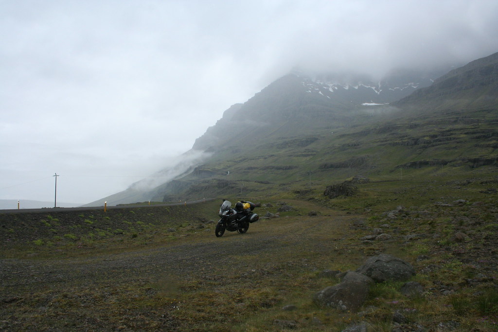 Photo of tunnel in Eastfjords iceland
This is the entrance to the tunnel linking Reydarfjordur and Faskrudsfjordur. They have built a new aluminum smelter in the area along with a major power plant to provide electricity to the facility so they went to the expense of building this tunnel. The tunnel is 5.9 kms in length. It is quit the experience to ride through it. The tunnel is well lit, so no problems seeing on the drive through.
 Closeup of entrance to tunnel
Scene on other side of tunnel
 The ride from Eskifjordur to Neskaupstadur
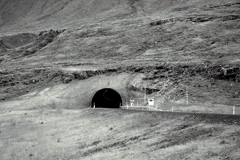
The ride between Eskifjordur to Neskaupstadur was quit the odyssey. The section of road that connects the two fishing villages is a windy gravel road that takes you up into one of the highest mountain passes in the country. It is only a distance of 25 - 30 kms between the two towns and would have been an enjoyable ride on a normal day. As I began my ride up the mountain pass the weather became more increment, it began to rain heavier than it had throughout the day, as I got higher up in the mountain, low lying clouds obscured my visibility to the point that I could hardly see more than 5 or 6 feet in front of at any one time. Those wonderful Icelandic sheep that usually keep to the sides of the road well I guess when it is foggy they prefer to walk in the middle of the roadway. The road surface also was a cause for concern. The road surface looked like coarse gravel that was bonded to the road with a thick tar. On top of this they spread some loose gravel just to make interesting for two wheelers.. The tires on the VStrom struggled mightily with this combination of loose gravel and irregular surface. When I finally got to the top of the mountain I came upon a tunnel. The tunnel is a single lane, about half a kilomter or more in length.
Photos of tunnel
It was so foggy at the time that I was not able to take a proper photo, but I did find an appropriate photo at Flickr (rights owned by ChrisGoldNY - Flickr)
The conditions in the photo actually looks a lot like what I experienced.
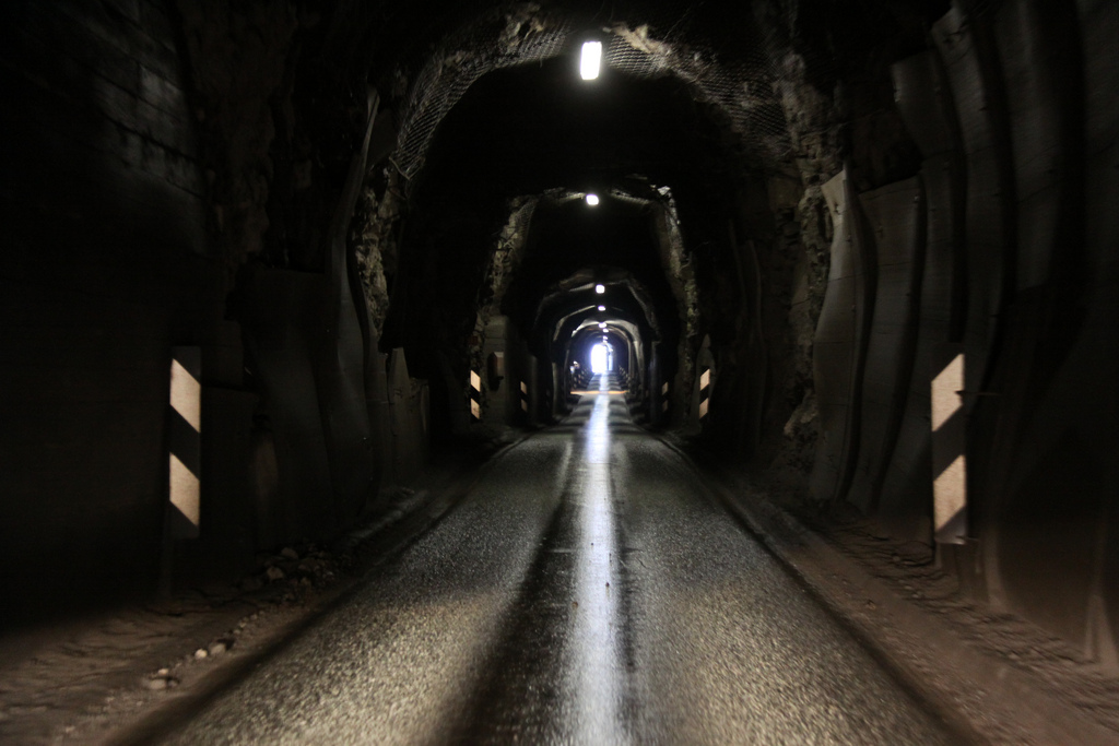
As I approached within the last 50 feet of the tunnel before exiting, I found myself riding into a thick fog and in the middle of the fog I could see a bright light shinning just beyond. It was a bit of a bizarre experience. It reminded me of an episode from the Twilight Zone. It turned out the light was that of a SUV waiting at the entrance.
After exiting the tunnel you follow a steep descent down the mountain and into the village of Neskaupstadur
Photos from around Neskaupstadur

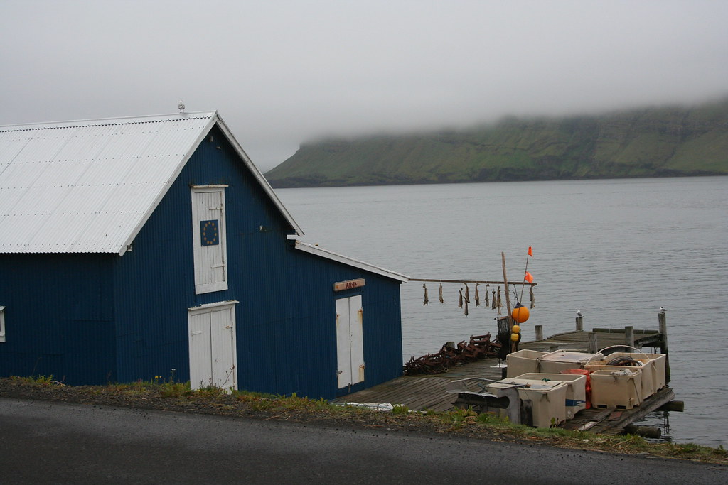
 Notice some of the fish that are hung up to dry
I checked into my Hotel here in town ( EDDA Hotel- Again)
Even on a sunny day this place would still look dreary
There were not too many options for eating out in this town. I found a dinning room at a place called Hotel Capitano. The Lonely Planet guide said that it was a "pleasant informal restaurant serves genuine Thai food". Trust me suffering the pangs of hunger is preferable to eating at this place.
As it was Saturday night I thought I would try and find a local establishment and try out a few Icelandic ales.
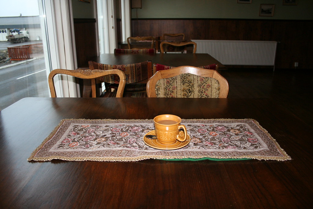
As you can see from the photo, no  just coffee. Its bad enough that they charged me 300 ISK for a coffee, they wanted 700 ISK for a that like 7 - 8 bucks. Booze is very expensive over here, the government imposes a very high tax on all alcoholic products
Now another observation - It is Friday night , I am sitting in one of the main bars in Neskaupstadur a town with a population of over 1400 people. Where is everybody. Since I have been in this town, I remember seeing 1 person over at the hotel, didn't see any other guests. In the bar, aside from the bartender I am the only person in the place. Before coming here I had walked from one end of the town to the other taking some photos of the place, never encountered a single soul. Is everyone out whale hunting or something ? or did I pass through some altered dimension when I passed through that tunnel on the way to Neskaupstadur.
End of day 4 - Hope I can find my way back to reality.
|
22 Jul 2009
|
|
Registered Users
Veteran HUBBer
|
|
Join Date: Jun 2009
Location: Ottawa
Posts: 100
|
|
|
Journey to Iceland Land of Ice and Fire Day 5
No need to check the weather this morning, its raining. Time to break out my rain gear. It may be raining here in Neskaupstadur but I hoped that perhaps on the other side of the mountain things would be a little better. The one thing I have learned about the weather in Iceland is that it is variable and changes hour by hour. It took me 3 or 4 trips to drag down my gear from my room on the second floor.
The only road out of Neskaupstadur is back down along the road that I traveled upon yesterday. I would have go back up the mountain and through that narrow tunnel way. I meet the same condition on top of the mountain that I came upon yesterday.There were a few other vehicles in the tunnel at the same time as I was going through. Every few hundred feet the lane in the tunnel widens to allow a vehicle to pull over to the side so as to let the other on-coming vehicle pass by.
Just as I had predicted when I arrived at the village of Eskifjordu the weather was improving. There was still a little bit of a mist hanging over the town but in the distance I could see patches of blue sky showing through. As I passed through town I again noticed that there didn't seem to anyone about on the streets. It was 9:00 on a Saturday morning. I remember reading another ride report for another motorcyclist who had toured across Iceland and he mad the same observation, outside of the major towns a living Icelander is hard to find.
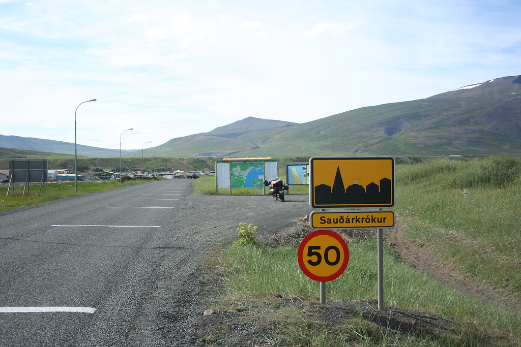
My destination for today would be the city of Akurureyri. I had originally planned on stopping in Husavik and go one one of the Whale watching tours but I had more pressing needs, I had to make a laundry run and I was fairly certain there was no laundry facilities in that town
Route Map for Day 5
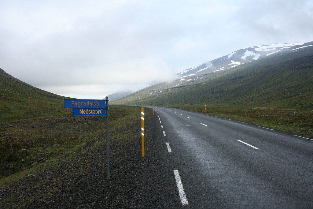
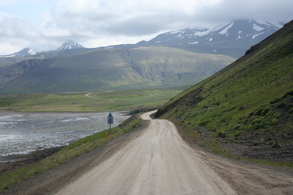
From the EastFjords the Ring-Road Hwy # 1 heads North and then westward. The topology is flat consisting of flat lands and moors. For most of the morning I was riding up in the mountains along elevated mountain valleys. In the higher elevations the road was covered in clouds ans as you entered into the next valley, the visibility would improve. Not really much to see along the way.

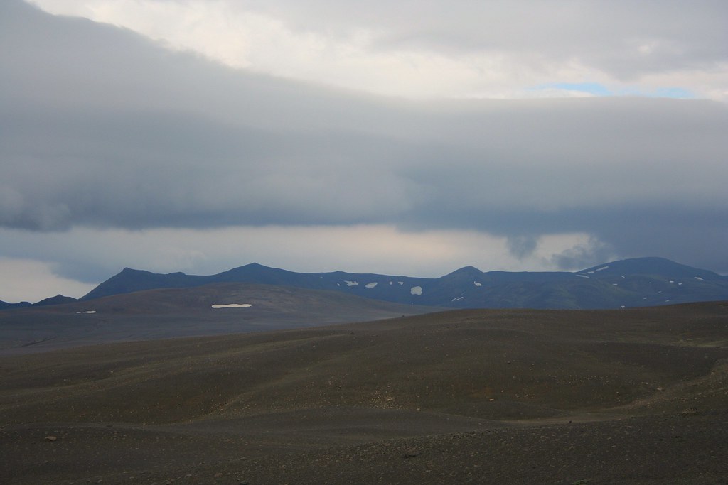
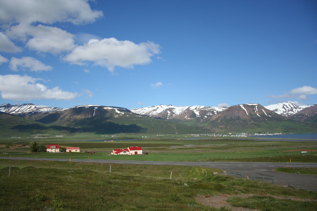
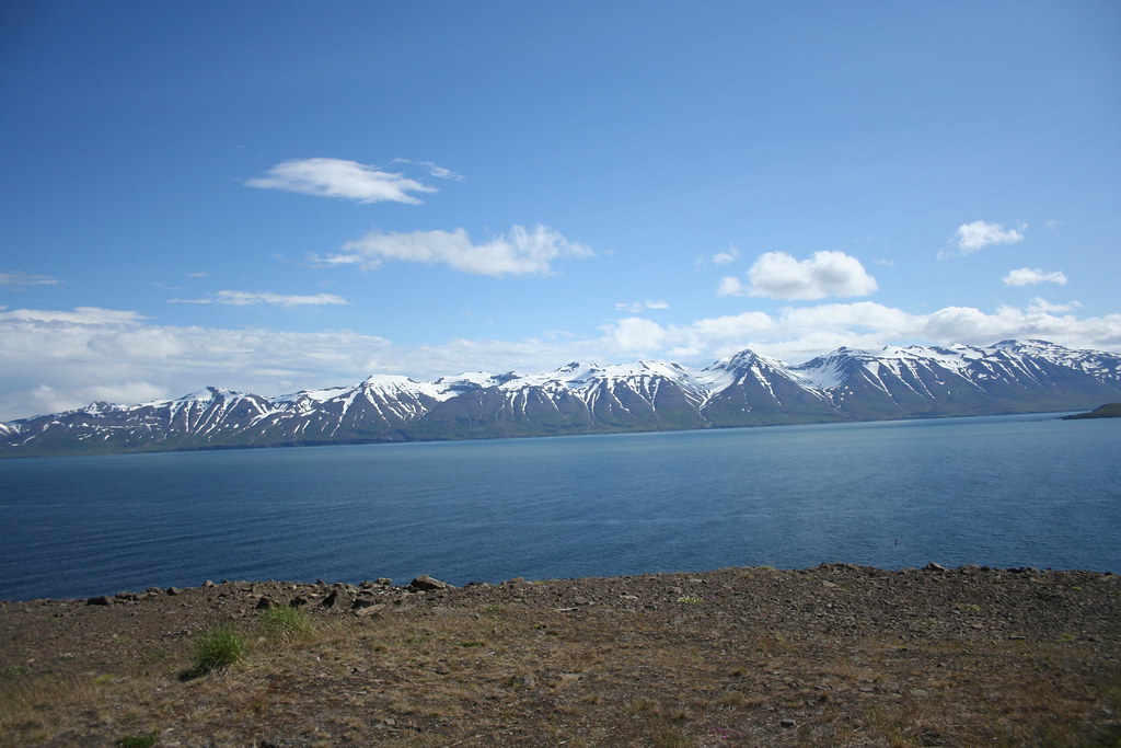
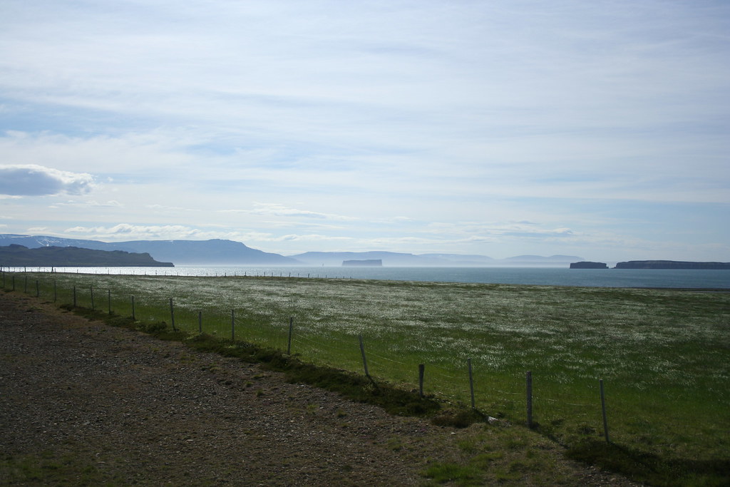
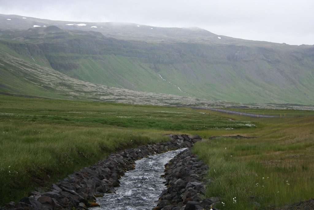
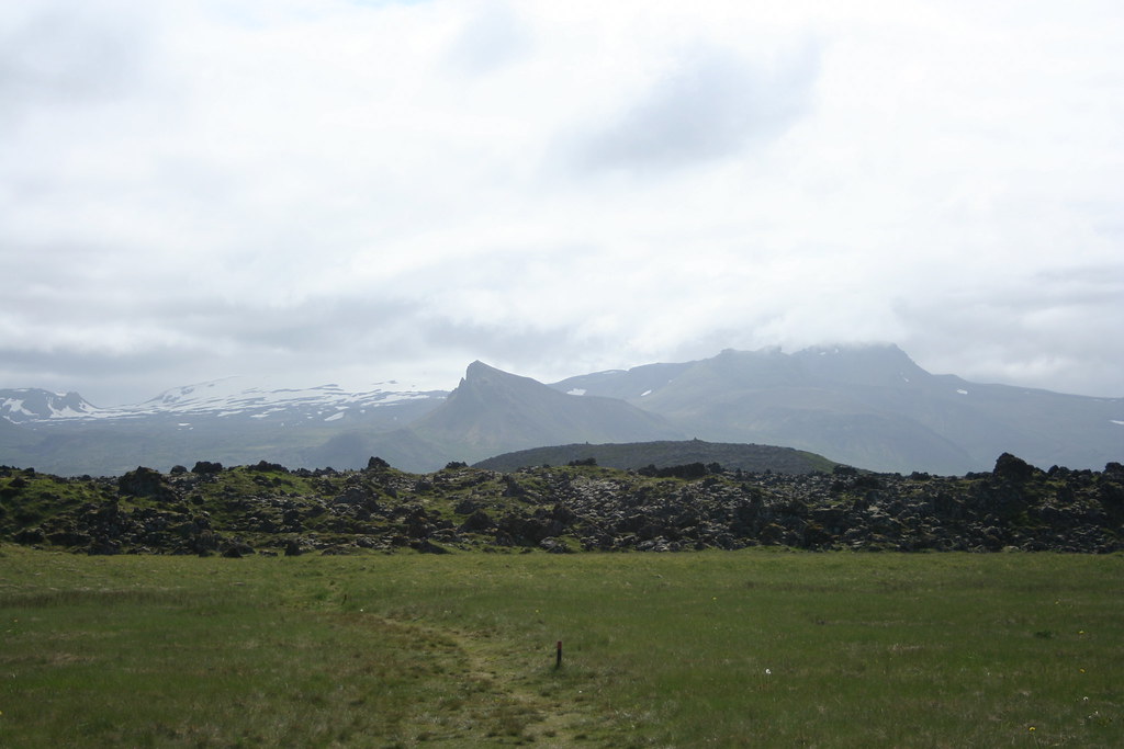
Once I got over the mountain ranges, the landscape began to dramatically change. Instead of the rugged mountains the land is transformed into a featureless landscape composed of low lying hills and desolate windswept barrens. The photo below does not convey how dull and bleak this region of Iceland is, it is like being transported to the dark side of the moon
|
22 Jul 2009
|
|
Registered Users
Veteran HUBBer
|
|
Join Date: Jun 2009
Location: Ottawa
Posts: 100
|
|
|
Journey to Iceland Land of Ice and Fire Day 5 Continue
Last edited by Ride4Adventure; 14 Jan 2015 at 01:09.
|
22 Jul 2009
|
|
Registered Users
Veteran HUBBer
|
|
Join Date: Jun 2009
Location: Ottawa
Posts: 100
|
|
|
Journey to Iceland Land of Ice and Fire Day 5 Continue
Last edited by Ride4Adventure; 14 Jan 2015 at 01:15.
|
23 Jul 2009
|
|
Registered Users
Veteran HUBBer
|
|
Join Date: Jun 2009
Location: Ottawa
Posts: 100
|
|
|
Journey to Iceland Land of Ice and Fire Day 6
Last edited by Ride4Adventure; 14 Jan 2015 at 01:39.
|
23 Jul 2009
|
|
Registered Users
Veteran HUBBer
|
|
Join Date: Jun 2009
Location: Ottawa
Posts: 100
|
|
|
Journey to Iceland Land of Ice and Fire Day 6 Continue
Last edited by Ride4Adventure; 23 Jul 2009 at 21:34.
|
24 Jul 2009
|
|
Registered Users
Veteran HUBBer
|
|
Join Date: Jun 2009
Location: Ottawa
Posts: 100
|
|
|
Journey to Iceland Land of Ice and Fire Day 7
Last edited by Ride4Adventure; 14 Jan 2015 at 01:41.
|
25 Jul 2009
|
|
Registered Users
HUBB regular
|
|
Join Date: Jul 2007
Location: Brighton UK
Posts: 25
|
|
|
Great great great
This is a great write up and the photos are just stunning. I wanna go, I wanna go, I wanna go
|
29 Jul 2009
|
|
Registered Users
Veteran HUBBer
|
|
Join Date: Jun 2009
Location: Ottawa
Posts: 100
|
|
|
Journey to Iceland Land of Ice and Fire Day 8
Last edited by Ride4Adventure; 14 Jan 2015 at 01:53.
|
|
Currently Active Users Viewing This Thread: 1 (0 Registered Users and/or Members and 1 guests)
|
|
|
 Posting Rules
|
You may not post new threads
You may not post replies
You may not post attachments
You may not edit your posts
HTML code is Off
|
|
|
|

Check the RAW segments; Grant, your HU host is on every month!
Episodes below to listen to while you, err, pretend to do something or other...

2020 Edition of Chris Scott's Adventure Motorcycling Handbook.
"Ultimate global guide for red-blooded bikers planning overseas exploration. Covers choice & preparation of best bike, shipping overseas, baggage design, riding techniques, travel health, visas, documentation, safety and useful addresses." Recommended. (Grant)

Ripcord Rescue Travel Insurance™ combines into a single integrated program the best evacuation and rescue with the premier travel insurance coverages designed for adventurers.
Led by special operations veterans, Stanford Medicine affiliated physicians, paramedics and other travel experts, Ripcord is perfect for adventure seekers, climbers, skiers, sports enthusiasts, hunters, international travelers, humanitarian efforts, expeditions and more.
Ripcord travel protection is now available for ALL nationalities, and travel is covered on motorcycles of all sizes!
What others say about HU...
"This site is the BIBLE for international bike travelers." Greg, Australia
"Thank you! The web site, The travels, The insight, The inspiration, Everything, just thanks." Colin, UK
"My friend and I are planning a trip from Singapore to England... We found (the HU) site invaluable as an aid to planning and have based a lot of our purchases (bikes, riding gear, etc.) on what we have learned from this site." Phil, Australia
"I for one always had an adventurous spirit, but you and Susan lit the fire for my trip and I'll be forever grateful for what you two do to inspire others to just do it." Brent, USA
"Your website is a mecca of valuable information and the (video) series is informative, entertaining, and inspiring!" Jennifer, Canada
"Your worldwide organisation and events are the Go To places to for all serious touring and aspiring touring bikers." Trevor, South Africa
"This is the answer to all my questions." Haydn, Australia
"Keep going the excellent work you are doing for Horizons Unlimited - I love it!" Thomas, Germany
Lots more comments here!

Diaries of a compulsive traveller
by Graham Field
Book, eBook, Audiobook
"A compelling, honest, inspiring and entertaining writing style with a built-in feel-good factor" Get them NOW from the authors' website and Amazon.com, Amazon.ca, Amazon.co.uk.
Back Road Map Books and Backroad GPS Maps for all of Canada - a must have!
New to Horizons Unlimited?
New to motorcycle travelling? New to the HU site? Confused? Too many options? It's really very simple - just 4 easy steps!
Horizons Unlimited was founded in 1997 by Grant and Susan Johnson following their journey around the world on a BMW R80G/S.
 Read more about Grant & Susan's story
Membership - help keep us going!
Horizons Unlimited is not a big multi-national company, just two people who love motorcycle travel and have grown what started as a hobby in 1997 into a full time job (usually 8-10 hours per day and 7 days a week) and a labour of love. To keep it going and a roof over our heads, we run events all over the world with the help of volunteers; we sell inspirational and informative DVDs; we have a few selected advertisers; and we make a small amount from memberships.
You don't have to be a Member to come to an HU meeting, access the website, or ask questions on the HUBB. What you get for your membership contribution is our sincere gratitude, good karma and knowing that you're helping to keep the motorcycle travel dream alive. Contributing Members and Gold Members do get additional features on the HUBB. Here's a list of all the Member benefits on the HUBB.
|
|
|


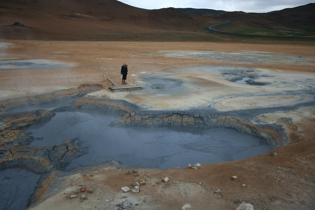

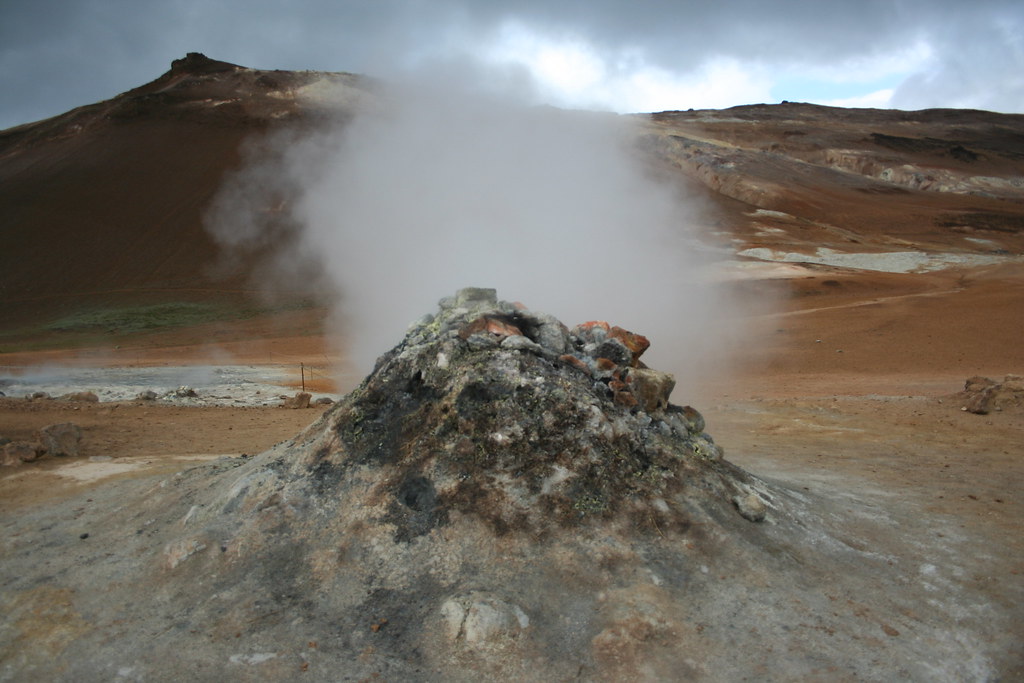
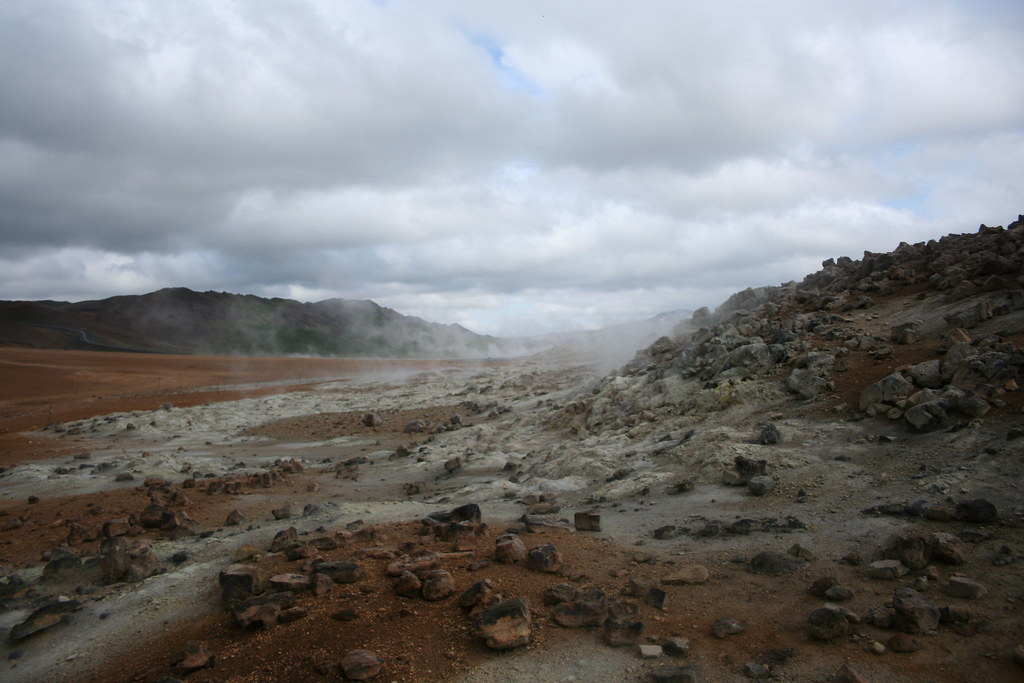
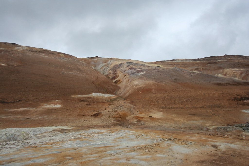
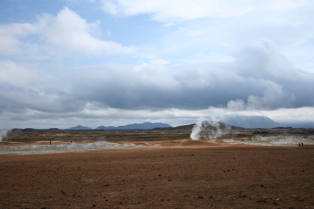


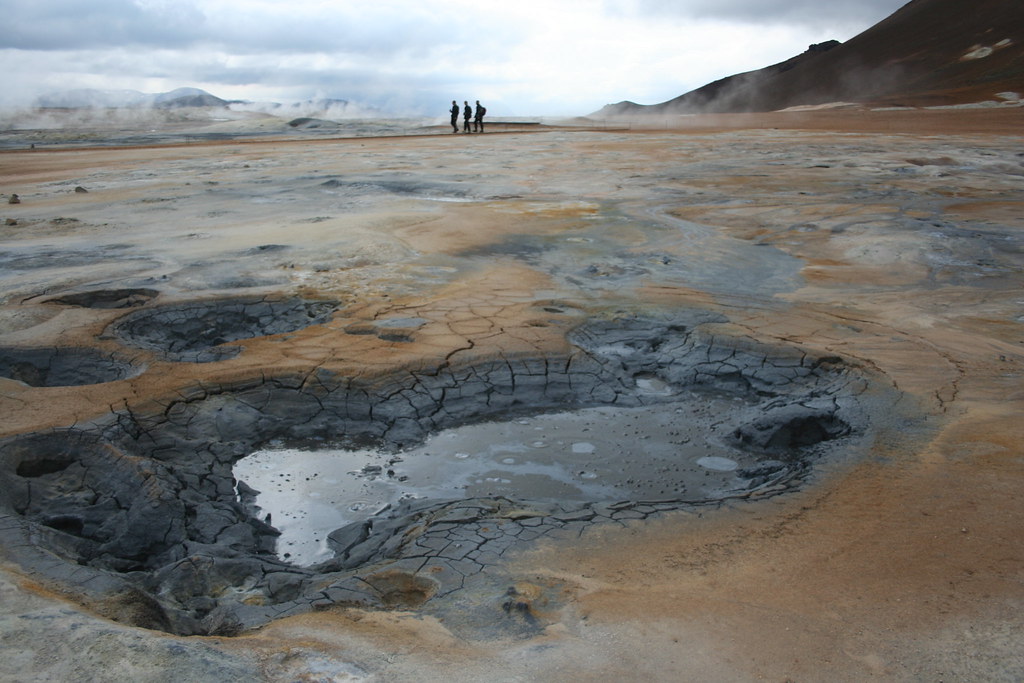
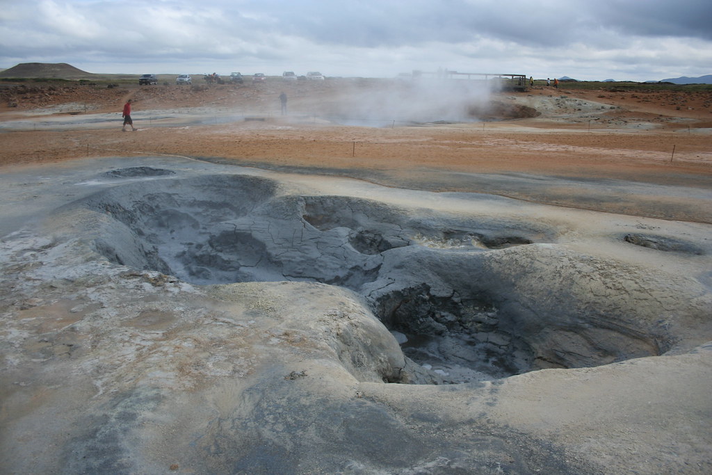

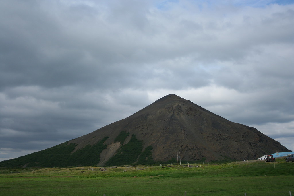
 65°44′0″N 16°47′0″W / 65.73333°N 16.78333°W / 65.73333; -16.78333 Type Caldera Last eruption 1984 Krafla is a caldera of about 10 km in diameter with a 90 km long fissure zone, in the north of Iceland in the Mývatn region. Its highest peak reaches up to 818 m; it has erupted 29 times and it is 2km in depth.
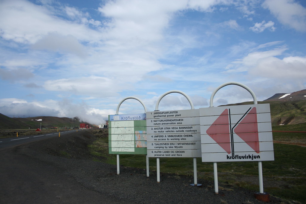


 Linear Mode


