Go Back   Horizons Unlimited - The HUBB > Ride Tales, Trip Reports and Stories > Ride Tales
Ride Tales Post your ride reports for a weekend ride or around the world. Please make the first words of the title WHERE the ride is. Please do NOT just post a link to your site. For a link, see Get a Link.
Photo by George Guille, It's going to be a long 300km... Bolivian Amazon

I haven't been everywhere...
but it's on my list!


Photo by George Guille
It's going to be a long 300km...
Bolivian Amazon


Like Tree13Likes

Reply
 
LinkBack Thread Tools Display Modes
  #1  
Old 18 Jan 2014
Registered Users
New on the HUBB
 
Join Date: Aug 2013
Posts: 10
Exploring Balkans. Montenegro and Bosnia off-road.

Hi everyone, this is my first RR here on the HUBB

This is a story about two trips I took last year, exploring and enjoying some less traveled routes trough Bosnia, Montenegro and Serbia... Enjoy.

Part one:
Last winter several people contacted me trough another forum with plans of riding trough Balkans and doing some parts of the route together. Honestly, I never expected to see those people, who'd come and ride here anyway...

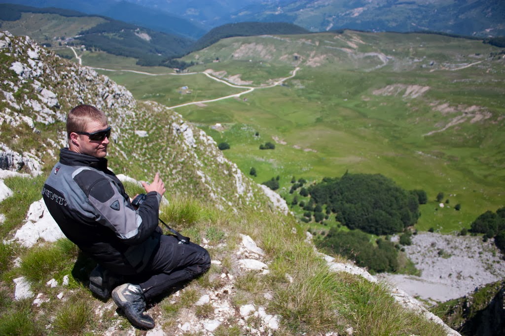
You can imagine my surprise when, few months later, my phone rang one night. PJ from Belgium was in Croatia, on his six weeks trip trough Balkans. His plan was to ride trough Bosnia for couple of days and then move to Montenegro. Since I was itching for a ride it wasn't to difficult to persuade me to join him Few messages were sent back and forth and we agreed to meet in Sarajevo, Bosnia and Herzegovina, in couple of days.


Day 0, getting to Sarajevo.
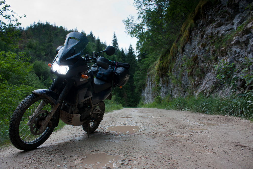
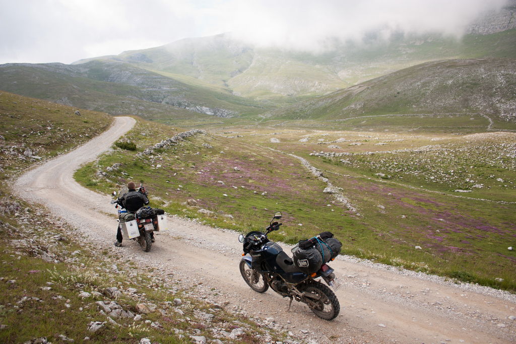
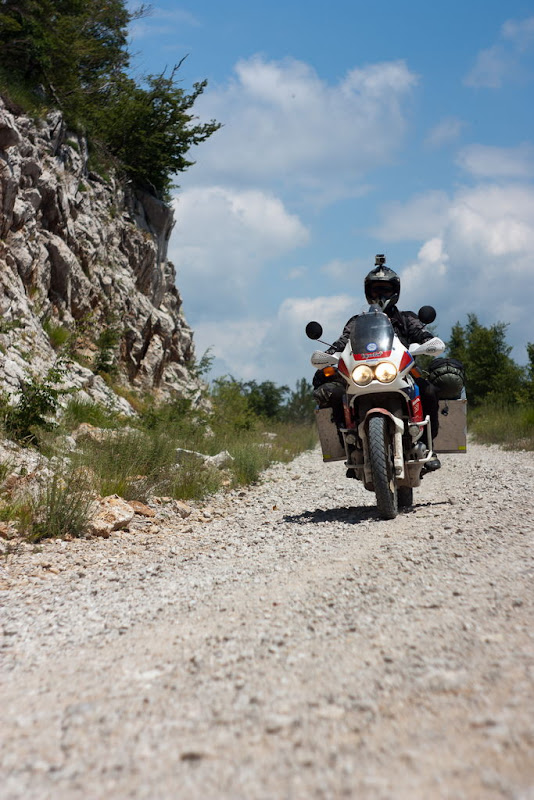
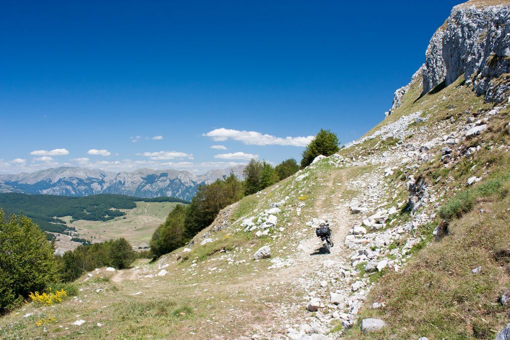
Since I live in Novi Sad, Serbia, I first had to ride to Sarajevo. It is a 300 km pavement ride, second half being on great twisty mountain roads trough Bosnia. I know that route well and was eager to change it at least a little bit. That means I "replaced" last 80 kilometers of pavement with 60-70 kilometers of completely unknown forest roads. Route planning was done in Google Earth so I had no actual info about road conditions.

Along the way I visited a friend in Han Pjesak and from there to Sarajevo I would ride off road. Now, to start making things interesting... It was around 6PM by the time I got back on the road. 60 km of unknown off road with only three hours of daylight. Oh, and I like to stop very often to take photos... What could possibly go wrong?


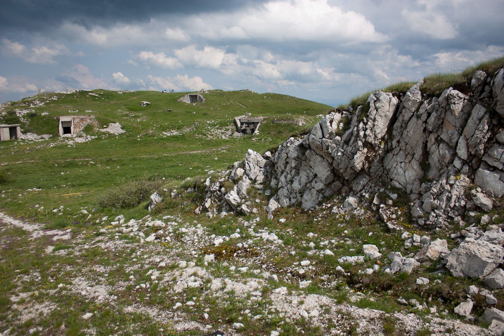
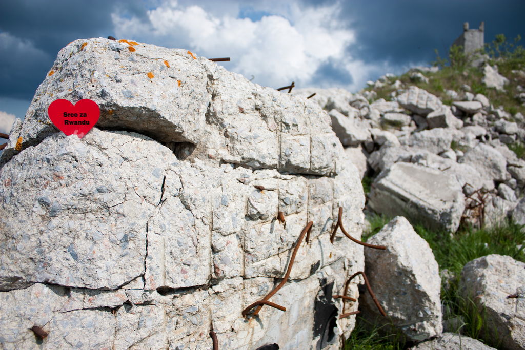
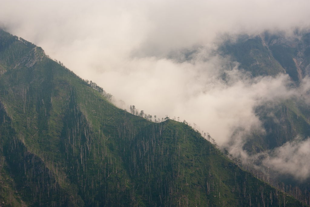
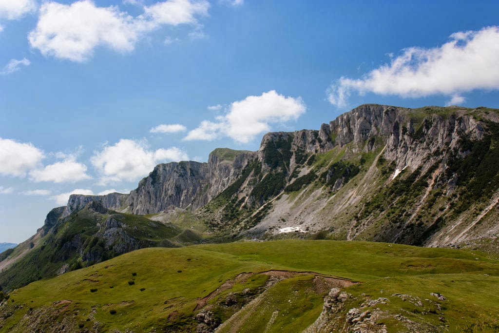
Scenery is nice, roads in good shape and I'm making good progress. There are several sections where road goes trough areas demolished during the war in the '90s. All homes are destroyed, meadows are overgrown with grass as there's nobody to look after. Oh yeah, fact that everything is heavily mined is surely not helping...


I'm on a narrow forest road, there is a broken truck, overloaded with logs sitting there. Driver, his wife and their baby... No mobile phone reception here so they can't call for help. Nearest village is some 6-7 kilometers away, they explain me where to find their relatives who would be able to help. "Just tell them to bring chainsaw..." Luckily there was enough room for me to pass the truck. I've done my good deed for today, losing some half hour of dayligh before I was able to find right house


Soon after my track log takes me into someones front yard. I can see the road going further but it's clear that it is in very bad shape and that I won't be able to pass. Owner advises me on another route and says that I should have no problems what so ever. Since I actually had alternative route I paid little attention to his words. Mistake No. 1...

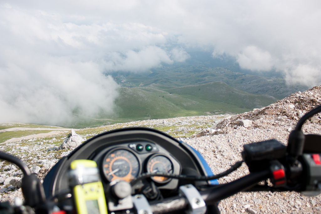
This might be a good time to tell you about my navigation equipement. It's old, old handheld Garmin Geko 201 GPS. It supports no maps, no automatic routing or anything. All it can do is give me coordinates (useless for me since I don't have any proper maps) and show me a line on the screen, representing tracklog I made back home. So, basically I have no idea where I am and how far 'till I reach "other side".

It's sunset...

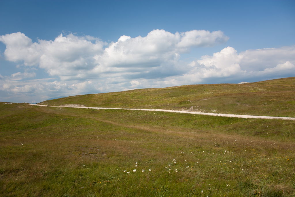
Soon I leave the main road (gravel). Right from the start it's obvious that this "new" road is not being used at all. It is however on my planned route so I decide to press on. Have I took a better look at my GPS at that point I could also see that there was another planned alternative, just a few hundred meters further down the main road. But, in that case this post would end quickly and it would be boring...

So, road is overgrown in tall grass, streams are running at the surface, using the road as riverbed. Going is slow but easy. At least there are no hidden obstacles in that grass... After few minutes I reach a landslide, most of the road is gone but there is a path going over. "Ah, that's why they don't use it. Surely it gets better from now on..." Yeah, right...


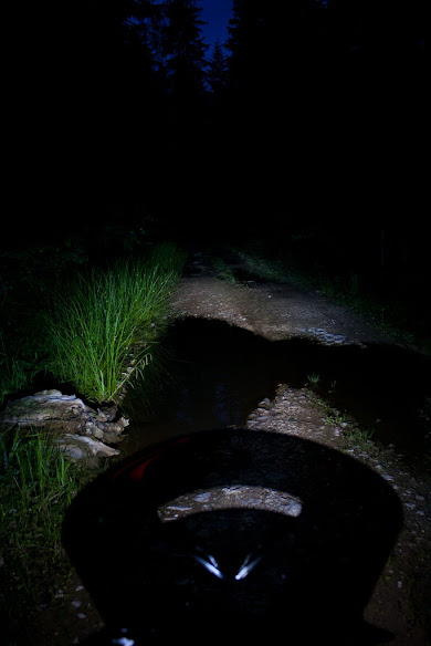
It's quite dark among the trees and headlights are already doing their job. As soon as I get past the landslide road gets worse. Grass gets taller and there is more standing water, also some mud. By now I can't see road surface at all.


Short hill, road is now damaged by ruts but at least grass isn't that tall. I reach a cross road, place where my original route (one that ended in that front yard) joins with this alternative. There is an abandoned hut there, one normal forest road leading in unknown direction with some vehicle tracks and a track that I have to take.

It's bad from the start... Surface is loose and rutted, it's uphill. There are no signs of any traffic. I can already guess how this is going to end but I'm stubborn and quitting is not an option at this point. And sure enough, after few minutes I come across huge pile of rubble, dumped right across the road. It would be possible to go around but it's dark and I can't see what lies behind and I don't have intention to find out. There is surely a good reason to put that road block there. A bit of logical thinking at that point might be a good idea but it escaped my mind back then (for the last 30 or so minutes I was riding on closed of road, that block was actually on the BEGINNING...).

So, to put it simply: at that time I was less than 100 meters away from proper, normal and well used forest road which would take me to civilization in 5 or so kilometers... I found that out once I got home, after the trip was over. If I knew that back than remainder of this post would be short and boring...


Now, I have two options. Backtrack all the way to that last village and ask for directions from there (maybe a 30 minutes of riding trough well known tall grass and water) or to go and explore that unknown road with tracks on it. Fu@$#% it, I don't like backtracking. Besides, the truck that made those tracks had to come from somewhere. I should have no trouble following tracks back to civilization, even if there are some crossroads... Silly me...

I have some idea where this road should go (actually I know where I want it to go ) and everything is still fun. Road is in good condition, riding is easy and relaxing.


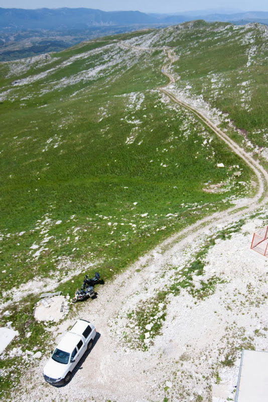
Fork in the road. Main road continues straight on. Other, minor, road goes left. That's general direction where I need to go in order to rejoin with my original route and I still hope that will happen eventually. Gravel road climbs up gradually, it is narrowed by the vegetation on both sides. By this time it's pitch black. Shadows produced by headlights are already playing with my mind... Gravel stops after some time. Road enters small clearing in the forest and disappears. It's a place where logging trucks are (actually were, once) loaded. There is some track going further into forest but it's steep and rutted. I'm on a heavy bike (Kawasaki KLE 500) and have no intention to hurt my self here.


Going back toward the main road my windshield mount breaks. It was cracked for some time now so it was just matter of time before it breaks completely... Now, those few moments between hearing something breaking under front wheel and realizing what it is were unpleasant to say it mildly... Fu%#$%! It was a great windscreen... At that point this game stopped being fun...

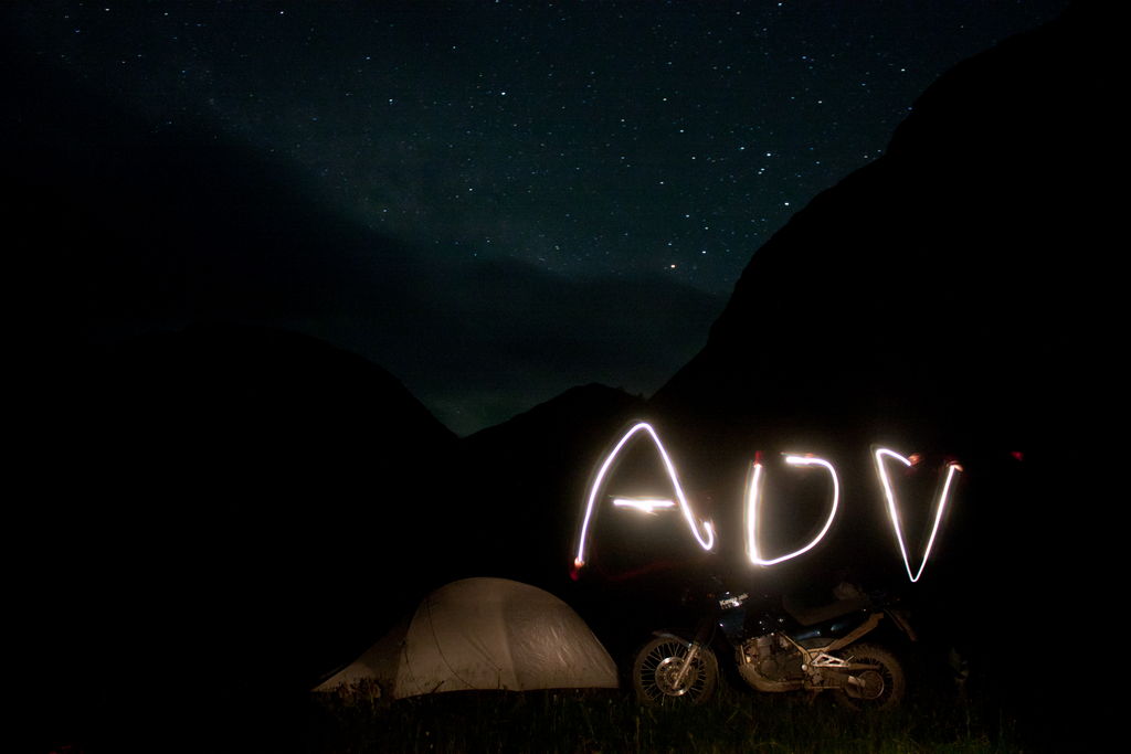
I don't have sleeping bag with me so idea of spending the night there is not appealing. Good thing is that there is plenty of fuel in the tank so I can ride for hours if need be. One less thing to worry about. By that time I was so happy with my decision to upgrade stock headlights to two bi-xenon projectors. At least I can see the road.


here are couple intersections where it's easy to decide where to go. And then shit hit the fan... Few kilometers down the main/only road forks again. Trouble is I can't decide which one to take, both look equally used. I go left but after few minutes decide it's not a good choice. So, back to intersection and I go right. Road soon becomes muddy and after few minutes I'm greeted bu logs lying across the road, completely blocking it... So, yeah. It looks like i'll have to start liking that "left" road.


No photos from now on, for no reason whatsoever I didn't feel like stopping and shooting anymore BTW camera I'm using is Canon 450d (xSI) with several lenses. It sits in its bag on back seat so every photo means stopping for at least a minute or so, taking of the gloves...

Next few forks in the road I don't even stop to think about proper route. Just choose randomly and ride. At one point I realized that I made a full 180 turn from my "original" direction so that I was now riding back toward that last village. At same time I was so pissed of with myself for not noticing that happening but then again, idea of reaching civilization sounded good by that time.

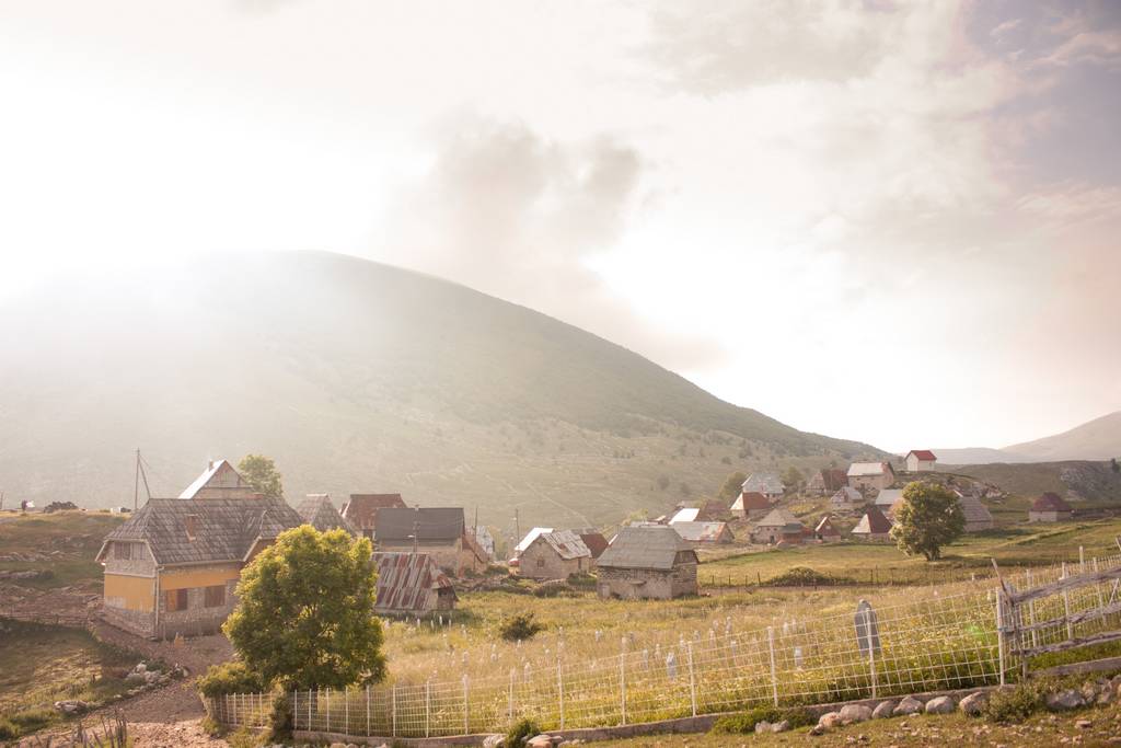
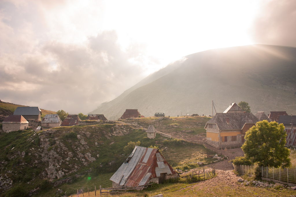
Then road exits the forest. I was ready to backtrack to the last fork as road itself looked pretty minor. But then there was light!!! A house right by the road! When I said to owner how I got there he didn't think it was possible. He tells me that there is a pavement only a kilometer (and few intersections) away, going to that last village I was at. I'm as happy as ever. It's been some two hours since I left that village...

I take a look at my phone (stays turned off in pocket while I ride) and there are several messages from PJ. "I'll be in Sarajevo in few hours." "I'm in Sarajevo and waiting instructions how to find your place." "I'm in Sarajevo, in a campsite..." Ups... My bike takes the opportunity to tip over from side stand...

By the time I finished talking with home owner his guests were ready to leave. Now I had escort to the pavement I get detailed instructions how to reach proper civilization and it suddenly doesn't sound like fun. I hear words like "gravel", "forks in the road, in forest", "30-40 kilometers before you reach main road..."

In reality it wasn't bad at all. Road is well used and there is no dilemma which one to take when it forks.

By the time I reached main road, the one that I know, I was completely beaten. I was finally able to relax for a few minutes and take a well deserved break. All that is left now is a 40 minute ride to my destination...
Reply With Quote
  #2  
Old 19 Jan 2014
sparco's Avatar
Registered Users
HUBB regular
 
Join Date: May 2012
Posts: 80
yo gligo seems like a nice ride cmon continue dont stop now, greetings from montenegro
Reply With Quote
  #3  
Old 20 Jan 2014
Registered Users
Veteran HUBBer
 
Join Date: Feb 2013
Location: SW France
Posts: 119
Hi Gliga, read this before on ADV
Phil
Reply With Quote
  #4  
Old 21 Jan 2014
Registered Users
New on the HUBB
 
Join Date: Aug 2013
Posts: 10
No you haven't This is completely new, previously unpublished RR

Next part will be online tommorow evening, sorry for delays.
Reply With Quote
  #5  
Old 22 Jan 2014
Registered Users
New on the HUBB
 
Join Date: Aug 2013
Posts: 10
Day 0.5 (riding around Sarajevo)

Met up with PJ sometimes in the morning. This day I had to deal with some bureaucracy in downtown Sarajevo. By the time I finished it was already to late for proper ride. So, instead we rode to a nearby Jahorina ski resort. Gravel leading up from the ski resort up to the ridge is nice to ride and takes us to few peaks. After only few hundred meters of gravel it became obvious that riding pace will be much slower than I anticipated. PJ's Africa is heavily loaded with luggage racks which are stressed close to breaking point.


If you find yourself in this area be aware of DANGER, MINES signs. This area is heavily mined so your safest option is to stay ON ROAD. There is a destroyed military base on one of those peaks. Three words were enough to decide that thorough exploration of underground tunnels is necessary.


After we finished exploration of the base it was time to head back toward Sarajevo. On the way back we visited Trebevic mountain. There is an old, now destroyed, restaurant which served as turning point for cable car running from the city below. Restaurant has a terrace with a great view. For a while we debated if it was safe to ride our bikes onto the terrace as it looked pretty dodgy. In the end we decided that it would be worth it, as long as camera keeps on filming


Close to that place is another cool place, starting point of bob-sleigh track (which is demolished, just like most things here...). Well, this also deserves time for exploration... Walking down the track I could only think about riding it with a MTB. Some time later I found out that track actually runs all the way down (there are no destroyed spots in concrete) and that people have ridden down...


Afterwards it was time to slowly head back. In the evening we had great barbecue with my niece and her friends. Tomorrow real trip begins.
Reply With Quote
  #6  
Old 22 Jan 2014
Registered Users
New on the HUBB
 
Join Date: Aug 2013
Posts: 10
Day one (Sarajevo-Visocica mountain)

Another late start today, my fault again. This time we have added bonus of ever increasing rainfall. It doesn't look like it plans to ease off anytime soon so there's no point in waiting.

Right from the beginning we're riding on gravel road up the Igman mountain. This particular road used to be Sarajevo's only life line during the war. All food and medications had to pass here... As soon as we started climbing we found ourselves in a cloud. Dense fog, heavy rain, misting visor, soaked gloves. You know the drill. When weather is nice you can get some cool views from this road. All we could see now was a whiteout...

At some point we got above that low layer of clouds. Rain eased off and it looked like it would clear up later during the day. We reached Bjelasnica ski resort where we planned to climb to the top following the track which goes up the ski slopes. When we got to start of the really steep part we decided not to do it. Fully loaded Africa with street oriented tires was far from optimal solutions for a steep, wet and loose climb.


We climb some more as weather is constantly changing. Road climbing to the top of Bjelasnica has some 17 switchback turns and has been renovated earlier this year. We're in a cloud once more, it's windy and it's chilly. When we stop I take opportunity to warm up the gloves using engine heat. We also visited another destroyed military base nearby.


Riding down from the top we're once again in extremely changing weather. In one hairpin we'd ride trough a cloud and then be in sunshine in next one. This repeated all the way down...


Next we ride toward Lukomir medieval village.


Lukomir village is located at the edge of Rakitnica river canyon, one of deepest canyons in Europe. It's difficult to imagine more attractive position...


We had to do some backtracking in order to rejoin with main road in Umoljani village. There is one shortcut here, only technical section for today. Road is not being used anymore so it is in rough shape. It's fun riding thou


Before we started riding I had some loose plan that we'll cover around 300 kilometers today. Late start, rain, slow riding pace and numerous photo stops meant that by this point we only covered some 70 km, with sunset approaching. Not a big deal as both of us had plenty of time and this area is ideal for camping. Just before we reached pavement PJ's rear tire picked up a nail. By the time we reached flatter ground his bead was broken so at least we didn't struggle with that. An hour later we were ready to roll. Not bad for first roadside tire change


We have some 10-15 kilometers of nice and narrow winding pavement and then just a little gravel to reach our camping spot for today. Nice meadow along the road, with mandatory small stream in between.


It might be few days before I'm able to do another update as I won't have internet access. Plenty more to come thou, please be patient
Reply With Quote
  #7  
Old 23 Jan 2014
Registered Users
HUBB regular
 
Join Date: Jun 2013
Location: London
Posts: 71
Quote:
Originally Posted by Gliga View Post
Day one (Sarajevo-Visocica mountain)

Another late start today, my fault again. This time we have added bonus of ever increasing rainfall. It doesn't look like it plans to ease off anytime soon so there's no point in waiting.

Right from the beginning we're riding on gravel road up the Igman mountain. This particular road used to be Sarajevo's only life line during the war. All food and medications had to pass here... As soon as we started climbing we found ourselves in a cloud. Dense fog, heavy rain, misting visor, soaked gloves. You know the drill. When weather is nice you can get some cool views from this road. All we could see now was a whiteout...

At some point we got above that low layer of clouds. Rain eased off and it looked like it would clear up later during the day. We reached Bjelasnica ski resort where we planned to climb to the top following the track which goes up the ski slopes. When we got to start of the really steep part we decided not to do it. Fully loaded Africa with street oriented tires was far from optimal solutions for a steep, wet and loose climb.


We climb some more as weather is constantly changing. Road climbing to the top of Bjelasnica has some 17 switchback turns and has been renovated earlier this year. We're in a cloud once more, it's windy and it's chilly. When we stop I take opportunity to warm up the gloves using engine heat. We also visited another destroyed military base nearby.


Riding down from the top we're once again in extremely changing weather. In one hairpin we'd ride trough a cloud and then be in sunshine in next one. This repeated all the way down...


Next we ride toward Lukomir medieval village.


Lukomir village is located at the edge of Rakitnica river canyon, one of deepest canyons in Europe. It's difficult to imagine more attractive position...


We had to do some backtracking in order to rejoin with main road in Umoljani village. There is one shortcut here, only technical section for today. Road is not being used anymore so it is in rough shape. It's fun riding thou


Before we started riding I had some loose plan that we'll cover around 300 kilometers today. Late start, rain, slow riding pace and numerous photo stops meant that by this point we only covered some 70 km, with sunset approaching. Not a big deal as both of us had plenty of time and this area is ideal for camping. Just before we reached pavement PJ's rear tire picked up a nail. By the time we reached flatter ground his bead was broken so at least we didn't struggle with that. An hour later we were ready to roll. Not bad for first roadside tire change


We have some 10-15 kilometers of nice and narrow winding pavement and then just a little gravel to reach our camping spot for today. Nice meadow along the road, with mandatory small stream in between.


It might be few days before I'm able to do another update as I won't have internet access. Plenty more to come thou, please be patient
Great report. Keep us posted!
Reply With Quote
  #8  
Old 27 Jan 2014
Registered Users
Veteran HUBBer
 
Join Date: Feb 2013
Location: SW France
Posts: 119
Yep , you tricked me
Great rxr and looks like i'm going to have to get a bigger notepad with all these places to visit

Phil
Reply With Quote
  #9  
Old 3 Feb 2014
Registered Users
New on the HUBB
 
Join Date: Aug 2013
Posts: 10
I'm back and it's time for another update

Day two (Visocica-Zelengora)

Morning is cloudy but there's no rain and it looks like it's going to clear up later. Yesterdays judgement error meant that we now don't have any proper food and it will be a long time before we reach town where we can buy some.

As we were in middle of packing up (you know that phase where stuff is lying everywhere) we found ourselves in a path of cow herd. It was interesting trying to make them go around our stuff, not over it. Talk with older lady, herding the cows, once again reminds me how welcoming people living away from urban centers are. Sadly, I'm also reminded of horrors which they lived trough during the war, as she lost one of her sons... She was worried if we were cold last night and told me that we could knock on anybodies door in a village and they would be more than happy to house and feed us...
-Life is tough here. We must look one after another and help each other...


Right at the start of today's ride we had to choose between two roads. Shorter and attractive one which I knew from previous visit or longer and unknown... Both of them would meet up later on. We decided that it was time for exploration and took longer route. To put it simply: not the best decision. First part winds trough a dense forest and there's nothing else to see. After Donja Ljuta village road turns into a little used double track and again, there is nothing worth mentioning. Oh well, I now know which one to take next time


Extreme water crossing :P


One of rare opportunities to actually see something. Treskavica mountain.


In Argud village we reconnect with pavement road which soon takes us down into Neretva canyon. Thirty kilometers of twisties later we reach lake Boracko where it's time to leave pavement once again. At first road leads over a steep slope, right above the lake, and trough a forest. As we reach the pass surroundings change immediately. Steep slope is replaced with plateau, and forest turns into grass. Medieval graveyard is nearby.


There was one pavement section somewhere around here, luckily for us it didn't last for more than kilometer or three. Loose gravel road takes us trough a forest at the foothills of Velez mountain. Few times I lost front end, to the point that I have no idea how I stayed upright. I could see bike tracks on the road, somebody was blasting trough here, drifting in every corner...


Velez mountain, northern slope.


We reach Nevesinje town on some minor paved road. Right at the entrance to town I got pulled over by police. The moment I saw them was same moment when I remembered that my lights are off (still not used to fact that I installed light switches so the lights don't turn on automatically). Luckily for me officer was friendly and kind enough to let me off with a warning

In Nevesinje we refueled the bikes and finally bought some food. We don't hang around for to long because there is another interesting off-road section nearby. 30 kilometers of Mongolian like landscape of Morine plateau. We use newly built picnic area to eat and take a nap.

Less than a minute after our break was over it was time to stop once again as we reached another medieval cemetery. I just love this tempo of riding!


We climb down to Neretva canyon once again, in Ulog village and then up the other side toward Kalinovik. They are building a dam here so in few years this area will be flooded. Right now this part is so remote and out there. I hope that touristic potential of future lake will bring prosperity to people living here.


Short pavement ride to reach Kalinovik town, last opportunity to restock supplies. From there to our destination at lake Orlovacko at Zelengora mountain it's 25 kilometers of mainly good gravel. At first road leads trough evergreen forest with a narrow meadow on one side. It just looks right...


We reach the lake just before sunset. There are no other campers, it's windy and somewhat chilly. It was dark by the time we set up the camp and gathered firewood. As night fell so did the temperature. Sitting by the fire, even with all layers on, it was still unpleasant. We fooled around with cameras, shooting stars and playing with light painting and it was time to crawl into sleeping bags. There was even some light snow falling before we went to sleep...

Short time lapse videos of camp setup and spectacular sunset:


Reply With Quote
  #10  
Old 3 Feb 2014
Registered Users
Veteran HUBBer
 
Join Date: Feb 2013
Location: SW France
Posts: 119
This is great Gilga only 4 months and i'll be there
Reply With Quote
  #11  
Old 6 Feb 2014
Registered Users
HUBB regular
 
Join Date: Jun 2013
Location: London
Posts: 71
Amazing off-road tracks you are taking guys. I liked the river crossing too! good fun I guess.

Any chance you are keeping track of them on a nice GPX file?
I may try to go through some of the routes you are taking since they look awesome!
Do you know whether July is too hot to go through these places?

Thanks for sharing the adv with us.
Reply With Quote
  #12  
Old 6 Feb 2014
Registered Users
New on the HUBB
 
Join Date: Aug 2013
Posts: 10
Thanks for the comments guys. It means a lot to see that effort put into writing this is being rewarded

Update is in workings right now


@HEBBO
No tracks are available, sorry. If you have some specific questions about possible routes I'dd be happy to help.

July an August are hottest months. That newer prevented me from riding thou... May might be to early as there can be snow in some places. June to September, weather is mostly stable.
Reply With Quote
  #13  
Old 6 Feb 2014
Registered Users
New on the HUBB
 
Join Date: Aug 2013
Posts: 10
Day three (Zelengora-Durmitor National Park)

Before start of this ride my plan was to split from PJ sometime during today's ride. However, when he told me that his idea was to end this day at Durmitor I simply couldn't resist. It's less than hundred kilometers detour in one direction which is well worth it...

Morning brought clear blue skies for the first time on this trip. It was still a bit on the cold side but it will warm up later on. Breakfast, short walk to nearby hill to take photos, packing up... It's routine by now...

Another time lapse video (are these videos showing up at all?)


Somebody already noticed, this lake should be called AFRICA.


First few kilometers of today's ride are just beautiful. Road climbs to small pass, above tree line and views are great. After that it descends into forest.


After around 25 km of gravel we reach Cemerno pass. We have less than one kilometer of pavement to reach start of our next off road section; climb to Lebrsnik mountain (the one you see in background in first picture below). Road climbing up to Lebrsnik has one short but very fun part. That particular road is not being used anymore so now it's in bad shape. It's steep, rutted and demands attention. After that it reconnects with the main road, coming from the south, and it takes just few minutes to reach the top.


This little guy hitched a ride for at least 10-15 minutes. He wasn't bothered by wind or bumps...


This shot is from that "technical" section I mentioned above. It's from my last years visit.


North side of Lebrsnik mountain is in fact almost vertical rock face (the one you can see at pictures above). Views from the top are amazing. There is also communications tower at the top, right at the edge of a ridge. We got there while maintenance crew was doing their job. Guys were nervous as they had to wait for different crew to bring fuel for generators, they could do nothing without that and nobody bothered to check before dispatching them. Friendly guys, we started chatting up. I mentioned how spectacular views must be from up there. Next thing I hear is:

-"Well, you can climb up if you want/dare. Just don't go higher than first level, there is a lot of equipement on higher platforms. And also be careful on ladders, nobody went up there after last winter's snow so we don't know if there is something broken."

It was extremely difficult task to persuade PJ to climb. It took almost two seconds... After checking batteries in all cameras we were ready to go up. Now, that first platform didn't look high back from the ground. But once you got up there perspective changes. Fact that tower itself is located at the edge of few hundred meters high cliff helps. So does the fact that deck is made from grated steel. It takes some time to get used to all this but after that pleasure is guaranteed. Definite highlight of this day


Views from the ground ain't bad either


Riding down toward lake Klinje is somewhat anticlimactic experience. Road is not interesting and scenery is not special (yes, at this point you are spoiled by views from the top). We stop at the dam to take photos. Instantly I can hear the guard shouting at us, telling us to leave. Water color is so surreal that it deserves to be immortalized in a photo or three. And, that simply must be done from the dam... By the time we took few photos guard (60 or so years old, possibly drunk) got close to us. He was confused by PJ's licence plate and wasn't sure which language to use. Luckily he only knew one Being good guys as we are it was time to leave the place.


To be continued...
Reply With Quote
  #14  
Old 7 Feb 2014
Registered Users
New on the HUBB
 
Join Date: Aug 2013
Posts: 10
Day three continued

After lake Klijne it was time to hit pavement and go to Tjentiste WWII memorial. This was first proper pavement section on this trip, after 2.5 days of mostly gravel or minor roads. Twisty and with light traffic. That first part, climbing back to Cemerno pass, put huge smile on my face... We stopped for drinks at some roadside cafe, after that it was time to visit Tjentiste and explore abandoned hotel nearby.


There used to be a hotel in a same complex as monument. Now it stands there abandoned and totally open to visitors. Not a chance to be missed


We refueled and bought food and s for dinner in Foca. Our plan is to camp at lake Susicko in Durmitor National Park and this is last chance to get supplies. Road between Foca and border with Montenegro is narrow single lane and sort of busy with all organized rafting groups. We were unlucky to end up behind slow moving car almost at the beginning of that road. No room to pass and with driver being ignorant enough to move over it was frustrating 15 kilometers...

We planned to climb to Durmitor on a road which starts on no man's land between two borders. We had to check into Montenegro first, obviously. We expected that most of that road would be gravel but border guard informed us that it's mostly paved by now and that they are paving remaining few kilometers. He wasn't sure if we'dd be able to pass with bikes as construction site was in rough shape at this point...

We followed Tara river upstream for a while before starting to climb higher toward Crkveno Polje. Shadows are getting longer.


Just after Crkveno Polje pavement stops. What replaced it was worst excuse for a road I've ever seen. Old gravel road was at this point widened but surface is still unprepared and it's full of large rocks and dirt. Riding isn't difficult but it's just plain ugly. After climbing up to the plateau road condition improves and we are suddenly on perfectly smooth gravel. PJ almost crashed into a two meters deep ditch which was dug across whole road. Obstacle like that must have some warning signs, right? Well, here they used few football sized rocks, placed few meters away from a ditch from both directions. This could end up ugly...


Narrow pavement brings us to Nedajno village. From there we have some 6-7 kilometers of gravel to reach bottom of Susica river canyon and lake Susicko. Stop at the viewpoint at the edge of a canyon is mandatory before descending down. Sun is about to set and I know it will be almost dark as soon as we start riding down. Not a problem as I expect ride will take 10 minutes maximum...


Luggage racks on PJ's Africa are getting worse every day. Cases are flapping around like crazy and we ride slowly. I'm riding behind and waiting for one of two things to happen:
1. His cases fly off the bike
2. His food, which is very badly tied to those same cases, flies off...

Step No2 occurred at some point, not compromising edibility of the food

It took forever to reach bottom of a canyon. By the time we got to the lake it was already to dark to look for firewood. We pitched our tents, had dinner, drunk those few s and just stared at stars. It takes so little for traveler to be happy...

For whatever reason I decided not to put the rain fly on a tent. By the time we went to sleep it was obvious that air is really saturated with vapor but I was to lazy to dig trough my stuff to find rain fly. It's not going to rain tonight anyway...

Reply With Quote
  #15  
Old 8 Feb 2014
Registered Users
Veteran HUBBer
 
Join Date: Feb 2013
Location: SW France
Posts: 119
This is just getting better

Only 4 months to go

Phil
Reply With Quote
Reply


Currently Active Users Viewing This Thread: 1 (0 Registered Users and/or Members and 1 guests)
 

Posting Rules
You may not post new threads
You may not post replies
You may not post attachments
You may not edit your posts

BB code is On
Smilies are On
[IMG] code is On
HTML code is Off
Trackbacks are On
Pingbacks are On
Refbacks are On


Similar Threads
Thread Thread Starter Forum Replies Last Post
Croatia - Montenegro - Bosnia Tuaregsr Europe 8 23 Nov 2013 10:32
Wanted: Routes through Slovenia Croatia Bosnia & Herzegovina Montenegro Albania Sixtring74 Route Planning 6 9 Apr 2013 12:28
Carnet for Balkans dicklane1 Europe 5 27 Feb 2012 22:01


Announcements

Thinking about traveling? Not sure about the whole thing? Watch the HU Achievable Dream Video Trailers and then get ALL the information you need to get inspired and learn how to travel anywhere in the world!

Have YOU ever wondered who has ridden around the world? We did too - and now here's the list of Circumnavigators!
Check it out now
, and add your information if we didn't find you.

Next HU Eventscalendar

HU Event and other updates on the HUBB Forum "Traveller's Advisories" thread.
ALL Dates subject to change.

2024:

Add yourself to the Updates List for each event!

Questions about an event? Ask here

HUBBUK: info

See all event details

 
World's most listened to Adventure Motorbike Show!
Check the RAW segments; Grant, your HU host is on every month!
Episodes below to listen to while you, err, pretend to do something or other...

2020 Edition of Chris Scott's Adventure Motorcycling Handbook.

2020 Edition of Chris Scott's Adventure Motorcycling Handbook.

"Ultimate global guide for red-blooded bikers planning overseas exploration. Covers choice & preparation of best bike, shipping overseas, baggage design, riding techniques, travel health, visas, documentation, safety and useful addresses." Recommended. (Grant)


Ripcord Rescue Travel Insurance.

Ripcord Rescue Travel Insurance™ combines into a single integrated program the best evacuation and rescue with the premier travel insurance coverages designed for adventurers.

Led by special operations veterans, Stanford Medicine affiliated physicians, paramedics and other travel experts, Ripcord is perfect for adventure seekers, climbers, skiers, sports enthusiasts, hunters, international travelers, humanitarian efforts, expeditions and more.

Ripcord travel protection is now available for ALL nationalities, and travel is covered on motorcycles of all sizes!


What others say about HU...

"This site is the BIBLE for international bike travelers." Greg, Australia

"Thank you! The web site, The travels, The insight, The inspiration, Everything, just thanks." Colin, UK

"My friend and I are planning a trip from Singapore to England... We found (the HU) site invaluable as an aid to planning and have based a lot of our purchases (bikes, riding gear, etc.) on what we have learned from this site." Phil, Australia

"I for one always had an adventurous spirit, but you and Susan lit the fire for my trip and I'll be forever grateful for what you two do to inspire others to just do it." Brent, USA

"Your website is a mecca of valuable information and the (video) series is informative, entertaining, and inspiring!" Jennifer, Canada

"Your worldwide organisation and events are the Go To places to for all serious touring and aspiring touring bikers." Trevor, South Africa

"This is the answer to all my questions." Haydn, Australia

"Keep going the excellent work you are doing for Horizons Unlimited - I love it!" Thomas, Germany

Lots more comments here!


Five books by Graham Field!

Diaries of a compulsive traveller
by Graham Field
Book, eBook, Audiobook

"A compelling, honest, inspiring and entertaining writing style with a built-in feel-good factor" Get them NOW from the authors' website and Amazon.com, Amazon.ca, Amazon.co.uk.


Back Road Map Books and Backroad GPS Maps for all of Canada - a must have!

New to Horizons Unlimited?

New to motorcycle travelling? New to the HU site? Confused? Too many options? It's really very simple - just 4 easy steps!

Horizons Unlimited was founded in 1997 by Grant and Susan Johnson following their journey around the world on a BMW R80G/S.

Susan and Grant Johnson Read more about Grant & Susan's story

Membership - help keep us going!

Horizons Unlimited is not a big multi-national company, just two people who love motorcycle travel and have grown what started as a hobby in 1997 into a full time job (usually 8-10 hours per day and 7 days a week) and a labour of love. To keep it going and a roof over our heads, we run events all over the world with the help of volunteers; we sell inspirational and informative DVDs; we have a few selected advertisers; and we make a small amount from memberships.

You don't have to be a Member to come to an HU meeting, access the website, or ask questions on the HUBB. What you get for your membership contribution is our sincere gratitude, good karma and knowing that you're helping to keep the motorcycle travel dream alive. Contributing Members and Gold Members do get additional features on the HUBB. Here's a list of all the Member benefits on the HUBB.


All times are GMT +1. The time now is 07:31.