 |

14 Jan 2012
|
 |
Registered Users
Veteran HUBBer
|
|
Join Date: Aug 2009
Location: Peterborough
Posts: 318
|
|
|
Mongolia Road Atlas
Mongolia Road Atlas. 1:1,000,000. Gazryn Zurag Co. Ltd., 2009. 65-8989
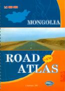 An excellent spiral-bound road atlas. The maps include contour lines and latitude/longitude grid. Also includes larger-scale maps of Ulaanbaatar and Lake Hovsgol. This new edition includes updated mapping, the addition of numerous distance tables plus a fold-out map of Mongolia. 84 pages, 7.5 x 10 inches. In English. See Sample.
OmniMap
An excellent spiral-bound road atlas. The maps include contour lines and latitude/longitude grid. Also includes larger-scale maps of Ulaanbaatar and Lake Hovsgol. This new edition includes updated mapping, the addition of numerous distance tables plus a fold-out map of Mongolia. 84 pages, 7.5 x 10 inches. In English. See Sample.
OmniMap are out of stock and I can't find anywhere that sells it except e-Mongol but they're charging almost £40 including shipping... seems a bit overpriced to me. Even Stanfords don't have it.
Anyone here got a copy they want to sell me for a reasonable price or know where I can get one at a reasonable price? Thanks in advance.
Last edited by stephen.stallebrass; 15 Jan 2012 at 02:42.
|
15 Jan 2012
|
|
Registered Users
Veteran HUBBer
|
|
Join Date: Feb 2011
Location: Tasmania
Posts: 102
|
|
Thanks for this Stephen. I just ordered one!
Callum 
|
15 Jan 2012
|
|
Registered Users
Veteran HUBBer
|
|
Join Date: Aug 2009
Location: Peterborough
Posts: 318
|
|
Quote:
Originally Posted by Landroverholic

Thanks for this Stephen. I just ordered one!
Callum |
If I can't get one any cheaper, looks like I'll have to order one too. 
FYI, the Mongolia Geographic Map, 1:2,000,000 (Gizimap), 65-89902, is also supposed to be quite good and only about £10.
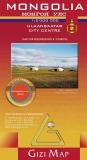 Detailed map of Mongolia. The map shows roads, towns, villages, rivers, etc. The geographic map has shaded relief, hypsometric shading, and spot heights to show elevation. Trilingual English/Russian/Mongolian. See sample
Again, OmniMap have them but they're also widely available from Stanfords and even Amazon.
|
15 Jan 2012
|
|
Contributing Member
Veteran HUBBer
|
|
Join Date: Jun 2008
Location: Seville (E)
Posts: 554
|
|
Download this map: distance tables and petrol stations indicated and it's reasoably ok (bought in Mongolia). Have thought about Reise-Know-How?
(I guess I tend to answer the same, feels like I have a "déjà-vu" :confused1 
Best luck and happy travels,
Esteban
|
15 Jan 2012
|
|
Registered Users
Veteran HUBBer
|
|
Join Date: Aug 2009
Location: Peterborough
Posts: 318
|
|
Quote:
Originally Posted by estebangc
|
Cheers, I have this one already... can't remember where I got it. Probably courtesy of someone round here? I've also found one from Weller (see attachment). But I'm really after the Road Atlas from Gazryn Zurag mentioned in my first post.
|
15 Jan 2012
|
|
Registered Users
Veteran HUBBer
|
|
Join Date: Aug 2008
Posts: 102
|
|
|
We were given this mongolian atlas before we entered the country last summer. It is not bad, but what really proved to be good maps, were the old soviet maps. As roads are not so relevant in Mongolia (depending on your route), the terrain is much more important and this is what you find in those russian maps.
|
15 Jan 2012
|
|
Registered Users
Veteran HUBBer
|
|
Join Date: Aug 2009
Location: Peterborough
Posts: 318
|
|
Quote:
Originally Posted by Chri8
We were given this mongolian atlas before we entered the country last summer. It is not bad, but what really proved to be good maps, were the old soviet maps. As roads are not so relevant in Mongolia (depending on your route), the terrain is much more important and this is what you find in those russian maps.
|
Be nice to see a sample of that... are they readily available?
|
16 Jan 2012
|
|
Registered Users
Veteran HUBBer
|
|
Join Date: Aug 2008
Posts: 102
|
|
|
Hi Stephen,
I've now checked our road atlas, it is the 2011 Gazryn Zurag, but in cyrillic letters. But it seems to have the same errors like the one above (see sample map). We crossed the Zagastayn Davaa (this map shows a perfect track over it) this summer, but it would be impossible on a motorbike or a car. It is only rarely used by horses. You see still sometimes the rest of the old road (perhaps 20 years ago you could cross it - just before Tosontsengel an older man recommended this pass). It was one of our best crossings in Mongolia though, beautiful valley to Arshaant (unfortunatly I have not yet made a trip report for fotos). The sample map has a better drawing, but is pretty the same as our atlas.
BTW the map on the pdf misses the second largest city of Mongolia and the tarmac road (+railway) thereto (Erdenet).
For the russian maps, I think you know where to get them (unfortunately the simplest way to get them downloaded freely closed in december), so the Atlas + those maps are perfect.
Regards
Christian
|
17 Jan 2012
|
|
Registered Users
New on the HUBB
|
|
Join Date: Dec 2011
Location: Mongolia
Posts: 19
|
|
|
That Mongolia road Atlas has too many mistakes. Mongolian drivers don't use it & we use the 1;500000 sheet maps which is unavailable in electronic version at the moment. If you can find decent one made by Russians, that's the best bet, I'd say.
|
20 Jan 2012
|
|
Registered Users
Veteran HUBBer
|
|
Join Date: Mar 2006
Location: Switzerland
Posts: 227
|
|
|
When I was there 5 years ago, they were selling a road atlas in UlanBataar that was available both in Roman and Cyrilic Alphabet. That was perfect for the 2 or 3 proper roads that had been built, but the rest was half outdated, half pure invention.
What you really need is the GPS coordinates of the next city, then you follow the most recent tracks.. that's where the fun starts! and probably one of the last country in the world where you can do this.
Or so it was a few years ago..
|
22 Jan 2012
|
|
Registered Users
HUBB regular
|
|
Join Date: Sep 2010
Location: Dalian
Posts: 67
|
|
I got one by mailorder from mapsohop - great map by reise knowhow - it is a 1:1 600 000 on that 'plastic' type paper- combinastion of road and topo.
|
23 Jan 2012
|
|
Registered Users
HUBB regular
|
|
Join Date: Apr 2011
Location: Yorkshire
Posts: 33
|
|
|
Russian Maps
Quote:
Originally Posted by stephen.stallebrass
Be nice to see a sample of that... are they readily available?
|
Try www.mapstor.com they will, for a small fee sell you a collection for Mongolia. You can also download one at a time for free. You will need a GPS software like OziExplorer to use them. Being Russian the text is in cyrilic, but they are very accurate except for any new roads that have appeared recently.
Stephen
|
23 Jan 2012
|
|
Contributing Member
Veteran HUBBer
|
|
Join Date: Jun 2008
Location: Seville (E)
Posts: 554
|
|
Quote:
Originally Posted by estebangc
Download this map: distance tables and petrol stations indicated and it's reasoably ok (bought in Mongolia).
|
Quote:
Originally Posted by Chri8
BTW the map on the pdf misses the second largest city of Mongolia and the tarmac road (+railway) thereto (Erdenet).
|
BTW, the one I posted has also a missing strech on the southeast, just in case (scanning mistake).
As others said, in Mongolia you'll use your road map to navigate following mountains, rivers, etc and your compass a lot.
|
|
Currently Active Users Viewing This Thread: 1 (0 Registered Users and/or Members and 1 guests)
|
|
|
| Thread Tools |
|
|
| Display Modes |
 Linear Mode Linear Mode
|
 Posting Rules
|
You may not post new threads
You may not post replies
You may not post attachments
You may not edit your posts
HTML code is Off
|
|
|
|

Check the RAW segments; Grant, your HU host is on every month!
Episodes below to listen to while you, err, pretend to do something or other...

2020 Edition of Chris Scott's Adventure Motorcycling Handbook.
"Ultimate global guide for red-blooded bikers planning overseas exploration. Covers choice & preparation of best bike, shipping overseas, baggage design, riding techniques, travel health, visas, documentation, safety and useful addresses." Recommended. (Grant)

Ripcord Rescue Travel Insurance™ combines into a single integrated program the best evacuation and rescue with the premier travel insurance coverages designed for adventurers.
Led by special operations veterans, Stanford Medicine affiliated physicians, paramedics and other travel experts, Ripcord is perfect for adventure seekers, climbers, skiers, sports enthusiasts, hunters, international travelers, humanitarian efforts, expeditions and more.
Ripcord travel protection is now available for ALL nationalities, and travel is covered on motorcycles of all sizes!
What others say about HU...
"This site is the BIBLE for international bike travelers." Greg, Australia
"Thank you! The web site, The travels, The insight, The inspiration, Everything, just thanks." Colin, UK
"My friend and I are planning a trip from Singapore to England... We found (the HU) site invaluable as an aid to planning and have based a lot of our purchases (bikes, riding gear, etc.) on what we have learned from this site." Phil, Australia
"I for one always had an adventurous spirit, but you and Susan lit the fire for my trip and I'll be forever grateful for what you two do to inspire others to just do it." Brent, USA
"Your website is a mecca of valuable information and the (video) series is informative, entertaining, and inspiring!" Jennifer, Canada
"Your worldwide organisation and events are the Go To places to for all serious touring and aspiring touring bikers." Trevor, South Africa
"This is the answer to all my questions." Haydn, Australia
"Keep going the excellent work you are doing for Horizons Unlimited - I love it!" Thomas, Germany
Lots more comments here!

Diaries of a compulsive traveller
by Graham Field
Book, eBook, Audiobook
"A compelling, honest, inspiring and entertaining writing style with a built-in feel-good factor" Get them NOW from the authors' website and Amazon.com, Amazon.ca, Amazon.co.uk.
Back Road Map Books and Backroad GPS Maps for all of Canada - a must have!
New to Horizons Unlimited?
New to motorcycle travelling? New to the HU site? Confused? Too many options? It's really very simple - just 4 easy steps!
Horizons Unlimited was founded in 1997 by Grant and Susan Johnson following their journey around the world on a BMW R80G/S.
 Read more about Grant & Susan's story
Membership - help keep us going!
Horizons Unlimited is not a big multi-national company, just two people who love motorcycle travel and have grown what started as a hobby in 1997 into a full time job (usually 8-10 hours per day and 7 days a week) and a labour of love. To keep it going and a roof over our heads, we run events all over the world with the help of volunteers; we sell inspirational and informative DVDs; we have a few selected advertisers; and we make a small amount from memberships.
You don't have to be a Member to come to an HU meeting, access the website, or ask questions on the HUBB. What you get for your membership contribution is our sincere gratitude, good karma and knowing that you're helping to keep the motorcycle travel dream alive. Contributing Members and Gold Members do get additional features on the HUBB. Here's a list of all the Member benefits on the HUBB.
|
|
|


