 |

31 Oct 2011
|
|
Registered Users
Veteran HUBBer
|
|
Join Date: Jun 2008
Location: Perth, Australia
Posts: 102
|
|
|
Which GPS for 4WD
Right,
so, for a trip like we all do, in a 4WD, which GPS would you select ? Seems like Garmin is on top of everyone's list, but then, would you pick mounted or handheld or both ? Are maps easily available for all these remote places like East Russia or Mongolia ? I read Zumo, Montana, etc they all look pretty much the same to me.
Is it worth having one at all or "paper-maps" and a compass, old school style, is just as good in a remote area ?
And last question, do they work in -50celcius condition ? (i.e Northern Siberia etc).
Tx for any advice you can throw at me,
Boags.
|
31 Oct 2011
|
 |
Contributing Member
Veteran HUBBer
|
|
Join Date: Mar 2004
Location: Saltspring Island,Canada/Poole,UK
Posts: 1,081
|
|
|
I wouldnt put my eggs in one basket - use a combination of paper maps with a GPS and mount a good quality auto/marine compass (compensated) on the dash of your vehicle - saves having to get out to shoot accurate bearing with a hand held compass when its bloody freezing - carry a handheld compass too as a back up.
You will probably end up relying on local knowledge more than you think, though everything locals say has to be taken with a pinch of salt - use it to back up what you think is a correct route, not as always accurate.
I prefer using a handheld GPS in an auto mount - the Garmin 60CSX/62 or the new Montana are flexible units.
GPS do work in the cold, if its on the dash it should be warm enough- if you are operating it handheld, keep the unit warm under clothing next to skin and use a remote antenna velcroed onto your pack for a reliable signal.
|
31 Oct 2011
|
|
Banned
Veteran HUBBer
|
|
Join Date: Dec 2009
Posts: 973
|
|
|
Hi,
Im just selling my Garmin GPS. Its actualy for cars but i used it on my bike. Its got all the maps of africa but i can put on the russian and mongolia maps for you. 100 Euro + Shiping. PM if interesdet...
LG, Tobi
|
1 Nov 2011
|
 |
-
Veteran HUBBer
|
|
Join Date: Apr 2006
Location: WWW
Posts: 2,341
|
|
Quote:
Originally Posted by Boags

I read Zumo, Montana, etc they all look pretty much the same to me.
Is it worth having one at all or "paper-maps" and a compass, old school style, is just as good in a remote area ?
And last question, do they work in -50celcius condition ? (i.e Northern Siberia etc).
|
"They all look pretty much the same to me...."
I would recommend you either read up or speak to Garmin and take the time to learn how to use one. In the EU with proper mapping software, it's not a problem to switch on and find a post code but navigation is a skill that takes time to learn and practice. Ask any rescue team ! then ask how many they have rescued from being lost who carried all 'the toys' but had no idea on how to use them. 
Paper maps and compass (and the knowledge on how to read and use them) are wise to have and, IMHO, would be a must have if going to remote areasfor your own safety.
- All electronic devices will fail the colder it becomes
- You must use Lithium batteries (alkaline fail fast in cold) and power the unit from vehicle too
For example- The Montana- a pretty rugged unit - Battery charging only takes pace between 0 degrees C to 45 degrees C.
- It is designed to work from -15 degrees C to +70 degrees Celcius
If you are going into serious cold, you will need to take appropriate measures to keep your unit within those operating temperatures.
Old but still good tip
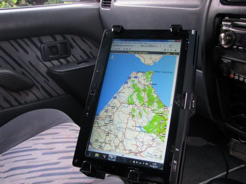
If you have a notebook that has XP as its op system (does not work on windows 7)
Load up Nroute (discontinued which is a shame) from Garmin
Plug in GPS in your USB port and there you have your moving map on your notebook screen just like the gps screen -easier on the eyes.
Last edited by Bertrand; 1 Nov 2011 at 14:56.
|
1 Nov 2011
|
|
Registered Users
Veteran HUBBer
|
|
Join Date: Aug 2008
Location: Dorset, UK
Posts: 339
|
|
Quote:
Originally Posted by Bertrand
If you have a notebook that has XP as its op system (does not work on windows 7)
Load up Nroute (discontinued which is a shame) from Garmin
Plug in GPS in your USB port and there you have your moving map on your notebook screen just like the gps screen -easier on the eyes.
|
That's what I use, I cannot fault nRoute it's very versatile.
|
|
Currently Active Users Viewing This Thread: 1 (0 Registered Users and/or Members and 1 guests)
|
|
|
 Posting Rules
|
You may not post new threads
You may not post replies
You may not post attachments
You may not edit your posts
HTML code is Off
|
|
|
 Similar Threads
|
| Thread |
Thread Starter |
Forum |
Replies |
Last Post |
|
GPS camera
|
mcgiggle |
Photo Forum |
2 |
10 Jan 2012 08:21 |
|

Check the RAW segments; Grant, your HU host is on every month!
Episodes below to listen to while you, err, pretend to do something or other...

2020 Edition of Chris Scott's Adventure Motorcycling Handbook.
"Ultimate global guide for red-blooded bikers planning overseas exploration. Covers choice & preparation of best bike, shipping overseas, baggage design, riding techniques, travel health, visas, documentation, safety and useful addresses." Recommended. (Grant)

Ripcord Rescue Travel Insurance™ combines into a single integrated program the best evacuation and rescue with the premier travel insurance coverages designed for adventurers.
Led by special operations veterans, Stanford Medicine affiliated physicians, paramedics and other travel experts, Ripcord is perfect for adventure seekers, climbers, skiers, sports enthusiasts, hunters, international travelers, humanitarian efforts, expeditions and more.
Ripcord travel protection is now available for ALL nationalities, and travel is covered on motorcycles of all sizes!
What others say about HU...
"This site is the BIBLE for international bike travelers." Greg, Australia
"Thank you! The web site, The travels, The insight, The inspiration, Everything, just thanks." Colin, UK
"My friend and I are planning a trip from Singapore to England... We found (the HU) site invaluable as an aid to planning and have based a lot of our purchases (bikes, riding gear, etc.) on what we have learned from this site." Phil, Australia
"I for one always had an adventurous spirit, but you and Susan lit the fire for my trip and I'll be forever grateful for what you two do to inspire others to just do it." Brent, USA
"Your website is a mecca of valuable information and the (video) series is informative, entertaining, and inspiring!" Jennifer, Canada
"Your worldwide organisation and events are the Go To places to for all serious touring and aspiring touring bikers." Trevor, South Africa
"This is the answer to all my questions." Haydn, Australia
"Keep going the excellent work you are doing for Horizons Unlimited - I love it!" Thomas, Germany
Lots more comments here!

Diaries of a compulsive traveller
by Graham Field
Book, eBook, Audiobook
"A compelling, honest, inspiring and entertaining writing style with a built-in feel-good factor" Get them NOW from the authors' website and Amazon.com, Amazon.ca, Amazon.co.uk.
Back Road Map Books and Backroad GPS Maps for all of Canada - a must have!
New to Horizons Unlimited?
New to motorcycle travelling? New to the HU site? Confused? Too many options? It's really very simple - just 4 easy steps!
Horizons Unlimited was founded in 1997 by Grant and Susan Johnson following their journey around the world on a BMW R80G/S.
 Read more about Grant & Susan's story
Membership - help keep us going!
Horizons Unlimited is not a big multi-national company, just two people who love motorcycle travel and have grown what started as a hobby in 1997 into a full time job (usually 8-10 hours per day and 7 days a week) and a labour of love. To keep it going and a roof over our heads, we run events all over the world with the help of volunteers; we sell inspirational and informative DVDs; we have a few selected advertisers; and we make a small amount from memberships.
You don't have to be a Member to come to an HU meeting, access the website, or ask questions on the HUBB. What you get for your membership contribution is our sincere gratitude, good karma and knowing that you're helping to keep the motorcycle travel dream alive. Contributing Members and Gold Members do get additional features on the HUBB. Here's a list of all the Member benefits on the HUBB.
|
|
|


 Linear Mode


