 35Likes 35Likes
 |
|

11 Jan 2013
|
|
Registered Users
Veteran HUBBer
|
|
Join Date: Mar 2007
Location: UK
Posts: 4,343
|
|
Quote:
Originally Posted by croissant_warrior

I did the job again from my Linux machine at home, had a lot more luck.
My first attempt was to select an entire country from the pull down. There was no filed for an email, rather just a link to obtain immediately...I am assuming these are pre-built, as the link pointed to a readily available IMG file.
Second attempt, I chose Australia and manually added some NZ sections. This time there was an email address filed, which I filled and requested the build. One different fromt he previous attempts is that the builds took a lot longer to obtain...about 15-20 minutes, rahter than the immediate responses I would get previously.
So all is well as far as download. Now I have to test reliability.
Anyone knows if these maps contain POIs?
|
This does not surprise me at all.
Here's my take on what is happening with OSM downloads:-
1. The OP describes how to obtain a bespoke, made-to-measure suit; this takes time to measure up, sort out the customers exact requirements and make the end product (in this analogy, the suit).
By email, you get confirmation that your suit is ready to be collected.
2. The method I mention in my recent posts is how to get an off-the-peg "high street" suit; it is available immediately, of course sir!
__________________
Dave
|
14 Jan 2013
|
|
Contributing Member
HUBB regular
|
|
Join Date: Aug 2010
Location: Dublin
Posts: 36
|
|
|
Searchable Addresses
I have used OSM maps when travelling in Russia and now in New Zealand with my Zumo 550 and have been very pleased with the quality of the maps with the exception of the fact that anything but the major road names are not searchable. I find this very strange in that nearly every street is named on the map and read in the audible directions.
This means I have had to enter my destination as a coordinate or make a waypoint in Basecamp and download it.
Am I missing some fundamental setting change or is it something you have to live with OSM maps on a Garmin
|
14 Jan 2013
|
|
Registered Users
Veteran HUBBer
|
|
Join Date: Jan 2008
Location: St Louis, MO
Posts: 124
|
|
Quote:
Originally Posted by EyeCake
.....the exception of the fact that anything but the major road names are not searchable. .....Am I missing some fundamental setting change.....
|
No.
I haven't had much luck searching for anything either. Keep it mind, you get what you pay for.
daryl
|
1 Feb 2013
|
|
Contributing Member
Veteran HUBBer
|
|
Join Date: May 2010
Location: Bristol, UK
Posts: 336
|
|
|
Address Navigation
From the start of our trip it will be handy to have address based navigation. Is OSM good for this or is it worth spending the money for the City navigator. £75 seems alot for only 3 weeks worth of traveling??
|
25 Mar 2013
|
|
Registered Users
Veteran HUBBer
|
|
Join Date: Sep 2007
Location: Kamloops, BC Canada
Posts: 109
|
|
|
Re: Searchable Addresses
I've been a pretty steady mapper and contributor to OSM for the past 3 or 4 years and have been lurking for almost as long on the developer's mailing list for MkGMap - the program that is used to convert OSM data to the img file used on Garmin GPS's. It's clear that the MkGMap project has an extremely active and impresssive group of developers who must never sleep! This is definitely not a dead project! I've never contributed on that side of the project as my programming skills are not up to it and admittedly much of the discussion is way over my head, but it's an interesting list to follow.
It's clear that address searchability has been a major topic of discussion and the focus of considerable work. From what I have been reading in my mailbox over the past year or so, it seems that the nut has been cracked. My understanding is that the issue seems now to be in the limitations of the OSM data.
Although there are tools in the JOSM mapping software for adding specific adresses to locations or for specifying a range of addresses along a road, mappers rarely use them... mostly because the values just aren't known to them. So if it is not in the OSM data, it's not going to show up on the GPS. Since data tags such as country, state, and city are generally not added to each point, MkGMap does try to fill in those data by comparing the location of each POI, line and polygon to a pre-compiled file of all the world's administrative boundaries. Unfortunately, that boundary information is often incomplete and/or inconsistently applied from one country to another. When all else fails, MkGMap does make a stab at assigning the object to the closest administrative center as best it can. For example, if a road lies outside a city boundary, but close to a small, mapped town, it would probably be found by specifying not the city in the search, but the town.
I've used the OSM-derived maps for a few years all over Europe, NA and now Australia. I think the search feature is definitely getting better... or I'm getting better at using it. I find that the trick when searching for streets or roads is to not get too hung up on what city they're in... If the street is clearly in a big city, then fine. If it's outside a little or you're not exactly sure where it is, just don't specify a city in the search at all. Skip entering the city and use "Search All". Also, the OSM standard is to spell out the whole name in the data. So, look for North River Road, not N River Rd.
Anyway, it's a great project. Best way to give back is to get involved and map your own area.
Sam Longiaru
Kamloops, BC
Now bikeless in Australia 
|
25 Mar 2013
|
|
Super Moderator
Veteran HUBBer
|
|
Join Date: Apr 2000
Location: Gunma, Japan
Posts: 1,104
|
|
|
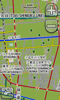
Sam, you seem to be "in the loop" with MkGMap. Can you tell me when/if they will ever fix the problem for Japan where place names are all transliterated into Latin characters with CHINESE readings. While many of the characters are the same, the readings are completely different. For example, what should be "Keihin-Kyuko" becomes "Jingbangjixingxian" (or something like that). I pointed it out years ago, but nobody seemed to be interested in fixing it...
|
25 Mar 2013
|
|
Registered Users
HUBB regular
|
|
Join Date: Jul 2012
Location: Robertson, NSW
Posts: 63
|
|
|
Technologically disabled cry for help!
Howdy all,
Big ask but would anyone in London, or southern Germany have a whole bunch of maps already to go on to an SD card and thus into my Garmin. I tried and tried to do as colebatch instructed, i have OSM, i have Mapsource, I have Basecamp...... i dont have much time left! im flying to Europe (from Sydney) in 10 hours and i have an emply Garmin.
Im heading to Rome via Stuttgart, maybe Munich, if anyone in that area could even just show me what i'm doing wrong it would be awesome..
Thank you
Tom
|
25 Mar 2013
|
|
Registered Users
Veteran HUBBer
|
|
Join Date: Mar 2007
Location: UK
Posts: 4,343
|
|
Quote:
Originally Posted by Tom Bon 865
Howdy all,
Big ask but would anyone in London, or southern Germany have a whole bunch of maps already to go on to an SD card and thus into my Garmin. I tried and tried to do as colebatch instructed, i have OSM, i have Mapsource, I have Basecamp...... i dont have much time left! im flying to Europe (from Sydney) in 10 hours and i have an emply Garmin.
Im heading to Rome via Stuttgart, maybe Munich, if anyone in that area could even just show me what i'm doing wrong it would be awesome..
Thank you
Tom
|
If you are really desperate then see my earlier post, number 52, for an alternative approach that has worked OK for me - it delivers a single country map "in real time" i.e. with no delay while waiting for an email confirmation.
__________________
Dave
|
25 Mar 2013
|
|
Registered Users
Veteran HUBBer
|
|
Join Date: Sep 2007
Location: Kamloops, BC Canada
Posts: 109
|
|
|
OSM and Japanese characters
Quote:
|
Sam, you seem to be "in the loop" with MkGMap. Can you tell me when/if they will ever fix the problem for Japan where place names are all transliterated into Latin characters with CHINESE readings. While many of the characters are the same, the readings are completely different. For example, what should be "Keihin-Kyuko" becomes "Jingbangjixingxian" (or something like that). I pointed it out years ago, but nobody seemed to be interested in fixing it...
|
Hi Chris...
It's not really a thread I've been following, but I did find this on the MkGMap wiki and it does seem to parallel my vague recollection of the discussion regarding Cyrillic characters that I was following for a while.
When MkGMap is executed, you may specify numerous options within the command line. One of those options specifies which code page (character set) the program should use when generating the img file. From what I see, code page 932 (Japanese characters) is now supported. It also appears, however, that the Garmin device must have the font installed. The wiki above does have a good link and intructions as to how to install the fonts on an older Nuvi. I'd check out the Garmin site to see if your model supports the character set natively or just what you have to do to get the Japanese character set to display.
The rub is to have an img file created using the --code-page=932 option set. I'd guess that most of the pre-made ones (like those on Lambertus' excellent site) are set to the default Latin. Although, it might just be worth a quick note to him to see if he would be willing to offer the option for Japan...
It is possible to generate your own img file using OSM data and MkGMap with whatever options you want, but it is not a quick and easy job or for those who are hardware-challenged. The data set for the entire planet now runs about 20G, although sub-sets are available. And it does take a machine with lots of memory. I've done it successfully for maps of BC, (but just barely) using a Linux machine (the way to go for this) with only 4G of memory. It took a few hours to generate the img file. Downloading from Lambertus is so much easier!
Anyway, I'm no real expert on this. Just an interested bystander. I think I'd take the easy route first by contacting Lambertus and asking about him offering the option of Japan with a 932 codepage and if that doesn't work, maybe ask the MkGMap folks if there are any problems to watch out for when generating your own. Then, if all is OK... maybe give that a try.
Last edited by Sam I Am; 26 Mar 2013 at 07:38.
|
26 Mar 2013
|
|
Super Moderator
Veteran HUBBer
|
|
Join Date: Apr 2000
Location: Gunma, Japan
Posts: 1,104
|
|
Quote:
Originally Posted by Sam I Am
Hi Chris...
The rub is to have an img file created using the --code-page=932 option set. I'd guess that most of the pre-made ones (like those on Lambertus' excellent site) are set to the default Latin. Although, it might just be worth a quick note to him to see if he would be willing to offer the option for Japan...
|
Thanks for the feedback Sam.
I will try to see if Lambertus would be willing to tweak his software to do something about Japan. Most of Garmin's devices not specifically for the Japanese market don't seem to handle the language by default, and travelers naturally don't want to mess with the firmware on the road. I don't use a Garmin myself, but it would be great for visitors to Japan to have something useful. Even something that just removes the non-Latin characters would be better than Chinese reading of Japanese words clogging up the screen. This is especially true as much of the info in OSM for Japan is bilingual.
Garmin is quite behind the times in language support it seems. My iPhone handles input as well as display of dozens of languages....
|
22 Apr 2013
|
|
Registered Users
Veteran HUBBer
|
|
Join Date: Dec 2012
Location: NSW Australia - but never there
Posts: 1,235
|
|
Hope you don't mind if I resurrect this thread for some advice that I feel I've already had 27 times in 54 different forms but to no avail..
At this stage I just want to view maps on a laptop.
I have MapSource installed on the computer - in a directory called Mapsource - naturally.
Clicking on Map Source application opens a map screen ready to go.
Then if I go to Free worldwide Garmin maps from OpenStreetMap and request a map - say of iceland and download it immediately, I get a choice of
[DIR] Parent Directory -
[TXT] tiles.txt
[ ] osm_generic_windows.exe 20-Apr-2013 14:56 15M Map
[ ] osm_generic_tiles.zip 20-Apr-2013 14:56 14M
[ ] osm_generic_macosx.zip 20-Apr-2013 14:56 14M
[ ] osm_generic_gmapsupp.zip 20-Apr-2013 14:56 14M
[TXT] country.txt 20-Apr-2013 14:56 19
[TXT] 63240000_license.txt 20-Apr-2013 14:56 379
[ ] 63240000.nsi
Now I understand that if I had a Garmin I could just drag [ ] osm_generic_gmapsupp.zip onto a sd card - maybe into a folder called Garmin and I would be away.
However as I want to run this on my laptop for now, I believe I have to download osm_generic_windows.exe
But - BUT - this is where I come unstuck.
What on earth do I do with this - meaning where do I install it. Do I install it in the Map Source Folder, in its own folder or where. I know it installs several files, mostly image files but ????
Then, how do I open the map on mapsource.
BTW - I know I can only open one such map at a time, but iceland iss the next trip so it will do for a test. Later I will swap to bottom half of S America which is what I really need.
Phil has made his files available for download but not having any luck with those either.
|
22 Apr 2013
|
|
Registered Users
HUBB regular
|
|
Join Date: Feb 2012
Location: Midlands, England.
Posts: 87
|
|
|
I've just has a quick play myself Tony.
I closed Basecamp to start off with.
I downloaded the OSM Windows file like you, ran it and during the install it already had "C:\Garmin\Maps\OSM generic routable" as the destination.
I then opened up Basecamp and along the top toolbar where all the icons are, there's a text dropdown box, I clicked this and there's an "OSM generic routable" option. This was the map I had just downloaded and it displayed fine.
Hope that helps. Dan
|
22 Apr 2013
|
|
Registered Users
Veteran HUBBer
|
|
Join Date: Dec 2012
Location: NSW Australia - but never there
Posts: 1,235
|
|
|
Bloody amazing - after lots of messing around last night I must have done the right thing and there is was, just as you described.
My problem stemmed from first getting on the OSM site and following some of their suggestions as to a map viewer, and where to get the maps Just ended up annoyed at broken links, obsolete software and stuff written by "experts' for "experts' that just never worked the way I thought it should.
Found this post through an internet search and it seemed to be written in a way that made sense, but something was still missing.
Just one little extra point - I have ended up with two maps available, the generic one you mentioned, plus one that Phil provided - both of Bolivia - which seems to contradict the advice that only one map can be referenced at a time.
Oh, the other problem that was giving me problems was I don't have a Garmin so was cheating a bit with how I got the Map Source to run, but then it still needed a base map to hang proper maps on so that slowed me up a bit too.
Thanks for the thread.
|
26 Apr 2013
|
|
Registered Users
Veteran HUBBer
|
|
Join Date: Feb 2009
Location: Bristol UK
Posts: 454
|
|
|
Is anyone having trouble loading these onto Mapsource recently?
It use to work fine. I had some downloaded before we left the UK.
now it downloads, the files are on my computer, but is not in the drop down box when you open MS. Seems someone changed something somewhere and it now wont show.
Luckily I still have it on my GPS60CX so I can get around but it would be nice to scroll through OSM in the evening on the laptop so what is what.
G
|
15 Sep 2013
|
|
Gold Member
Veteran HUBBer
|
|
Join Date: Sep 2013
Location: Bermuda
Posts: 163
|
|
|
Best Equipment For Viewing Open Source Mapping?
I'm interested in hearing opinions on what is the best/easiest option, equipment wise, for utilising OSM. I'm completely new to using anything other than Garmin mapping, so please forgive the basic questions. I'm still trying to wrap my head around the OSM option.
I do have the Garmin Mapsource World map on CD that I've been using for trip planning on my computer - using Garmin RoadTrip. I understand that I could save the route and waypoints that I have created onto an SD card for use in the Nuvi, but the detail on the World map is quite sparse.
I'll be travelling in a Land Rover Defender to Russia, Mongolia and the Stans. I have a Garmin Nuvi with 45 European countries loaded, so I am covered until I exit Ukraine into Russia. I'm looking at OSM for the areas not covered by the Garmin Nuvi mapping.
Having read this thread, it seems that installing OSM onto devices can be problematic. Before I move down the road of downloading OSM, I'd like to determine which equipment option would be the most suitable.
As I understand it, I could download map files and install them onto an SD card for use in a Garmin Nuvi (I have a second Nuvi that could be dedicated to use with the SD card). I could also purchase a hand-held Garmin such as the Oregon or Montana and load the maps directly to that (I think). Is either of these options easier or preferable?
I will also have an iPad and probably a Macbook Air laptop in the vehicle. Am I correct in thinking that OSM can be loaded onto the Macbook and somehow linked with the Nuvi (bluetooth?)? Are there any advantages/disadvantages to this option - other than having a significantly larger display screen?
I'd appreciate any advice on the best way to proceed regarding equipment. Then I'll try to follow the instructions in this thread for actually downloading and installing the maps.
__________________
2014 overland adventure to Russia and Central Asia in Land Rover Defender www.bermudarover.com
|
|
Currently Active Users Viewing This Thread: 2 (0 Registered Users and/or Members and 2 guests)
|
|
|
 Posting Rules
|
You may not post new threads
You may not post replies
You may not post attachments
You may not edit your posts
HTML code is Off
|
|
|
|

Check the RAW segments; Grant, your HU host is on every month!
Episodes below to listen to while you, err, pretend to do something or other...

2020 Edition of Chris Scott's Adventure Motorcycling Handbook.
"Ultimate global guide for red-blooded bikers planning overseas exploration. Covers choice & preparation of best bike, shipping overseas, baggage design, riding techniques, travel health, visas, documentation, safety and useful addresses." Recommended. (Grant)

Ripcord Rescue Travel Insurance™ combines into a single integrated program the best evacuation and rescue with the premier travel insurance coverages designed for adventurers.
Led by special operations veterans, Stanford Medicine affiliated physicians, paramedics and other travel experts, Ripcord is perfect for adventure seekers, climbers, skiers, sports enthusiasts, hunters, international travelers, humanitarian efforts, expeditions and more.
Ripcord travel protection is now available for ALL nationalities, and travel is covered on motorcycles of all sizes!
What others say about HU...
"This site is the BIBLE for international bike travelers." Greg, Australia
"Thank you! The web site, The travels, The insight, The inspiration, Everything, just thanks." Colin, UK
"My friend and I are planning a trip from Singapore to England... We found (the HU) site invaluable as an aid to planning and have based a lot of our purchases (bikes, riding gear, etc.) on what we have learned from this site." Phil, Australia
"I for one always had an adventurous spirit, but you and Susan lit the fire for my trip and I'll be forever grateful for what you two do to inspire others to just do it." Brent, USA
"Your website is a mecca of valuable information and the (video) series is informative, entertaining, and inspiring!" Jennifer, Canada
"Your worldwide organisation and events are the Go To places to for all serious touring and aspiring touring bikers." Trevor, South Africa
"This is the answer to all my questions." Haydn, Australia
"Keep going the excellent work you are doing for Horizons Unlimited - I love it!" Thomas, Germany
Lots more comments here!

Diaries of a compulsive traveller
by Graham Field
Book, eBook, Audiobook
"A compelling, honest, inspiring and entertaining writing style with a built-in feel-good factor" Get them NOW from the authors' website and Amazon.com, Amazon.ca, Amazon.co.uk.
Back Road Map Books and Backroad GPS Maps for all of Canada - a must have!
New to Horizons Unlimited?
New to motorcycle travelling? New to the HU site? Confused? Too many options? It's really very simple - just 4 easy steps!
Horizons Unlimited was founded in 1997 by Grant and Susan Johnson following their journey around the world on a BMW R80G/S.
 Read more about Grant & Susan's story
Membership - help keep us going!
Horizons Unlimited is not a big multi-national company, just two people who love motorcycle travel and have grown what started as a hobby in 1997 into a full time job (usually 8-10 hours per day and 7 days a week) and a labour of love. To keep it going and a roof over our heads, we run events all over the world with the help of volunteers; we sell inspirational and informative DVDs; we have a few selected advertisers; and we make a small amount from memberships.
You don't have to be a Member to come to an HU meeting, access the website, or ask questions on the HUBB. What you get for your membership contribution is our sincere gratitude, good karma and knowing that you're helping to keep the motorcycle travel dream alive. Contributing Members and Gold Members do get additional features on the HUBB. Here's a list of all the Member benefits on the HUBB.
|
|
|


 Linear Mode


