 |

7 Apr 2012
|
 |
Registered Users
Veteran HUBBer
|
|
Join Date: Aug 2010
Location: Middle England, UK
Posts: 457
|
|
|
Co-ordinates???
Rather basic question, so sorry in advance:
I use a Garmin 550, if that has any baring on the situation?
I've hypothetically found a point of interest in goolge maps; what's the best way to get accurate GPS co-ordinates so that I can use them when plotting a future destination?
I tried doing this in the past, with limited success. Maybe I'm just a luddite!
Thanks in advance 
|
7 Apr 2012
|
|
Gold Member
Veteran HUBBer
|
|
Join Date: Jul 2008
Location: London
Posts: 404
|
|
Example for Box Hill.
Find it on GoogleEarth:
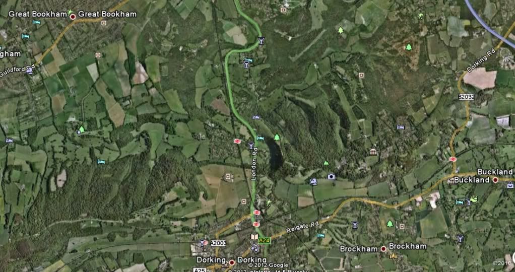
Zoom in enough to see the car park and put the cursor (usually a hand) on the car park entrance.
Read co-ordinates at the bottom of the screen:
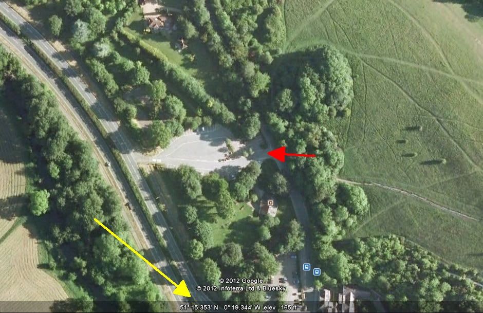
51 deg 15.353' N 0 deg 19.344' W
If you need a different format for the co-ordinates, select it here:
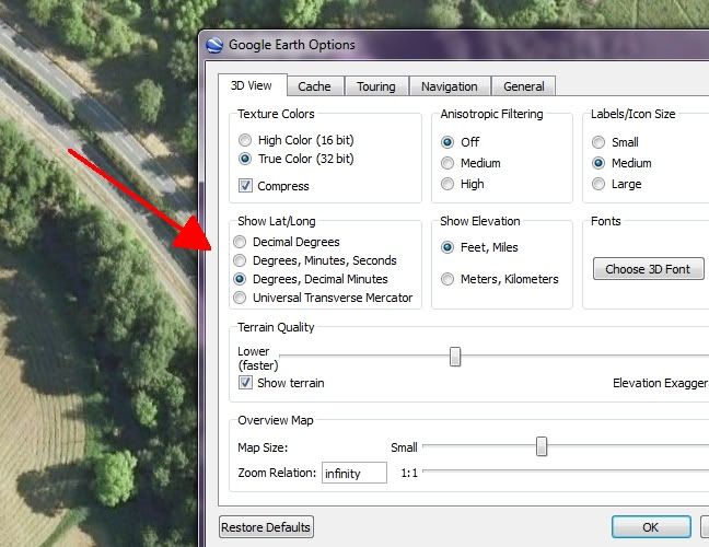
(Tools - Options from the main toolbar to get to this menu)
That should do you. 
Quote:
Originally Posted by Endurodude

Maybe I'm just a luddite!
|
If you have a Garmin 550 you're definitely not a Luddite. I'm still using my 15-year old Garmin GPSII.
(So I know how to load it with googleEarth co-ordinates, it's the only way to put a route on it!) 
Cheers
|
8 Apr 2012
|
|
Registered Users
Veteran HUBBer
|
|
Join Date: Aug 2010
Location: Middle England, UK
Posts: 457
|
|
Looks like a winner - thanks for that!
|
|
Currently Active Users Viewing This Thread: 1 (0 Registered Users and/or Members and 1 guests)
|
|
|
 Posting Rules
|
You may not post new threads
You may not post replies
You may not post attachments
You may not edit your posts
HTML code is Off
|
|
|
|

Check the RAW segments; Grant, your HU host is on every month!
Episodes below to listen to while you, err, pretend to do something or other...

2020 Edition of Chris Scott's Adventure Motorcycling Handbook.
"Ultimate global guide for red-blooded bikers planning overseas exploration. Covers choice & preparation of best bike, shipping overseas, baggage design, riding techniques, travel health, visas, documentation, safety and useful addresses." Recommended. (Grant)

Ripcord Rescue Travel Insurance™ combines into a single integrated program the best evacuation and rescue with the premier travel insurance coverages designed for adventurers.
Led by special operations veterans, Stanford Medicine affiliated physicians, paramedics and other travel experts, Ripcord is perfect for adventure seekers, climbers, skiers, sports enthusiasts, hunters, international travelers, humanitarian efforts, expeditions and more.
Ripcord travel protection is now available for ALL nationalities, and travel is covered on motorcycles of all sizes!
What others say about HU...
"This site is the BIBLE for international bike travelers." Greg, Australia
"Thank you! The web site, The travels, The insight, The inspiration, Everything, just thanks." Colin, UK
"My friend and I are planning a trip from Singapore to England... We found (the HU) site invaluable as an aid to planning and have based a lot of our purchases (bikes, riding gear, etc.) on what we have learned from this site." Phil, Australia
"I for one always had an adventurous spirit, but you and Susan lit the fire for my trip and I'll be forever grateful for what you two do to inspire others to just do it." Brent, USA
"Your website is a mecca of valuable information and the (video) series is informative, entertaining, and inspiring!" Jennifer, Canada
"Your worldwide organisation and events are the Go To places to for all serious touring and aspiring touring bikers." Trevor, South Africa
"This is the answer to all my questions." Haydn, Australia
"Keep going the excellent work you are doing for Horizons Unlimited - I love it!" Thomas, Germany
Lots more comments here!

Diaries of a compulsive traveller
by Graham Field
Book, eBook, Audiobook
"A compelling, honest, inspiring and entertaining writing style with a built-in feel-good factor" Get them NOW from the authors' website and Amazon.com, Amazon.ca, Amazon.co.uk.
Back Road Map Books and Backroad GPS Maps for all of Canada - a must have!
New to Horizons Unlimited?
New to motorcycle travelling? New to the HU site? Confused? Too many options? It's really very simple - just 4 easy steps!
Horizons Unlimited was founded in 1997 by Grant and Susan Johnson following their journey around the world on a BMW R80G/S.
 Read more about Grant & Susan's story
Membership - help keep us going!
Horizons Unlimited is not a big multi-national company, just two people who love motorcycle travel and have grown what started as a hobby in 1997 into a full time job (usually 8-10 hours per day and 7 days a week) and a labour of love. To keep it going and a roof over our heads, we run events all over the world with the help of volunteers; we sell inspirational and informative DVDs; we have a few selected advertisers; and we make a small amount from memberships.
You don't have to be a Member to come to an HU meeting, access the website, or ask questions on the HUBB. What you get for your membership contribution is our sincere gratitude, good karma and knowing that you're helping to keep the motorcycle travel dream alive. Contributing Members and Gold Members do get additional features on the HUBB. Here's a list of all the Member benefits on the HUBB.
|
|
|


 Linear Mode


