Quote:
Originally Posted by dlh62c

Yes you can, but make sure its into the 'Garmin' directory. You're need to rename the OSM gmapsupp.img file you unzipped to UK.img otherwise you will overwrite the gmapsupp.img file that's already there. Older Garmin units won't allow you to rename the file.
On the microSD card I have a directory called 'My OSM Maps' and that's where I park them. I can drag and drop them into the 'Garmin' directory on the microSD card when I need them.
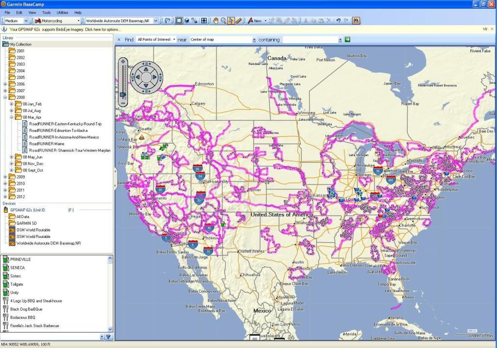
There's nothing wrong with having the gps connected to a pc when you do your route planning. I do it all the time. I use a Garmin 62s. It has a 8g microSD installed. This is where I keep my OSM maps and my gps project files. I'm using the gps as a mass storage device. I'm running BC on two desktops and a netbook, this allows me to move between any computer any anytime and work on any gps project using BC's Backup/Restore function.
I use the microSD card to store manuals, photos and other documents as well.
OSM Map On Garmin/Download - OpenStreetMap Wiki
daryl |
Hi Daryl,
Can I pick your brains again?
I've uploaded two or three OSM maps now and it is abit of a pain that they're all called 'OSM World Routable'
How can I change them so the device displays an easier to distinguish name? I downloaded JaVaWa which works if using an .exe file but not if downloading an .img [and I obviously can't get the .exe to work anyway as discussed].
I've read the wiki-link; but if I'm honest it's a bit over my head.
Any suggestions?
What if I have an existing gmapsupp.img file?
Some Garmin devices/applications support more than one img file. Try naming your openstreetmap img gmapsup2.img or gmapprom.img.
When tested on an Oregon 200 (firmware 3.42) and GPSMAP 62S (firmware 2.80), eTrex 20 (firmware 2.30), it will load any .img files in the Garmin directory. The nüvi 1xxx and 3xxx series will load any .img file in the Map directory. You don't need one named gmapsupp.img at all. (in fact, if you don't want the device to see a map for testing purposes, you need to move the file out of the Garmin directory or rename it so it won't end with .img)
When multiple ".img" files are installed, it is difficult to differentiate them in the on-device menu when they all have the default "OSM Street Map" name set in the ".img" file header, but it is relatively simple to change the on-device name:
Open the ".img" file in an editor that can handle binary data.
Edit bytes 0x49-0x5C to assign a new name using ASCII printable characters.
Pad unused characters at the end of the name with spaces.
In some map files, 0x5D is a space character, but it is not part of the name field.
Additional map descriptive text may be placed in characters 0x65-0x82.
Unused characters at the end of the field are padded out with spaces.
The descriptive text may not appear in the list of maps on-device. For example, on the eTrex 20, the descriptive text only shows up when the map name is selected.
Some devices may not display the entire descriptive text field. For example, the eTrex 20 seems to display only characters 0x65-0x73.
On some devices, when both name and description fields are populated, a space is either needed at the end of the name field, or at the beginning of the description field. For example, the eTrex 20 needs a space at either 0x5C or at 0x65 to be sure the two fields are separated by a space on some screens. Lack of a space in one of these locations can cause the name to truncate due to line-wrap issues.
Character 0x83 is also technically part of the description text, but a null character (0x00) is always required at this position.
Save the edited ".img" file.


 1Likes


 Linear Mode


