![]()
FAQ
Your questions answered!
TRAIL RATINGS
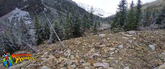
Trail difficulty depends a lot on motorcycle model/type and experience - plus personal preferences. For the HUMM, we try to make an event that is fun and yet challenging for all levels of rider. It takes place primarily on unpaved roads and trails. The challenge can be in the planning, the tag-collecting or the technical level of the trails; by no means do we expect people to push themselves beyond their ability. You should always make your own best judgement as to your skill level and the difficulty of the routes you choose to ride.
A chunk of the trails are great for those who are newer to off-road riding with just enough challenges to make things fun.
We haven't forgotten about the trail ninjas among you, either. There's adventure riding a-plenty for everyone!
We've used a 0-5 scale, in which 5 is the most challenging. On a color scale, we've used Green Circle to Double Black Diamond. See below for some explanations and pictures.

Level 1
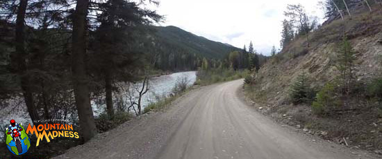
Good gravel or improved dirt roads that are fairly smooth, mostly hard-packed with minimal obstructions, anyone should have no trouble. Generally wide enough for full-size trucks to pass easily in either direction. Gentle slopes with generally clear sight lines. We expect no surprises like big potholes, big boulders, etc.
LEVEL 2
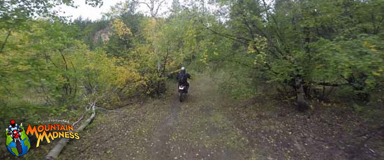
Good twin track, any competent rider should be happy on any "off-road" bike. Still a smooth surface, but you'll need to pick your line a little more because of occasional obstacles on the trail, or branches hanging over the trail and similar issues.

LEVEL 3
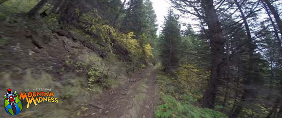
Unimproved dirt roads with loose surface in places and some obstructions. Competent riders with some off-road experience should be okay. Generally wide with mostly gentle slopes and mostly clear sight lines. You will want to be alert - there will be rocks and stuff on the trail which you can probably easily avoid - but you don't want to hit them. Beautiful riding through the woods and such - nothing too steep but keep your eyes open!

LEVEL 4
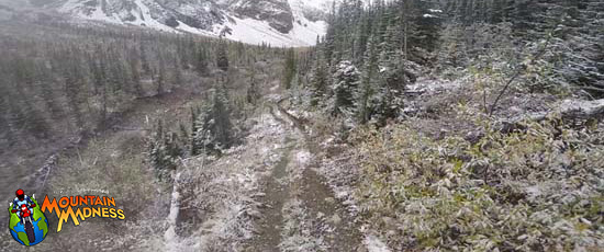
Level 4 is tough and challenging. A rider on any bike must have off-road experience, a competent rider on a 1200 GSA will be working hard. Although still generally wide enough for a 4WD truck, they are much narrower with sharper turns, shorter sight lines, and steeper grades. Surfaces will be loose and may include large areas of loose sand or mud, larger exposed rocks, and multiple water crossings. You want to take this easy but that is mostly also possible; there are lots of obstacles but you won't need speed and thus can paddle your way through when you consider it risky.

LEVEL 5
Level 5 routes are the most challenging. An expert rider on a 1200 GSA will be working hard. These routes may include long stretches of nearly continuous large rocks, loose sand, steep grades, narrow sight lines, sharp turns, off-camber surfaces, low overhangs, and multiple, challenging water crossings. Seriously challenging, especially on bigger motorcycles. Risk level increases also because of speed - sometimes you will just need to open the throttle to make it through or get up the hill.
What clues are we given?
Together, the clues get you "close enough" at first, then there's more than enough to hone in on the exact tag attachment point. Gotta use your eyes, sense of direction, and teamwork. Every team gets the exact same clues, maps, and related materials, no matter if you're in the MAP or GPS categories. It's how you use them, right?
But read on to Interpreting the Clues for hints.
Interpreting the Clues
We realize it's tricky to visualize these hints if you don't have the clues before you. However, if you do have the clues, these will make more sense. Refer back here whenever you need to.
- All coordinates are expressed in decimal degrees;
- "Camera Heading" and the white compass rose beneath it indicate the compass direction to face in order to see the same perspective as the main background image;
- Scenic levels are rated from 1 (a bit ho-hum) to 5 (gorgeous);
- Satellite inset images are always oriented NORTH at the top;
- The red circle with an arrow inside is the "arrow" that points to the exact tag attachment point.
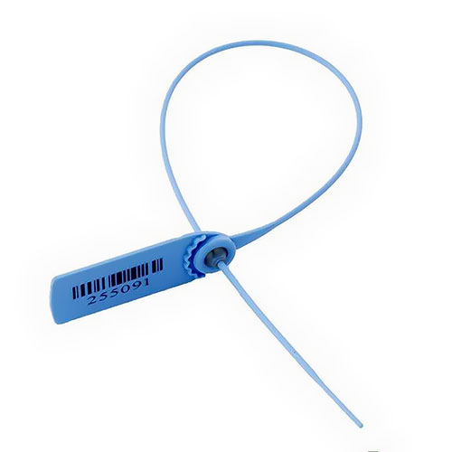
What do the tags look like? We found a tag... now what?
First, leave them undamaged and intact when you do find them - other teams need to find them, too. We usually use tags that look something like the one below. They may be blue, yellow, or red. You record the last 4 digits of the code imprinted on the tags... and dpn't mak anu typos! ;-P
Is it possible to get ALL the points? Do we NEED to get all the points?
No and no. Part of the challenge is to pick the best strategy that best suits YOUR TEAM's capabilities to find tagpoints - choose the most scenic or the highest values or a combination of both? The route you choose is totally up to you which is what makes HUMMs unique in the off-road navigation world - you get to carve out your own adventures.
If Level 3 trails are the most difficult level you want to ride, there are plenty of tagpoints for you to find. There is absolutely no need to ride the tougher trails if you don't want to! Remenber that you the rider decides when it gets too challenging. The trails can vary and may look easy to start, but get more challenging farther along. Also, you may try to find a different route to the tagpoint, which may be easier - or more difficult - but that's half the fun!
What distances can we expect to cover each day?
Distances are extremely variable ranging from 150 - 250+ km per day depending on the route you choose and riding skills.
What are the rules re: riding gear?
Primarily "be sensible!" Good motorcycle protective gear is required. Jeans and a t-shirt won't cut it. Helmets approved by someone like Snell or DOT required. Gloves, and basic armour required.
Technical Inspection ("Tech Check")
Your bike must be street legal where it is licensed, and will be inspected for obvious significant safety issues. Any problems found must be fixed for YOUR safety before you can participate.
What about fuel?
The only fuel available is at regular gas stations, so plan your route and fuel capacity carefully! We do not stash jerry cans on the course for you. There is no set route, so who knows where you will need it or when - it's part of your planning to ensure you don't run out of fuel.
Some HUMM areas have more gas stations while others don't. For any given HUMM, we will indicate whether we are allowing teams to carry extra fuel with them. And there are specific requirements about re-fueling in the field.
I don't understand the Competition Categories. Please explain.
There are a total of four (4) different competition categories. Each one is a different combination of Bike Class (single-cylinder vs. multi-cylinder) + Navigation Method (compass vs. GPS):
1. MAP-SINGLES
2. MAP-MULTIS
3. GPS-SINGLES
4. GPS-MULTIS
Your TEAM's chosen combination of Bike + Navigation Method determines your final competition category. If your team has a mix of single and multi cylinder bikes, then decide which ONE Bike Class (single or multi) you're competing in. Just make sure all your team members register in the SAME competition category.
- ALL Bikes MUST start and FINISH fully street legal, in compliance with local regulations;
- Teams consist of two to four bikes;
- You may mix class of BIKE in a TEAM, but not navigation method!
- If you mix class of bike in your team, you must confirm which class your TEAM competes in, Singles or Multis;
- Mixed teams get the best - and worst - of each class of bike.
Bike Classes:
- Singles: any single-cylinder motorcycle with off-road pretensions.
- Multi-cylinders: any twin or three or four (or, if you're crazy, six) cylinder motorcycle with off-road pretensions.
Navigation Methods:
MAP:
- This is the traditional HUMM class using map and compass only!
- Your team receives a set of Event Map(s), an Event Points Book, and score sheet to find the tagpoints and record the secret codes;
- You may carry a smartphone, but are NOT allowed to use the GPS function;
- You may carry a GPS with map data of the area for emergency use only. It will be sealed in an opaque plastic pouch before you check out to ride. If the bag is opened for non-emergency purposes before returning to HUMM base, your team is disqualified;
- No other paper or digital map(s) of the event area other than those provided by HUMM organizers;
- Except for your GPS device (for emergency only), no laptops, tablets, or other digital devices that are capable of storing other map information;
- HIGHLY RECOMMENDED: Magnifying glass, map measuring device, markers, pens, highlighters, etc.;
- Figure out the best route to get the most points!
GPS:
- GPS or smart phones with GPS capabilities are allowed, but we aren't supplying GPX co-ordinates. This keeps the navigation playing field even and we don't want it to be too easy. ;-) The HUMM is a navigation challenge, not a race from point to point;
- Your team receives a set of Event Map(s), an Event Points Book, and score sheet to find the tagpoints and record the secret codes;
- No other paper or digital map(s) of the event area other than:
a) paper maps provided by HUMM organizers, and
b) electronic maps already loaded onto your GPS or GPS-enabled smartphone; - No laptops, tablets, or similar devices;
- HIGHLY RECOMMENDED: Magnifying glass, map measuring device, markers, pens, highlighters, etc.;
- Figure out the best route to get the most points with ALL the tools at your disposal!
Trophies are awarded up to third place for all competition categories, subject to numbers of entrants.
Each member of the winning teams gets a keeper trophy!
If there are sufficient teams for additional classes, we award trophies to 33% of each class - for every 3 teams we give out a trophy up to top 3. If there are 1-5 teams first place only, 6-8 teams second place, and 9 up third place gets a trophy.
Additional Participant Categories:
Pillion in a million - I'm out there on the back!
- Your passenger / pillion rider, on the back of your bike.
- MUST register as a pillion rider
- Is NOT a "Team Mate" for safety purposes - there must be TWO bikes in every team.
Awards Dinner Guest: Not riding at all, enjoying the hotel and sightseeing
- Significant other, friends, children that are NOT riding AND are attending the Awards Dinner, MUST register.
NOTE: IF NOT attending the Awards Dinner, no requirement to register.
We're in the GPS Category. Can we use our laptops? Do we get GPX files?
Are you kidding? 😉 HUMMs are off-road wayfinding at its 1000% purest.
So, no on both counts. No laptops, no GPX tracks given. It's the best way we know to even the playing field between the MAP teams (going analog with compass) and the GPS teams. Also, a little background, paraphrasing Grant Johnson, Horizons Unlimited co-founder:
"Our original focus on creating the (HUMM) was for people travelling the world, adventure riding somewhere they need to actually navigate! That meant that we wanted to assume the local maps were rubbish, if available, and your GPS has broken - again. So, back to map and compass. We added the GPS category due to "popular demand", but we strongly recommend the MAP category. A GPS makes life easy, but when it breaks or there just is no map for it, you're in deep caca if you can't navigate the old-fashioned way. We also want everyone to be on an even footing and work it out on the fly when handed the event maps in the morning."